Curated OER
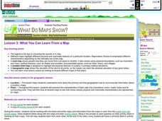
What You Can Learn From a Map
Students investigate the use of road maps, shadeded relief maps, and topographic maps.
Smithsonian Institution
Borders with the World: Mexican-American War and U.S. Southern Borderlands
The Mexican-American War created social borders—not just physical ones. Scholars learn about the effects of the Mexican-American War on the people living in the borderlands using text excerpts, maps, and partnered activities. Academics...
Curated OER
What You Can Learn From a Map
Learners discover how to interpret maps. In this geography skills lesson, students explore geographic themes as they complete worksheet activities regarding road maps, shaded relief maps, and topographic maps.
Curated OER
Mapmaker, Make Me a Map!
Students are introduced to the state quarter program and examine the Colorado state quarter. They locate Colorado on a map and create a map with a key. They discuss the state motto and examine pictures of the state's geographical features.
Curated OER
What do Maps Show?
Seventh graders practice reading maps. In this geography lesson, 7th graders compare a topographical map to a picture of the actual place.
Curated OER
State My Name
Students study the names of all fifty states, their capitols, location on a map, and an economic resource of each state. They complete a matching game activity.
Curated OER
Finding Longitude and Latitude on Pennsylvania Maps
Students draw the lines of longitude and latitude on a map. Students look at a topographical maps to see how topography relates to land use.
Curated OER
U.S. Geography: The Northeast
Students investigate U.S. Geography by creating a map in class. In this natural resource instructional activity, students create a map of the United States and research the Northeast based on their resources and recyclable...
Curated OER
Working on the Railroad
Young scholars plan a trip on the railroad. In this railroad creation and implementation lesson, students listen to the song "Working on the Railroad", make a map of where the track was laid and discuss the geographical...
Curated OER
U.S. Place Names Show Our Diversity
Students study place names for different area in the US and determine why they were named in such a way. They examine maps to look at the religious names, "new" beginning names, and copy cat names. They complete a word search to find...
Curated OER
What's Its Slope
Students identify the slope of a lines.In this algebra lesson, students define the meaning of slope and write an equation given the slope. They graph linear functions using the slope and y-intercept.


