Keep it Simple Science
The Earth in Space
Skim the surface of the earth with this brief, compact, summary of outer space. The sun, stars, galaxies, planets, and phases of the moon can be found in this all-in-one resource. Seventh graders will enjoy these simple worksheets to do...
Curated OER
The Earth's Surface
Students identify the characteristics of places. In this communities lesson, students discuss what they observe when they travel and construct a list of places in their neighborhood. Students use a Landscape Picture Map to circle...
Curated OER
Explore Surface Types on a Journey Around Earth
Students explore satellite data. In this technology cross-curriculum math and world geography lesson, students locate specific map areas using a microset of satellite data. Students use technology and math skills to determine percentages...
Curated OER
Observation and Inference
Assess your young scientists' understanding of the difference between observation and inference with this 20-question multiple choice quiz. It reviews a variety of physics and astronomy concepts, such as solar eclipses and sunspots, the...
Owl Teacher
Introduction to World of Geography Test
Assess your learners on the five themes of geography and the most important key terms and concepts from an introductory geography unit. Here you'll find an assessment with 15 fill-in-the-blank and 14 multiple-choice questions, sections...
Institute for Geophysics
Understanding Maps of Earth
Here is your go-to student resource on primary geography concepts, including facts about the surface of the earth and its hemispheres, latitude and longitude, globes, types of maps, and identifying continents and oceans.
Curated OER
Some Things You Need to Know to Read a Map
Students study things the you need to know to read a map and explain location.
Curated OER
Water Features - Lesson 2 - U.S. Political Map Grade 4-5
Students locate water features on maps. In this geography lesson, students complete worksheets that require them to identify water features on a U. S. political map.
Curated OER
Map Grids
Students study map grids and explore how they can be used to locate positions of objects or features on a map. They read a story and then participate in a grid activity using a large map of the setting of the story.
Curated OER
Plate Tectonics
Students complete a data sheet. In this Earth composition lesson, students learn what happens when the Earth's plates push against each other. They watch a teacher demonstration and complete a data sheet.
Curated OER
What do Maps Show?
Eighth graders practice the skill of reading maps. In this geography lesson, 8th graders participate in a classroom lecture on how to read a map.
Curated OER
Places on the Planet: Latitude and Longitude
Middle schoolers locate different places on globes and maps by learning about latitude and longitude lines. In this latitude and longitude lesson plan, students identify specific locations based on the degrees of latitude and longitude.
Curated OER
Wales: An Interdisciplinary Unit
Students practice basic map and geographic skills as they compare Oregon to Wales. Students color map of Wales and Oregon using color codes to distinguish between land, water, and bordering nations or states, listen to stories and...
Curated OER
Principles of Flight: Where are We?
Students explore the concept of topographical maps. In this topographical map lesson, students discuss how airplanes know where to fly. Students use topographical maps to simulate a field trip on the computer.
S2tem Centers SC
Seasons
Winter, spring, summer, and fall—take the learning of the seasons beyond the elementary level to the middle school classroom. Curious learners begin by watching videos about the seasons and the rotation of planet Earth. Then,...
Chicago Botanic Garden
Albedo, Reflectivity, and Absorption
What is reflectivity, and what does it have to do with the Earth's climate? As reflectivity is measured by albedo, scientists can gather information on Earth's energy balances that relate to global warming or climate change. Budding...
Syracuse University
Erie Canal
While canals are not the way to travel today, in the first half of the nineteenth century, they were sometimes the best way to move goods and people. Scholars examine primary sources, including maps and pictures, to investigate the role...
Curated OER
Latitude on World Maps - World Map Activity 2
Students explore the concept of latitude. In this geography lesson, students discover the global grid system and complete a map activity which require them to record the latitude of various cities in the world.
Curated OER
World Projections
Students identify map projections and examine polar maps. In this map skills lesson, students use a flat world map to identify various projections and calculate the distances between locations by using a map scale.
Curated OER
Let's Make a Map
Second graders draw maps of their playground, noting objects such as trees and play equipment. Working in groups, they make maps of different parts of the school and assemble them into a schoolwide map. They make maps on a field trip to...
Curated OER
The Coldest Place at the Bottom of the World
Students examine Ernest Shackleton's journey through the Antarctic and trace Shackleton's Actual Route on a map using longitude and latitude coordinates. Students compare his intended route with his actual and determine how far off...
Curated OER
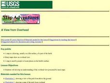
A View from Overhead
Students explore the concept of mapping. Using given illustrations, students observe views of a park from above the ground. They compare and contrast the different views. Students discuss uses for maps. Using a resource from the...
Curated OER
Water and Land 207
Young scholars examine maps of different projections, mathematically calculate distortions, and note the advantages and disadvantages of each map. They study the different maps and transfer the map to graph paper.
Curated OER
Locating Patterns of Volcano Distribution
Students examine patterns of volcanic distribution worldwide, use tables to plot and label location of each volcano on map, lightly shade areas where volcanoes are found, and complete open-ended worksheet based on their findings.


