Curated OER
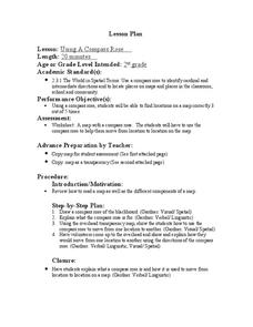
Using a Compass Rose
Second graders practice navigating around their neighborhood by utilizing a compass. For this geography lesson, 2nd graders view a compass rose, discover the purpose of it, and utilize it to navigate through a printed map of their...
Curated OER
Using 4 main directions in a classroom
Learners use the four directions of a compass rose to locate classroom features. In this directions lesson plan, students locate the features by identifying directions.
K12 Reader
Where On Earth Are You?
What do we use to determine the exact locations on the earth? Your kids can learn all about compass roses and latitude and longitude. Test understanding with the five reading comprehension questions included on the page.
Curated OER
Compass Rose Tossing
Young scholars use different pieces of equipment to practice throwing and catching. They use the cardinal directions of North, South, East and West in making a compass rose with the equipment. They must use higher order and decision...
Curated OER
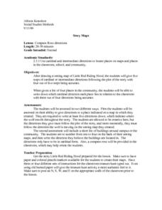
Compass Rose Directions
Second graders use cardinal and intermediate directions to locate places on maps and places in the classroom, school, and community. They draw a setting map of "Little Red Riding Hood." Students give five steps of cardinal or...
Curated OER
Ticky Goes to Jr. Map School
First graders sing "We All Live Together," by Greg and Steve. They look at a map and sing the "Soggy Waffle Song" to study about the compass rose. Students write N, E, S, W on the borders of paper that goes under a 100's chart. The...
Curated OER
Mapping My World
First graders make two maps. In this developing and reading maps lesson, 1st graders read Mapping Penny's World, discuss the parts of a map, create a map of their classroom, and create a list of directions of how to get to various...
Curated OER
Second Graders on the Map
Second graders explore the various types of maps. They examine the differences between street maps and aerial photographs. Students identify various features on each map. They use cardinal directions and the compass rose. They write...
Curated OER
Our States, My State
Students examine the Louisiana state quarter and locate Louisiana on a map of the U.S. They relate the location of Louisiana to other states (and vise versa) using directions and the compass rose.
Super Teacher Worksheets
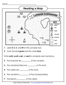
Reading a Map
Young geographers improve their map skills by practicing locating the cardinal directions on a map, identifying symbols on a map key, and describing where objects on the map are located relative to other locations.
Curated OER
Globe Lesson 4 - Intermediate Directions
Learners explore the concept of intermediate directions. In this geography skills instructional activity, students use map skills in order to identify intermediate directions as they complete a map activity.
Curated OER
Cardinal Directions
Young scholars explore cardinal directions. In this social studies lesson, students create maps of home and school using the cardinal directions.
Curated OER
Lesson on GPS
Students investigate global positioning systems. In this technology and mapping lesson, students view a PowerPoint presentation in which they identify the features of a GPS, state its uses, and follow steps to find a waypoint.
Curated OER
Four Main Directions
Students describe directions using a globe for north, east, south and west. In this mapping lesson plan students identify the north and south pole. Students understand the importance of the equator and the Prime Meridian. Students...
Curated OER
Using Four Main Directions in the Classroom
Students identify the four cardinal directions. In this map skills geography lesson, students use a magnetic compass to label the four directions in the classroom. Students use the four directions to locate objects in the classroom.
Curated OER
World Map and Globe - Four Main Directions
Students study the four main directions on a map. In this map lesson, students locate the North and South pole, and learn the four cardinal directions. They use the compass rose on a map to help with the directions. (Map is not included...
Curated OER
United States Map - Lesson 9
Learners explore the concept of cardinal directions. In this geography lesson, students identify the compass rose on a large U. S. map and then discuss the cardinal directions.
Curated OER
Following Plans
Students learn to follow a specific plan in order to do something or get somewhere. In this following directions activity, students explore key vocabulary related to following plans, complete fun activities that require attention to...
Curated OER
Finding Your Way
Students work in small groups to practice basic map skills. They take turns giving directions and tracing a path from one location to different destinations on the map.
Curated OER
Where Am I: How to Read a Map
Third graders develop an understanding of maps. They explore what a map is, who uses maps, and how to use maps. Students investigate the compas rose. They create a compose rose which illustrates the cardinal directions. Students practice...
Curated OER
China Quest
Read and research information on China. Young researchers complete a knowledge hunt about China then locate and describe each location using directional words. They recognize the word meaning through context clues and application practice.
Curated OER
Learning to Read a Map
First graders identify the map and globe symbols: Cardinal Directions; Compass Rose; Mountains; Rivers; Lakes; Towns; Roads.


