Royal Geographical Society
An Introduction to Maps
First graders are introduced to a variety of maps such as globes, street maps, atlases, and different types of floor plans. The focus of the lesson requires individuals to create their own plan of the classroom using the PowerPoint...
Curated OER
CLASSROOM MAPS
Students do a blind tour of their school by responding to verbal commands. They look and discuss various maps in the classroom. They locate the direction of the sunrise and discuss the compass directions of North, South, East, and West.
California Academy of Science
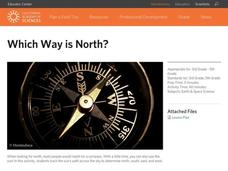
Which Way is North?
Who needs a compass to find cardinal directions? Just place a stick in the ground and record the movement of its shadow over the course of a day. Then, measure the shadow lengths in order to determine a north-south line. A simple...
Curated OER
Those Who Have Come Before Me
Class members are transformed into explorers as they work in groups to locate hidden items and map their journey along the way. They then leave clues for other groups of learners to follow, and ultimately discover how past explorations...
Curated OER
Direction of River Flow
Students determine the direction the river flows. They use a US map with rivers listed, colored pencils and a compass or transparency with directions marked. Students use a color key to determine which direction the river is flowing...
Curated OER
Through the Forest and Home Again: Maps Help Us Find Our Ways
Students read Little Red Riding Hood, focusing on her path home to Grandma's house. In this language arts and geography lesson, students perform a reader's theater, re-creating the walk home and possible routes that could have been...
Curated OER
Orienteering: Map Skills
Young scholars discover orienteering. In this orienteering instructional activity, students search for six specific landmarks. Young scholars brainstorm how maps and landmarks are helpful.
Curated OER
Orienteering 2
Students are shown the basics of map and compass work. They name the parts of a compass and comprehend the function of each part. Students define paces and tallies and use them in a real world situation. They use a map and compass to...
Curated OER
Using a Compass Rose
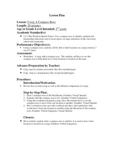
Second graders explore geography by completing a mapping activity in class. In this directional lesson, 2nd graders examine a map in class and utilize a compass rose to identify their location and destination. Students write directions...
Curated OER
Wales: An Interdisciplinary Unit
Young scholars practice basic map and geographic skills as they compare Oregon to Wales. Students color map of Wales and Oregon using color codes to distinguish between land, water, and bordering nations or states, listen to stories and...
Curated OER
Yo Ho, Yo Ho, A Pirate's Map for Me: An Original Story
Students read Blackbeard and brainstorm their knowledge of maps. In this language arts and geography lesson, students use landmarks on their playground to review north, south, east and west and discuss the compass rose. Students read...
Curated OER
Follow the Light
Young scholars investigate the role of lighthouses in navigation and practice the use of cardinal directions through reading activities, discussion, locating geographical features, and mapping lighthouses along the east coast of the...
Curated OER
Naviagational Tools
Fifth graders create a compass, with the help of written instructions and then write six sentences discussing how compasses work and why they are helpful. They discuss the different types of navigational tools and how they are helpful.
Curated OER
In Mr. Lincoln's Shoes
Students demonstrate basic map skills. In this US history lesson, students review cardinal directions and use a compass rose while at the same time discuss what life was like for Abraham Lincoln.
Curated OER
Native American Homelands
Students discuss the Navajo, Sioux, and Iroquois tribes, noting their distinctive characteristics. They trace the homeland of each of the tribes on maps and create map keys. Students explain how they developed their map keys.
Curated OER
Put Me in My Place: Using Alphanumeric Grids to Locate Places
Learners practice locating points on a large wall grid and create and label a neighborhood map. For this geography lesson, students spell and discuss places as the teacher places them on the map. They discuss the concept of an...
Curated OER
Orienteering II
Students name the parts of a compass and comprehend the function of each part. They define paces and tallies and use them in a real world situation. Students are shown the proper use of radio terminology. They use a map and compass to...
Curated OER
A Sense of Location: The Mental Map
Students consider the ways a mental maps of geographic landmarks can help migrating animals stay on the correct course.
Curated OER
Putting the World in Perspective
Students work in small groups to: make a mental map of the world by tearing paper shapes of the seven continents and locating them on a flat surface in their relative positions, compare their finished mental map to a reference world map,...
Curated OER
Our 50 States
Students identify the location of the 50 states using an interactive map. They practice geography skills by playing a fun game. Pupils become familiar with the state abbreviations for the US states. Students become familiar with the...
Scholastic
Reading Characters
Philip Pullman's The Golden Compass provides the text for a study of how writers bring characters to life. Using the provided character mapping worksheets, readers respond to questions and then write a short character sketch.
Curated OER
Cartography Project
A lesson involving mapping, the use of a compass, writing and following directions, and exploring the first two themes of geography is here for you. Learners create original maps that show the routes they take through their own...
Curated OER
Let's Travel!
Students review the rules and expectations, they earn points each day by making the correct behavioral choices. They read maps and do Internet reserach, students become aware of United States and or world geography. Students check...

