Curated OER
Magical Maps
Second graders discuss the importance of using maps and how they are used. After they listen to a folktale, they develop their own story line maps and write their own folktale to accompany a map. They also identify and locate the seven...
Curated OER
Exploring Biomes Lesson 4: Mapping Arizona
Once junior ecologists are familiar with Earth's major biomes, they hone in on Arizona's biomes. Using a website about Arizona's natural resources, learners will identify biotic communities. Beautiful maps and worksheets are provided for...
Curated OER
Map It!
Fourth graders demonstrate map making skills by using the computer to create maps of the geographic features, regions, and economy for their state.
Curated OER
MAPS AND TOPOGRAPHY
Students analyze the details of a topographic map and create one of their own by utilyzing a map of elevations.
Curated OER
Waldseemuller's Map: World 1507
Students investigate the 1507 word map. In this world geography lesson, students examine the details of each section of the map and then draw conclusions about how the people of 1507 understood the world. Students are evalated on...
Curated OER
Map It With Pixie
Fourth graders use the computer program 'Pixie' to create a topographic, detailed map for the state they live in. In this mapping skills lesson, 4th graders use Pixie to make a map of their state that includes topographic features, state...
Curated OER
A Map of the Big Race
Students read a novel and practice putting the events into the correct sequence. Using the text, they create a map showing the events of the race in order and a legend. They must use vocabulary from previous chapters and make their map...
Curated OER
The Crash Scene
Fifth graders explore geography by participating in a mapping activity. In this engineering instructional activity, 5th graders identify the differences between latitude and longitude and practice locating precise points on a globe or...
Curated OER
Isoseismal Maps
Young scholars examine the difference between magnitude and intensity in earthquakes. They complete map work and write a first hand account of a person living in each level of intensity on the Modified Mercalli Scale.
Curated OER
Drake's West Indian Voyage 1588-1589
Students investigate several maps detailing Sir Francis Drake's voyages. For this geography lesson, students practice reading maps and locating the precise locations of where Sir Francis Drake visited. Students create an...
Curated OER
Map It!
Fourth graders collect and explore different maps and their uses before using the program Pixie to create maps of geographic features, political features, and economic information for the state in which they live.
Curated OER
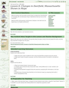
Lesson 8: Changes in Deerfield, Massachusetts Shown in Maps
Eighth graders study maps of the same area from different time periods which show the ways in which the land stayed the same, and the ways this New England village changed over the years.
Howard Hughes Medical Institute
Measuring Biodiversity in Gorongosa
Take your biology class' understanding of biodiversity to a whole new level! Ecology scholars use data to calculate three different diversity indices based on the organisms in the Gorongosa National Park. The four-part activity uses an...
Howard Hughes Medical Institute
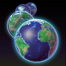
EarthViewer
Can you imagine Washington DC and London as close neighbors occupying the same continent? Learners will be fascinated as they step back in time and discover the evolution of the earth's continents and oceans from 4.5 billion...
Curated OER
Colonial Vacation Planner
Students plan a family vacation to states that were among the original 13 colonies. The groups determine which state they visit, map their route, calculate the mileage, and determine how much money they spend on gasoline.
Curated OER
Earth on the Earth
Fourth graders plot points on a graph and transfer those coordinates onto a large scale model resulting in an outline of the Western Hemisphere. They identify the major geographical landforms of the Western Hemisphere.
Curated OER
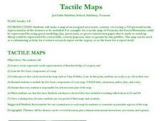
Tactile Maps
Students make a map of an assigned area (state, country, etc.) using a 3-D pictorial-tactile representation of the features to be included. They also learn to create a pictorial- tactile representation of their knowledge of a region, and...
Curated OER
Mush! Tracking Travelers on the Trail
Students get to know Alaska and the Iditarod route that is run by dogs as they track the mushers' progress on a map that they create specifically for the race. They learn about latitude, longitude, plotting on a map, checkpoints, and...
Curated OER
Park Brochures
Sixth graders investigate natural environments by researching national parks. In this brochure making lesson, 6th graders explore a specific national park and research it's information by utilizing the web. Students create travel...
Curated OER
Vocabulary Review and Map Skills
Students, when given the name of a community, identify a food, a craft, a custom, language and music, unique to that community 100% of the time. They find similarities and differences between this community and their own in four...
Curated OER
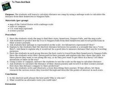
To There And Back
Learners calculate distance on a map by using a mileage scale to calculate the distance from their hometown to Niagara Falls. They, in groups, determine the best route, then compose stories about their journey to Niagra Falls.
Curated OER
The Mekong River
Junior geographers explore the region through which the Mekong flows, its pathway, the landscape, how people depend on the Mekong, and future uncertainties. They apply the five themes of geography to examine the region. They create a...
It's About Time
Volcanic Hazards: Airborne Debris
Pupils interpret maps and graph data related to volcanic ash. Then they analyze the importance of wind speed and the dangers of the ash to both life, air temperature, and technology.
Curated OER
U.S. Geography: The Northeast
Students investigate U.S. Geography by creating a map in class. In this natural resource lesson, students create a map of the United States and research the Northeast based on their resources and recyclable materials. Students...


