Curated OER
Maps and Globes
First graders complete a unit on map skills and the globe. They label maps, create a styrofoam ball globe, create a map of their community, sing a continent song, and complete a map and globe assessment worksheet.
Curated OER
Magical Maps
Second graders discuss the importance of using maps and how they are used. After they listen to a folktale, they develop their own story line maps and write their own folktale to accompany a map. They also identify and locate the seven...
Institute for Geophysics
Understanding Maps of Earth
Here is your go-to student resource on primary geography concepts, including facts about the surface of the earth and its hemispheres, latitude and longitude, globes, types of maps, and identifying continents and oceans.
Curated OER
Leapin' Landmarks: Locating 10 Man-made Landmarks Around the World
Third graders label continents, oceans, and major mountain ranges on maps and use the maps to write an informational report about landmarks. In this landmarks lesson plan, 3rd graders write about 1 major landmark.
Curated OER
Continents of the World
Second graders participate in a lesson about how people are the same, how people are different and where the continents are located. They go on a trip around the woworld to visit a country in each continent.
Curated OER
Continents
Students investigate World Geography by researching the different continents. In this Asian Geography instructional activity, students discuss the continent of Pangaea and color a worksheet of the continents. Students locate China on the...
Curated OER
World Map and Globe
Students locate and identify continents and countries. In this world map lesson, students locate and identify one country on each continent.
Curated OER
Exploring the World's Geography
Students discuss the seven continents of Earth and the diverse geography. After discussion, they create their own paper-mache globes which properly display all seven continents, the equator, and the prime meridian. They conduct research...
Curated OER
Exploring an Atlas
Learners explore global geography by participating in an atlas activity. In this countries of the world instructional activity, students collaborate in small groups and analyze an atlas while researching continents, countries and...
Curated OER
Around the World in 5 Days
Students explore continents, draw map, discuss cultures, use research to learn geography, and investigate cultures.
Curated OER
Welcome to the Americas
Young scholars research and map the North and South American continents. For this geography lesson on the Americas, students can locate North, Central and South American countries and states. Young scholars choose a location to research...
Curated OER
Places in My World
Second graders explore where they are located on the globe. In this maps and globes instructional activity, 2nd graders use a map to show where they live and show the cardinal directions. Students identify characteristics of...
Curated OER
Identifying Island Countries
Learners discover the definition of an island and identify island countries around the world. For this geography lesson, students determine the characteristics of an island. Finally the learners will identify specific island countries,...
Howard Hughes Medical Institute
EarthViewer
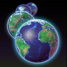
Can you imagine Washington DC and London as close neighbors occupying the same continent? Learners will be fascinated as they step back in time and discover the evolution of the earth's continents and oceans from 4.5 billion...
Curated OER
From Claws to Jaws: Atlantic Regions of the United States
Students explore New England, Mid-Atlantic, and southeastern regions of the United States. In this social studies thematic unit, students research a state and make a regional quilt. Students wrte a book report and read two novels...
Curated OER
Barrels and Buckets: Access to Water - What Would It Be Like to Live in Africa?
Students compare water access in the United States with that of Africa. In this water access lesson, students located Ghana and Kenya on a globe before reading Peace Corps Volunteer accounts of the difficulty of accessing clean water....
Curated OER
Geography: Snow Cover on the Continents
Students create maps of snow cover for each continent by conducting Internet research. After estimating the percentage of continental snow cover, they present their findings in letters, brochures or Powerpoint presentations.
Curated OER
GEOGRAPHY: SPACE CENTERS
Young scholars examine the descriptive science dealing with the surface of Earth, its division into continents and countries, climate, natural resources, inhabitants and industries of the various divisions and analyze the political...
Curated OER
Antarctica
Students explore the Antarctic continent, Australia's role in Antarctic exploration and development, the issues concerning Antarctica's future and the needs of the Antarctic community.
Curated OER
Fantastic Flying Journey
Third graders listen to a teacher reading of the "Fantastic Flying Journey." students research each country/continent using the Internet and creating a travel journal.
Curated OER
Yo-ho, Yo-ho a Viking's Life for Me
Students complete a unit of lessons on the Vikings. They analyze maps, read and discuss myths, summarize the main ideas from resource materials, watch videos, sing a song, draw a picture to illustrate Norse mythology, and define key...
Curated OER
Get the Drift?
The anticipatory set is clever: give groups five minutes to work on the puzzle and then discuss what strategies they used to match the few that connected. This introduces middle schoolers to the concept of continental drift. A portion of...
California Polytechnic State University
Australian Geography Unit
At the heart of this resource is a beautifully detailed PowerPoint presentation (provided in PDF form) on the overall physical geography of Australia, basic facts about the country, Aboriginal history, and Australia culture and lifestyle.
Curated OER
Displaying the Data
Students gather facts about their parent's families through the completion of parent interview forms. Using tally marks, the data gathered is counted, transferred to graphs and used to create family timelines.


