Curated OER
Lesson 7: Smart Grids
Energy conservation is a hot topic these days; introduce your kids to the Smart Grid solution through a video clip and several interactive online tools. They discuss areas of household energy consumption, examining a pie chart...
Curated OER
Wreck Detectives
Students investigate shipwrecks. In this marine archaeology instructional activity ,students collect data and make inferences about the causes of shipwrecks. Students work in groups to create their own model of a shipwreck using clay....
Curated OER
Economic Decisions in Other Systems: Comparative Systems
Students identify and describe the charactertics in each economic system. In groups, they discuss how economic decisions are made in each system and use the Internet to research Chad, United States and North Korea's economic systems. ...
National Wildlife Federation
Quantifying Land Changes Over Time Using Landsat
"Humans have become a geologic agent comparable to erosion and [volcanic] eruptions ..." Paul J. Crutzen, a Nobel Prize-winning atmospheric chemist. Using Landsat imagery, scholars create a grid showing land use type, such as urban,...
Curated OER
Tuck Everlasting
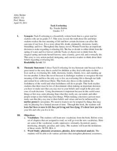
Clearly written as an assignment for a higher-level education class, this formal lesson plan contains some fun and well-researched strategies for teaching the novel Tuck Everlasting by Natalie Babbitt. Among the best ideas...
Curated OER
Rivers And Capitals
Students become familiar with the use of GIS for research and become aware of the importance of rivers to cities. They also analyze the placement of cities and learn the names of rivers in the United States.
Curated OER
Indiana Tornado Project
Learners become familiar with the use of GIS for research, natural phenomena in Indiana, and analyzing collected information.
Curated OER
Plotting A Hurricane Using latitude and Longitude
Students explore map and plotting skills by tracing the movement s of hurricanes through the Earth's systems. a hurricane map is developed from daily media reports.
Curated OER
Rearrange the Room
Second graders measure and grid their ideas for the new classroom floor plan. They create their own ideas for the classroom arrangement on grid paper. When they finish, they share their draft plan with their peers and with the teacher...
Curated OER
Less is More: Realizing Mathematics Through Agriculture
High schoolers study the architectural designs of different popular sites. In this math lesson, students draw a grid diagram. They explain what geodesic algorithms are used for.
Curated OER
What are Fractals?
Middle and high schoolers identify and analyze fractals and research information using the Internet to locate information about them. They look at fractals in relation to nature and other real world situations. Pupils create several...
Curated OER
Perimeter Playground
Young scholars explore geometry by participating in a school measuring activity. In this perimeter lesson, students discuss the techniques and methods used in order to measure a large perimeter or geometric figure. Young scholars utilize...
Curated OER
Introduction to Archaeology
Students view a PowerPoint presentation called, Archaeological Terms then discuss the job of an archaeologist and new vocabulary. They view the teacher made "artifact grid" and photograph the grid from different angles. They work in...
Curated OER
Earn Points with Technology
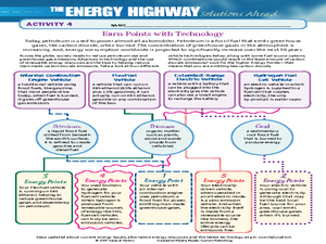
Students explore renewable energy by analyzing a diagram. In this fossil fuel lesson, students view a chart explaining the different energy consumption from automobiles and how they impact our environment. Students analyze a point based...
Curated OER
How Do You Measure Up?
Students explore the concept of measurement, modelling the increments on a standard ruler using cubes and grid paper. They identify the length of a line to a designated standard unit and measure specified body parts.
Curated OER
We Accuse Colored Peoples of California V. State of California
Students participate in a WebQuest to investigate discrimination of African Americans, Chinese and Californio/Latino during the Gold Rush era. They act as law clerks to write a letter to their clients about a potential trial.
Curated OER
A Contouring We Go
Students examine the built environment and infrastructures of their community by constructing contour equipment, using the equipment, and comparing their results to current topographical maps of the same area
Curated OER
Sam Houston for President...Again
Fourth graders discover the political career of Sam Houston. In this Texas history lesson, 4th graders research primary resources and create a modern-day version of Sam Houston's political campaign of the 1840s.
Curated OER
Lewis and Clark: Prized Possessions
Young scholars consider the role of Sacagawea as part of the Corps of Discovery. In this Lewis and Clark expedition lesson, students discover details about Sacagawea's wampum belt and then create their own wampum belts using their...
Curated OER
Shipwreck Mystery
Young scholars draw inferences about a shipwreck. In this marine archaeologist activity, students examine historical and archaeological data to draw inferences about the age and identity of shipwrecks.
Curated OER
Native Americans and Topography at Rose Bay
Students visit a wetland ecosystem. While they are there, students explore how to read topography maps of Rose Bay.
Curated OER
Regions of Virginia
Fourth graders research an assigned region of Virginia. They work in groups to create a PowerPoint presentation. They present their information to the class. Students are tested on the information from their region as well as the regions...
Curated OER
Career Connections
Students research the characteristics of specific occupations with personal career interests and aptitudes. In this career exploration instructional activity, students select three careers to explore and consider their own interests and...
Curated OER
Cherishing the Water of Life
Learners work in small groups to brainstorm a list of all creatures, plants, natural, and artificial processes that use or depend on fresh water. The class views an aquarium filled with water representing all the water in the world. The...
Other popular searches
- Global Grid System
- Grid System Drawing
- Mapping Grid System
- Grid System Art
- Drawing With a Grid System
- Texas Grid System
- Grid System Worksheets
- Map Features Grid Systems
- Map Features "Grid Systems
- Map Features "Grid Systems"
- Alphanumeric Grid Systems


