Curated OER
What do Maps Show: How to Read a Topographic Map
Middle schoolers identify the characteristics of topographical maps. Using examples, they practice reading them and describing the information they gather from them. They also discover how to use the website from the U.S. Geological Survey.
Curated OER
Magical Maps
Second graders discuss the importance of using maps and how they are used. After they listen to a folktale, they develop their own story line maps and write their own folktale to accompany a map. They also identify and locate the seven...
Curated OER
Mapping Perceptions of China
Young scholars discuss what types of things are included on a map. They compare and contrast maps of China with a map they create and practice using different types of maps. They write analysis of their classmates maps.
Curated OER
A world of oil
Learners practice in analyzing spatial data in maps and graphic presentations while studying the distribution of fossil fuel resources. They study, analyze, and map the distribution of fossil fuels on blank maps. Students discuss gas...
Curated OER
Gopher It! Exploring German Cyberspace
Learners are introduced to the Gopher research tools. In groups, they compare and contrast English and German services on the gopher servers. They create their own dictionary of computer related terms and spend time downloading picture...
Curated OER
Drawing A Map
Students discuss any information they already know about maps. As a class, they draw a map of a park following written directions making sure to include a compass rose and key. They are graded based on a rubric and discuss the need for...
Curated OER
Virtual Field Trip
This hands-on resource has future trip planners analyze graphs of mileage, gasoline costs, and travel time on different routes. While this was originally designed for a problem-solving exercise using a Michigan map, it could be used as a...
Smithsonian Institution
A Ticket to Philly—In 1769: Thinking about Cities, Then and Now
While cities had only a small fraction of the population in colonial America, they played a significant role in pre-revolutionary years, and this was certainly true for the largest city in the North American colonies: Philadelphia. Your...
Curated OER
Right Place, Right Time
Fourth graders complete mathematical word problems. They study the relationships among distance, speed, and time; and measure travel distances. They measure distances using a piece of string and a ruler and practice converting several...
Curated OER
Storm Clouds-- Fly over a Late Winter Storm onboard a NASA Earth Observing Satellite
Students study cloud data and weather maps to explore cloud activity. In this cloud data lesson plan students locate latitude and longitude coordinates and determine cloud cover percentages.
Curated OER
Mapping The Ocean Floor
Young scholars explore and analyze the bottom structure of underwater habitats. They describe and explain what can't see through the collection and correlation of accurate data. Learners assess that technology is utilized as a tool for...
Curated OER
Using Non-Text Features
Second graders examine graphs and charts from their local newspaper. As a class, they discuss what the data means and how it relates to the article. In groups, they are shown two sets of graphs or charts and they practice explaining...
Curated OER
Solar Heating in the Himalayas
A fascinating lesson on how solar power is utilized by people who live in the Himalayas is here for you. In it, learners perform a case study which will help them understand that solar energy is a renewable resource, that geography...
Curated OER
Mapping the Ocean Floor
Students study the bottom structure of underwater habitats and how they can be mapped.
Curated OER
Nautical Navigation
Students work together to discover the importance of charts while navigating. They complete a worksheet and practice reading maps. They create their own nautical chart to complete the lesson.
Miami-Dade County Public Schools
Five Themes of Geography Packet
The five themes of geography are perfect for introducing learners to some of the ways that people interact with the world around them. This packet contains 20 full lessons, each focused on topics relating to the five themes of geography,...
EngageNY
Discovering the Topic: Inferring and Confirming Using Evidence
Allow your class to figure out what they will be studying through an inquiry-based anticipatory set that involves analysis of mystery documents and practice with making inferences. The lesson plan document includes a detailed description...
Curated OER
Immigration to the United States
Learners examine the reasons why people immigrated to the United States. Using maps and charts, they analyze population movements and religious affiliations. They discover how the United States became a lesser Protestant country.
Curated OER
Seeing in 3D: Interpreting Two-Dimensional Diagrams of Three-Dimensional Objects
Students hone in on their skills at reading diagrams. For this dimensional lesson students collect information on the functions of organs then figure out how all the parts work together.
Curated OER
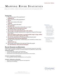
Mapping River Statistics
Students research different statistics to do with the Mississippi River. They answer questions about finding data and collect it by conducting research. The research is used to construct a data table. Then students use the table to...
Curated OER
Lesson 1 Activity 1: Tools of the Ancients
Learners examine how Christopher Columbus determined his latitude.
Curated OER
Life Cycle of the Monarch Butterfly
Third graders access prior knowledge of the monarch butterfly and discuss what they would like to know. In this Monarch Butterfly lesson,students read Monarch Butterfly and discuss the life cycle of the butterfly. Students gather...
Curated OER
The Sun Affects Earth
Third graders read, write, and listen to information about the sun and its effects on the Earth.as it relates to its axis, orbit, rotate, and revolution. In this solar system lesson, 3rd graders examine how the sun...
Curated OER
Wetlands: Pave or Save?
Students discuss the characteristics of wetlands and how to make them more productive. Using a map, they locate the major wetlands in the United States and color them using a key. They read an article and in groups answer discussion...


