Curated OER
Hurricanes and Climate
Students investigate maps and data to learn about the connections between hurricanes and climate. In this exploratory lesson plan students describe and graph the 6 regions where hurricanes happen and discuss how hurricanes have changed...
Curated OER
Sunken Slave Ship
Students imagine they are archaeologists who are looking for treasure under the sand or sea. They work in teams to create the story and site of a shipwreck in a tub or aquarium filled with sand and water.
Curated OER
Let's Spice It With Pepper
Learners identify and locate the areas in which pepper and spices orginated. On a map, they locate the areas and write the name of the spice that is found there. They use historical events to trace its route to the Americas. They...
Curated OER
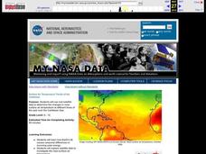
Surface Air Temperature Trends of the Caribbean
Students investigate the seasonal changes to sea surface and near-surface air temperatures near the equator. They use actual satellite data to track and graph the differences in air and sea temperatures during different seasons in the...
Curated OER
Exploring Marine Ecosystems in the Caribbean and Maine
Students compare the marine habitats of Maine and the Caribbean using temperature, tides, ocean currents, latitude and longitude. In this marine ecosystems instructional activity, students analyze maps to complete graphic organizers that...
Michigan Sea Grant
Exploring Watersheds
Collaboratively, students partake in a hands-on activity in which they build models of a watershed. Each group member draws an elevation map—a bird's eye view—of their model and predicts how water will flow from the high to low points....
Curated OER
Plate Tectonics: Recycling the Seafloor
Students classify earth's layers and plates using Ocean Seismicity data. In this plate tectonics lesson, students outline where the plate boundaries are on the world map. They then compare these predicted boundaries with USGS map of the...
Curated OER
My Life as a Loggerhead
Students discuss the current flow of the Gulf Stream and the characteristics of the Sargasso Sea. They visit websites to gather information on loggerhead sea turtles. Students imagine that they are newly hatched loggerhead turtles.
Curated OER
The Sound of Calm
Students examine the relationships that exist between ocean currents, wind and climate. Using those relationships, they discuss how they affect the oceans. They create their own music to represent the sounds of the ocean and share them...
Curated OER
The Maggie B.
Students are read the book "The Maggie B.". Using the text, they try to name the locations mentioned. They use a map to name all the oceans and seas and discuss the characteristics of each. They color a map worksheet to keep with them...
Curated OER
Climate Change in My City
Students investigate the climate changes occurring locally, regionally and globally over the last one hundred years. They brainstorm and predict whether the current year's weather was warmer or colder than last year then check the...
Curated OER
Aerosol Lesson: Science - Graphing SAGE II Data
Students examine and plot atmospheric data on bar graphs.
Curated OER
Salmon Homing Instincts
Students identify the stages of the salmon life cycle. In this fish activity, students experience first hand what it would be like to be a returning salmon attempting to identify a home stream by smell.
Curated OER
Using the New Zealand plate boundary models
Students examine the differences in the effects of the tectonic plates of New Zealand. In this tectonic plate lesson, students define and explain the process of subduction. Students recognize the difference in the movement of a...
Curated OER
El Nino
Students explain what El Nino is, where it is located and how it is created. They describe the weather changes caused by El Nino. They draw the patterns of El Nino on a world map. They predict economic effects El Nino has on the areas it...
Curated OER
Teaching About the Hydrosphere
Eighth graders are introduced to the Earth's hydrologic system including the cycling of water in the atmosphere and the movement of water on the surface of the planet using the Great Lakes watershed as an example.
Curated OER
Air Pressure and Wind
Fifth graders study air pressure and learn how it can change the weather. In this air pressure lesson, 5th graders study the given diagrams and complete the experiments to learn how air pressure can change the weather. Students read...
Curated OER
Is There Sewage in My Sample?
Students explore the proximity of the Hudson Shelf Valley and the Hudson Canyon to one of the Nation's most populated areas. They study that from 1987 to 1992, two dumpsites in the Hudson Shelf Valley and Hudson Canyon, one 12 miles
Curated OER
Jeannette
Students develop hypothesis about what might happen when salt water is frozen. In groups, they freeze ice samples with different salt concentrations. They use the internet to research the situation of the Jeannette to discover their...
Curated OER
Warm up to the Gulf Stream
Students find out the temperature difference between the Gulf Stream and the surrounding water. They locate the Gulf Stream on the infrared image of the eastern seaboard of the US.


