Curated OER
Ocean Animals - A Kindergarten Research Project
Something’s fishy! Assign each of your pupils an individual sea creature and investigate the oceans. Young oceanographers utilize Kidspiration software to research a creature, illustrate an image, and create fact cards about their...
NASA
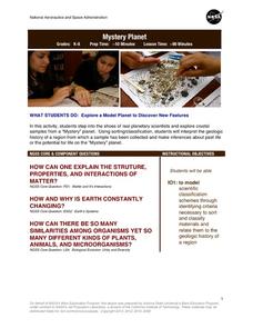
Mystery Planet
What can one learn about a planet based on a small surface sample? Learners will explore artifacts from a mystery planet and see what they can determine about the planet based on the evidence in front of them.
Curated OER
Mapping the Human Genome
Students study DNA and how it was discovered. In this biology lesson students see the effects of mapping the human genome would have.
NOAA
Sediments
Calcareous ooze ... what an interesting name! The 15th installment of a 23-part NOAA Enrichment in Marine sciences and Oceanography (NEMO) program focuses on sediments found on the ocean floor. After viewing the slideshow lecture,...
Curated OER
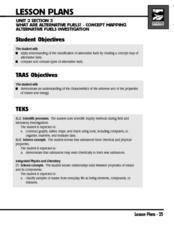
What Are Alternative Fuels? Concept Mapping Alternative Fuels Investigation
Students compare and contrast the different types of alternative fuels. They create a concept map to understand their classification. They examine the properties of matter and energy as well.
Curated OER
Ecology of the Savanna-Forest Boundaries in Central Brazil
Students explore photosynthesis. In this photosynthesis lesson, students label parts of photosynthesis and take notes. Students conduct experiments on leaves, make observations and record their findings.
Curated OER
How would an oil spill affect a Marine Sanctuary?
Students explore the concept of environmental stewardship. For this science lesson, students discover how scientists assess damages to the environment following oil spills. Students conduct a simulation of a public meeting in order to...
Curated OER
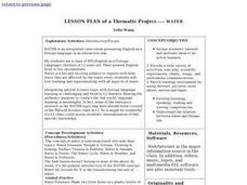
Lesson Plan of a Thematic Project - Water
Sixth graders investigate the properties of water. In this life science lesson, 6th graders create a concept map of water. They share their work with the class.
Curated OER
The Web of Life - Ecosystem
Students examine the concepts of ecosystems and interdependence. They construct block pyramids to demonstrate interdependence, and map off an area to observe and identify animals. They create food chain mobiles and play a web of life game.
Curated OER
Flower Power
An engaging, multi-session art and science lesson awaits your class. Within this lesson, you'll find everything you need to implement the plan. They go on a nature walk around their school, and must identify many living and non-living...
Curated OER
Biodiversity in an Estuary
Students investigate the biodiversity in estuaries. In this estuary lesson plan, students use Google Earth to explore the Rookery Bay National Estuarine Research Reserve. They produce a biodiversity concept map and portray the life of a...
National Nanotechnology Infrastructure Network
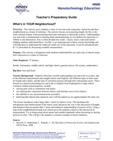
What’s In Your Neighborhood?
Chart your way to an understanding of nanoscale. Using a Google map, learners estimate a radius around their location of 1,000 and 1,000,000 meters. Predicting what 1,000,000,000 meters would look like takes them off the charts!...
Curated OER
Weather Forecasting Unit
Students study weather concepts, mapping, characteristics in this series of lessons.
Howard Hughes Medical Institute
Building Ecological Pyramids
Looking for a fresh take on traditional food/energy pyramids? Conduct an innovative activity where pupils build their own! The lesson uses research data from Gorongosa National Park in Mozambique for a real-life safari touch. Scholars...
Curated OER
The Class Trip
Mrs. Moore's class is trying to earn money for a trip to the science museum, but how much more do they need? Solve this problem with your own class as they develop their ability to model real-life situations algebraically. As an added...
Curated OER
Is the Hudson River Too Salty to Drink?
Students explore reasons for varied salinity in bodies of water. In this geographical inquiry lesson, students use a variety of visual and written information including maps, data tables, and graphs, to form a hypothesis as to why the...
Curated OER
Endangered Animals Books
Middle schoolers research endangered species and create and publish books to present their findings. Designed to use Inspiration software, this resource could be adapted if you don't have access to the program. Contains handy website...
Curated OER
Levers and Pulleys
Seventeen pages of material leave you well-prepared to carry out this lesson on levers and pulleys. Photos and diagrams make the instructions clear; resource links provide additional information. The missing aspects of this teacher's...
Curated OER
Arthur's Tooth
Young scholars practice their reading comprehension by reading a story in their class. In this story map lesson, students read the Marc Brown book Arthur's Tooth and discuss the story, characters and setting. Young scholars create a...
Curated OER
Out of the Deep
Students observe, describe, and record characteristics of ocean animals (mammals and fish) and sea shells. They conduct an experiment comparing and contrasting sugar water, salt water and fresh water and create a mural of coral reef...
Curated OER
Exploring Living Science Careers
Young scholars explore a variety of agricultural careers that are available and look into them in terms of the economics and suitability to their interests. In this agriculture careers lesson students research the agriculture...
Curated OER
Trichinella Forensics
Learners engage in DNA manipulation using forensics techniques. Students investigate topics involved in forensics studies such as cloning, electrophoresis, gene mapping, replication, and transcription.
Curated OER
Classifying Living Things
Students identify how to classify living things. They classify various concepts including family members, kinds of clothing, numbers, shapes, and vocabulary words. They discuss how to classify various concepts and classify pictures of...
Curated OER
GPS Treasure Hunt
Students explore geography by participating in a treasure hunt activity. In this Global Positioning System lesson, students define the terms latitude and longitude while utilizing an electronic GPS device. Students view a PowerPoint...

