Curated OER
Exploring Energy with GIS
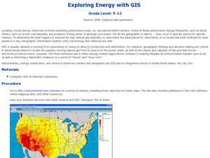
Students examine GIS technology as it is used to locate energy sources. In this GIS lesson, student access an assigned website to locate a series of lessons using the GIS software. They use the maps that are located on the primary lesson...
Curated OER
Mapping Lab and Lead Poisoning
Students are introduced to GIS and its uses. They make predictions before viewing the actual lead poisoning cases by location of Dade County. Pupils use actual Miami-Dade County spatial data to explore basic principals. Students
Curated OER
Fostering Geospatial Thinking: Space to Earth: Earth to Space (SEES)
High schoolers locate and access data to help them with their science inquiry. In this geographical positioning lesson students evaluate and compare data sets.
Curated OER
Measuring Distance and Area in Satellite Images (College Level)
Pupils are able to download, install, and use Image J image analysis software to quantify change over time in satellite images. They access and download satellite images for specific locations and times. Students set a scale (spatial...
Curated OER
Where in the United States Are We?
High schoolers spend the lesson identifying the location of the fifty states and the capitals. Using a software program, they retrace te outline of each state numerous times. To end the lesson, they write a story about a state and city...
Curated OER
Weather Pals
Students study maps of the United States to locate weather pals from a list of schools. They communicate with Weather Pal schools through the use of closed circuit TV. Using weather data collected in their area, they exchange the...
Curated OER
Fluctuations in the Price of Oil
Students examine the fluctuating gas prices and the effect it has on the Canadian economy by reviewing an online database that contains information on the retail price of gas for Canada's largest cities.
Curated OER
Using Vegetation, Precipitation, and Surface Temperature to Study Climate Zones
Students begin their examination of the climate zones found around the world. Using a software program, they identify the relationship between the vegetation, climate and temperatures of the different zones. They also plot coordinates...
Curated OER
What's Driving Us?
Students determine what the people in their community are driving. Using traffic flow information, they develop recommendations on how to achieve sustainability. They calculate the carbon dioxide emission index for various sites and...
Curated OER
What Are The Characteristics of Your Neighborhood?
Learners make a mental map of their neighborhood. Using a software program, they make an aerial and digital map of their school and locate their school on given maps. In groups, they calculate the distances to various locations and...
Curated OER
Comparative Stream Quality
Students examine water quality on a nearby stream. They collect water samples and test for various factors, including any contamination from the treatment plant, and present their information in a Powerpoint presentation.
Curated OER
The Great MPA Debate
Students study the 'Marine Protected Areas' process. In this ocean activity students work in groups, conduct research and present it to the class.
Curated OER
Living Swamps, Bayous and Forests
Third graders explore interesting environments by exploring Louisiana. In this wetland lesson, 3rd graders utilize the web to research the State of Louisiana, the bayous in the area, and the Gulf of Mexico. Students write a journal entry...
Curated OER
Japanese Collage
Seventh graders compare and contrast different types of art associated with different cultures. They identify how cultures express their values in art. They create their own collage about Japan.


