Curated OER
Geography and Culture of China
Take out a map, a paper, a ruler, and those coveted colored pencils for a lesson on Chinese culture and geography. This is a multifaceted approach to basic geography skills that incorporate story telling, class discussion, primary source...
New York City Department of Education
Egypt
This six-week unit encompasses all subjects with a focus study on world history and the development of ancient civilizations. As gifted and talented students dive into the interesting yet challenging topic of Egypt, they...
California Polytechnic State University
Australian Geography Unit
At the heart of this resource is a beautifully detailed PowerPoint presentation (provided in PDF form) on the overall physical geography of Australia, basic facts about the country, Aboriginal history, and Australia culture and lifestyle.
Education Development Center
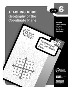
Geography of the Coordinate Plane
Put the graph into graphing and allow learners to understand the concept of point plotting and how it relates to data. The worksheet provides a nice way to connect data analysis to a graph and make predictions. The worksheets within...
Curated OER
Investigating the Countries of the World
Explore world geography by creating presentations for different countries around the world. Researchers identify many different countries on a globe and select one for which they will create a presentation. They share their research and...
Curated OER
Geography Puzzles
Students study the continents of the world. In this Internet geography lesson plan, students connect to online mapping games. Students collaborate in order to develop their understanding of world geography, including countries and...
Curated OER
The Time Has Come: Poetry and Drama Use in the Geography Class
Students use drama and poetry in their Geography class. In groups, they role play an interviewer or the interviewee in various plays that were presented to them. In their role, they must locate and label where the countries mentioned...
Curated OER
How Big is Big?
Geography learners compare and contrast population densities throughout the world. Using maps, they estimate the relative size of the world's regions and populations. They develop analogies to discover the world they live in and...
Curated OER
Egg Hunt Lesson
Fourth graders explore religious holidays by participating in an egg hunt. In this Easter lesson, 4th graders review the different U.S. states and capitols before completing a geography egg hunt activity. Students read geographic clues...
Curated OER
Immigration: Marijana's Story
Second graders explore world geography by researching U.S. history. In this immigration lesson, 2nd graders read the book Marijana's Story and discuss the main character, her goals, and the plot. Students complete a worksheet about U.S....
Curated OER
Teaching the Five Themes of Geography Through Picture Books
Read the story Make Way for Ducklings and introduce little ones to the five themes of geography. Reread the story, while displaying transparencies to reinforce the five themes. In groups, learners view pictures and identify the themes on...
NOAA
Into the Deep
Take young scientists into the depths of the world's ocean with the second lesson of this three-part earth science series. After first drawing pictures representing how they imagine the bottom of the ocean to appear, students...
Curated OER
Let Me Tell You About My State
Fifth graders research one of the 50 U.S. States that they were unfamiliar with. For this U.S. Geography lesson, 5th graders utilize encyclopedias as well as the Internet to research a chosen U.S. State in order to write a report....
Curated OER
Molas from South America
Third graders research world geography by creating a class presentation. In this South American lesson, 3rd graders read assigned text regarding the customs and traditions of different Indian communities in South America. Students...
Curated OER
Growth of a River
Students evaluate geography by drawing an image in class. In this river lesson, students identify a list of vocabulary terms associated with bodies of water. Students identify how a river is formed and draw a picture of one including the...
Curated OER
GPS Treasure Hunt
Learners explore geography by participating in a treasure hunt activity. In this Global Positioning System lesson, students define the terms latitude and longitude while utilizing an electronic GPS device. Learners view a PowerPoint...
Curated OER
States and Mates
Discuss and reflect on the concept of allies and alliances. The class examines the competition between the United States and Venezuela. Using the New York Times, they search for examples of geopolitical alliances. In addition, they write...
Curated OER
Nifty Fifty State Trivia
A wonderful game on U.S. States Trivia awaits your class. In this geography lesson, they will play a Jeopardy-style game. All the worksheets with the questions and answers are embedded in this beautifully-designed plan. Your class should...
Curated OER
Follow the Light
Here is another in the interesting series of lessons that use the special State Quarters as a learning tool. During this lesson plan, pupils learn about lighthouses, maps, the cardinal directions on a compass, and U.S. geography. There...
Edgate
Journal Maps
Inspire your class to look at their environments as if they were seeing them for the first time in order to gain a better understanding of the concept of perspective. After exploring their communities and keeping a journal of major...
Curated OER
Good Apples
Students investigate diversity. In this diversity lesson, students look at a variety of apples in order to compare and contrast their physical characteristics. They apply the concept to people by listing how people are the same and...
Curated OER
Geography and Archeology of the River People
Seventh graders work together in groups to read a handout and answer questions about the geography and archeology of a group of native peoples. As a class, they discuss their opinions and answers and the importance of using artifacts to...
Curated OER
Mapping Districts
Students become literate in their use of maps. For this 2010 Census lesson plan, students visualize census data on maps, use map keys to read population maps, and explore the concept of population density.
Curated OER
Mapping Districts
Young scholars use maps to learn about the U.S. Census. In this 2010 Census lesson plan, students visualize census data on maps, use map keys to read population maps, and explore the concept of population density.
Other popular searches
- Geography Skills Concepts
- Geography Tools and Concepts
- Geography Skills, Concepts
- Geography Concepts
- Basic Geography Concepts


