Curated OER
Map It Out
Explore how illustrations add to a story. Young learners will look at picture books to see how the pictures tell the story. They create illustrations to go with a chosen story, and then flip the activity so they have to write a story to...
Curated OER
Plotting the Ocean Floor
Fourth graders plot points on a graph, connect the dots to make the ocean floor profile and label the topographical features. They utilize a worksheet and a website imbedded in this plan to plot the ocean floor.
Curated OER
Learning Lesson: Analyzing a Weather Map
Pupils use weather maps to locate warm and cold fronts. They discover the different types of weather associated with these fronts. They also observe the weather in their local area.
California Education Partners
Animals of Rhomaar
Investigate the growth rates of alien animals. Pupils study fictional animals from another planet to determine how much they grow per year. The investigators plot the growth of their animals over a period of time and then compare...
Curated OER
Electric Field Mapping in 3D
Students create a 3D vector field map of an electric field. In this physics lesson, students measure the voltage inside an aquarium with water. They present their findings and map to class..
Curated OER
Plot and Conflict
Students review the literary elements of plot and conflict. In this plot and conflict instructional activity, students read a story and answer questions about the plot and conflict within. Students create a concept map for the novel to...
Curated OER
What If: The Seed Of A Story
Students read and comprehend a piece of fictional writing, analyze how setting, characterization, and plot affect the theme of a story and work in a group to create a new writing assignment. This 5-day plan culminates in students writing...
Curated OER
Lesson 3 Activity 1: On the Trail of Knowledge
Students plot the earthquake epicenter data on the base map of the North Atlantic ocean floor using different symbols or colors to characterize different values.
Curated OER
Coordinate Plane Treasure Hunt
Students create a treasure map by plotting points on a coordinate plane using a computer drawing program. Students name and identify different landmasses and structures on their map. They create instructions to find the treasure that...
Curated OER
Sound Walk: Discovering Data and Applying Range, Mode, and Mean
Elementary schoolers sharpen their listening skills as they use sound maps, tallies, and line plots to organize and interpret data. Everyone takes a "sound walk," and focuses on the sounds around them. They chart and tabulate the sounds...
Curated OER
Narrative Writing for Publication
Seventh graders create an original narrative story in a diary or journal format involving a fictional character with conflict, plot, resolution and falling action within the story line. They follow the steps of the writing process with...
Curated OER
California Here We Come!
A highly relevant and great cross-curricular project! In teams, your class will plot a course from the East Coast to Sacramento, California passing through all of the state capital cities along the way. As part of the journey, teams...
Curated OER
Inches Away
Students are introduced to maps, scale representations, ratios and cartography. They plot the itinerary for their family's dream vacation or a trip across the United States. Using maps, they determine the short route and second longer...
Curated OER
Food Detectives
Students investigate the regions in which particular grains are grown. Using the packaging from a variety of foods, grains are identified and the general locations where they are grown are plotted on a map.
Curated OER
Cross Section and Slope
Students draw cross sections of given contour maps. In this math lesson, students interpret the different symbols used in the map. They determine slope and steepness through direct measurement.
Curated OER
"Planet" Vacation
Students research a location of their choice using the internet. They list the characteristics of the location and why they chose it as their ideal vacation spot. Using maps, they pinpoint their destination and trace their route. They...
Curated OER
Sonar Mapping
Students use a shoe box to create a seafloor model and use cardboard for layering inside of the shoe box to simulate the ocean floor. They probe the ocean floor to simulate sonar echoes. Finally, students graph their data to get a...
Curated OER
Picturing a Story
Learners view slides from the movie "Hoot" and discuss characters, setting and the caption. They identify where in the rise and fall of the plot this scene takes place. They brainstorm elements needed to create a story from a picture....
Curated OER
Into the Wild: Settling the South Carolina Backcountry
Eighth graders select their own plot of land in the Backcountry to settle in the 1700s in SC. Students first find a point for settlement and sketch out the best route from the Lowcountry to arrive at the point. They...
Curated OER
Charlotte's Web Trading Card
Students read Charlotte's Web, view variety of trading cards, discuss what they know about trading cards and their purpose, choose character from story, complete bubble map about character, and create character trading card using...
Curated OER
Story Writing
Young scholars work in groups to create a story that will be presented to the class. In this story writing activity, students complete a project planning sheet, work together to create a story that includes a hero and at least two...
Curated OER
Dramatizing Fables
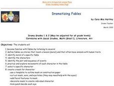
Students familiarize themselves with fables by listening to several of them. They define fables. They identify the moral of a specific fable. They identify characters, plot and sequence of events. They create a mask of a character in a...
Curated OER
If These Walls Could Talk: Seeing a Culture Through Human Features
Students read Talking Walls and discuss the walls presented and their importance to the culture. In this geography lesson, students locate and label each country/continent discussed in the book on a world map. Students take a walk and...
Curated OER
Hit The Road Jack(or Jill)
Young scholars find the approximate area of the court order on a current map of Delaware. They draw a layout of their school and decide where a new hallway or outside pathway would be most needed.
