Curated OER
Geo-Magazine
Divide your geography class into groups and have each research an assigned region. The result of this project is a regional magazine that addresses the five themes of geography. Many valuable resource links are embedded into the...
Curated OER
Fantasy / Art Maps
Ninth graders analyze a fantasy art map by Jeremy Anderson, paying careful attention to the way the topographic features of the land are represented. They create a similar map of Sacramento that includes topographical features as well as...
Curated OER
Introducing Maps Through Dance
Students are introduced to the key concepts of maps; direction, pathway/line, shape and symbol. They create the pathways and shapes they have "mapped" out on paper on the floor. They dance along the paths.
Curated OER
Geography/Current Events Project
Using the Balkan region as an example, fourth graders review the five themes of geography as a class. They identify the physical and human characteristics of a region before labeling the countries and landforms on a map. They then...
Curated OER
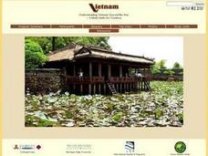
Understanding Modern Vietnam Through the Five Themes of Geography
Young scholars explore Vietnam and prepare a studenT book about Vietnam using the five themes of Geography. These books be used to teach a younger classroom about Vietnam, as part of a service-learning project in our school.
Curated OER
African Safari
Seventh graders examine different countries in Africa to research. They choose one to concentrate their research on using the five themes of geography. They design a multimedia presentation that will make up the African safari.
Curated OER
Why All Maps Lie
Eighth graders discover the fundamental advantages/disadvantages of both maps and globes. They see that maps may distort size, shape, distance and direction. They discuss the advantages and applications of 5 types of map projections and...
Curated OER
Create Your Own Country Project
Young scholars demonstrate their knowledge of geography with this fun, collaborative social studies project. Working in small groups, students develop their very own countries, writing descriptions...
Curated OER
Yo Ho, Yo Ho, A Pirate's Map for Me: An Original Story
Students read Blackbeard and brainstorm their knowledge of maps. In this language arts and geography lesson, students use landmarks on their playground to review north, south, east and west and discuss the compass rose. Students read...
Curated OER
Region Reality
Eighth graders compare and contrast world regions and explore the theme of world regions. In this world geography lesson, 8th graders name regions in the U.S. and mark them on a map. Students discuss the cultural and physical...
Curated OER
How Can We Organize Study of a Given Place?
Seventh graders embark in discovery of basic facts about an assigned continent and are asked to organize their information into categories. The Five Themes model is taught and students reshuffle their information appropriately.
Curated OER
African Country Study and PowerPoint Presentation
Students investigate the geography of Africa. In this African culture lesson, students research the lifestyles of African residents and create a PowerPoint presentation based on a single African country. Students share their...
Curated OER
New Hampshire and the Five Themes of Geography
Pupils explore the location, place, human-environmental interactions, movement, and regions of the New Hampshire landscape through the use of visual representations.
Curated OER
My Own Private Idaho; Using Social Studies to Explore Idaho
Students engage in several activities to explore Idaho and Social Studies themes. Using an variety of media, students become familiar with Idaho's geography and geology.
Learning to Give
Africa - The Great Southland
Applying the five themes of geography, preteen explorers develop a visual aid for younger learners in celebration African American History Month. They investigate the political, geographic, economic, and social aspects of the continent...
Curated OER
Discovering New Mexico
Seventh graders discuss the elements of maps and using basic linear measurement. They calculate the distance between the cities and create a simulated journey around New Mexico using a road map. They write out the directions for their...
Curated OER
Study of New York City
Fourth graders read A Cricket in Times Square and examine the essence of living in New York City. They examine subway maps and other resources concerning NYC and then complete several writing activities about the city. They also create...
Curated OER
Flat Stanley
The geography of the United States is the focus of this lesson, as well as writing friendly letters. Your second graders read, "Flat Stanley," by Jeff Brown. They create their own Flat Stanley out of poster board, markers, crayons and...
Curated OER
Building an Empire Mapping China
Students create travel brochures of China's nine regions and make a bulletin board display with them.
Curated OER
Microsoft Publisher Country Brochure
Students explore geographic information. In this geography and technology lesson, students choose a county and answer related questions on a Webquest. Students create a word web and design a country brochure.
Curated OER
Where Should We Put a Store?
Students analyze population data. They convert population data into simple density maps to help make decisions about their world. They select the best location for a school store based on population density. They present their maps...
Curated OER
Mental Map Postcard
Learners visit an outdoor setting and make a mental map of what they observe. They return to the classroom and create a postcard with specified elements such as a description of the land and the ecosystem. Students illustrate the...
Curated OER
Defining Success
The class defines what it means to be successful by examining the achievements of Rich Wilson. They create headlines for a mock paper, discuss achieving personal goals, and create a scrapbook of his journey. Tip: Use this resource when...
Curated OER
Social Studies:
Students identify various types of breads fromother countries and locate them on maps. In small groups, they make story maps of books that mention bread and make books resembling sandwiches. Students have a bread tasting party and...


