Curated OER
Where in the Latitude Are You? A Longitude Here.
Students distinguish between latitude and longitude on the map. In this mapping lesson, students participate in mapping skills to recognize spatial relationships, and where to find natural resources on the map. Students create...
Curated OER
Project Jukebox
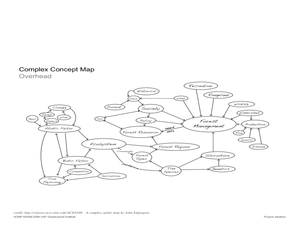
Students analyze an interview with the Climate Change Project Jukebox in order to help them undertand how to use a concept map. In this writing and climate change lesson, pairs of students log onto the Internet site for Climate...
Curated OER
Exploring Arizona's Biotic Communities Lesson 1: Mapping Biotic Communities
As part of a unit on Arizona's biotic communities, young ecology learners create a map. They describe how humans and animals adapt in their habitat. They take notes and create graphic organizers from articles they read. Beautiful maps,...
Curated OER
Water - Our Future
How is it that water that falls as rain ends up coming out of the tap on our sinks? Learners trace water's journey and examine how along the way pollutants make their way into the water supply. They conduct experiments, use the Internet...
Curated OER
Three Dimensional Geology
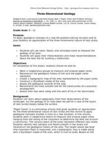
Here is a fine lesson plan on geology designed for high schoolers. Learners use rocks, fossils, and other geological clues to determine the geology of an area. Then, they make recommendations to a fictitious city council about the...
Curated OER
Beary O'Mometer Learns About Careers In Meteorology
Students explore the field of meteorology. In this meteorology lesson, students explore weather-related careers as they research the field of study as well as various weather concepts. Students interview meteorologists, write business...
Curated OER
Exploring Hawaiian Mountain Zones
Fourth graders watch a video that describes the climate and vegetation zones of Hawaii. They describe the different physical conditions that create vegetation zones from the sea to the mountains. In groups, they create an illustrated...
Curated OER
The Nine Planets
A solid instructional activity on teaching the nine planets in our solar system is here for you. In it, young scientists learn the correct order of the planets, and they choose one of the planets to do a research report on. They must...
Curated OER
Maps In Our Everyday Lives
Young scholars break into groups and complete a chart about information on maps of their hometown.
Curated OER
Christopher Columbus: The Man, the Myth, the Legend
Learn more about maps by examining Christopher Columbus's voyage to the New World. Kindergartners will learn about basic map skills and how to identify the compass rose, oceans, and land masses. They will also discover the purpose of...
Curated OER
Living in the Desert
Conduct an investigation on the plants used by the Hohokam tribe. To survive in the harsh desert environment the Hohokam used many natural resources. Learners read, research, map, and graph multiple aspects of Hohokam plant use as a...
Curated OER
Galaxy Mapping
Students research the constellations and discuss their findings. Then they construct their own maps of the galaxy using paper, black paint, aluminum foil, etc. They make a 3-D map of their chosen constellation.
Curated OER
Relief Maps
Learners study geographical maps and their functions. For this geography lesson students work in groups to build a map to scale.
Curated OER
Designing a Hiking Trail
Put your students' map skills to the test with this engaging cross-curricular project. Given the task of developing new hiking trails for their local community, young cartographers must map out beginner and intermediate...
Curated OER
Map Projections: The Grapefruit Activity
Students partcipate in activities in which they examine different map projections. They discover the positives and negatives of each type. They use grapefruits to help them with the different types of map projections.
Curated OER
The Missing Piece: A Tale of a Tail
Students analyze and write about their findings of the dinosaur discoveries of Edward Cope. For this Edward Cope lesson plan, students examine illustrations of concept maps, discuss challenges, analyze skeleton diagrams, and write...
Curated OER
You Are Here
Students map local places and learn to use scale and distance. In this mapping instructional activity, students map their school and a favorite place. Students recreate their maps showing distance and scale sizes. Students...
Curated OER
The Responsibility of Preservation
Upper elementary and middle schoolers study the case of the ivory-billed woodpecker, a bird that was once-thought to be extinct. Learners explore the responsibility of people to preserve habitats, and take care of the animals who live in...
Purdue University
The Represented World: Recreational STEM
How are forces and motion important to a swing set? Scholars explore the concepts of force and motion using swing sets. In preparation for their own STEM design project, individuals take surveys and data from peers, complete labs on...
Curated OER
Photosynthesis
Fifth graders work in small groups to brainstorm responses to a problem related to some disaster that wipes out half or all plant life on earth. Groups complete a graphic organizer to compare and contrast their ideas. Students select...
Curated OER
Genetics and Heredity: The Next Generation
Tenth graders work in teams to order events of DNA transcription and translation protein synthesis. In the second instructional activity, they put the steps of mitosis and meiosis in order using a concept map poster. They use modeling...
Curated OER
Planning A Railroad Online Lesson
Students plan a route across Donner Summit using topographical maps in order to understand the challenges involved in constructing the railroad in the Sierra Nevada Mountains. In this history lesson, students first discover how to read...
Curated OER
Mapping a Garden
Second graders recognize the components of a map, particularly the legend, the key, the symbols and the area. They develop their own map of a garden they be planting in their upcoming science lesson.
Curated OER
Amazon Rainforest: You Won't Find George in This Jungle
Students identify locations of rainforests, compare/contrast layers of the rainforest, construct and interpret maps and graphs, recognize relationships between man and the environment, and write about an imaginary walk in the rainforest.

