Fremont Unified School District
4th Grade California Relief Map Project
Bring life to your next California geography lesson with this great project! Learners design a three-dimensional wall relief map of California, painting and decorating regions using a variety of materials and labeling major geographical...
California Polytechnic State University
Australian Geography Unit
At the heart of this resource is a beautifully detailed PowerPoint presentation (provided in PDF form) on the overall physical geography of Australia, basic facts about the country, Aboriginal history, and Australia culture and lifestyle.
Curated OER
Dos mapas de Florida, el Caribe y parte de Sur America
What can maps tell us about the past? Find out with a Spanish lesson that incorporates geography. After examining maps individually, comparing two old maps of Spanish Florida and writing notes in the provided Venn diagram, pupils pair up...
Curated OER
N is for Natural State
For any pupils who live in the state of Arkansas, this would be a fabulous educational experience to help them get to know their state better. Through the use of activities in literature, art, mathematics, science, social studies, and...
Curated OER
Arkansas: A Changing Climate, a Changing Land
Here is a lesson on the climate zones and geography of Arkansas. In it, learners look at maps (embedded) of different climate zones found throughout Arkansas. They engage in discussions regarding how global warming and climate change is...
Curated OER
Create Your Own Country Project
Young scholars demonstrate their knowledge of geography with this fun, collaborative social studies project. Working in small groups, students develop their very own countries, writing descriptions...
Howard Hughes Medical Institute
BiomeViewer
Which holds more influence, the environment over humans or humans over the environment? Young scientists explore an online interactive that addresses this discussion. They observe changes in the natural world over time and see which...
Curated OER
Call to Arms: A Service Project
Sick of selling candy and washing cars? How about hosting a Digital Day or a Learning Lunch? The suggestions here make fund raising fun and rewarding. Raise money to preserve important maps and other primary source documents.
Theodore Roosevelt Association
Roosevelt's Legacy: Conservation
The legacy of Theodore Roosevelt carries through modern American politics, economics, foreign policy, and society. But his proudest and most profound efforts were in the world of conservation, and in preserving the natural beauty of...
Population Connection
The Human-Made Landscape
Agriculture, deforestation, and urbanization. How have human's changed the planet and how might we mitigate the effects of human activity on the planet? To answer these questions class members research the changes in human land use from...
Curated OER
Water Sources in Cape Verde and West Africa
Young explorers study the scarcity and importance of a continuous supply of fresh water in Cape Verde. They research the five main ways that fresh water is obtained in these countries. Each research group prepares a presentation, and...
National Endowment for the Humanities
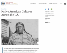
Native American Cultures Across the U.S.
Middle schoolers examine how American Indians are represented in today's society. They read stories, analyze maps, and complete a chart and create an illustration about a specific tribe.
Roy Rosenzweig Center for History and New Media
Differences Among Colonial Regions
Classes look at and analyze primary source images to explore the differences between the colonial regions during the Revolutionary era. They break into groups to tackle each region and then present their findings to the class. A final...
Curated OER
Integrated Lesson Plan
An ambitious and engaging instructional activity on the Westward Movement for your young scholars to enjoy! Groups of learners rotate between learning tasks such as learning about the Chislom Trail, Lewis and Clark, and the Gold Rush. A...


