Curated OER
Cinderella in Africa
Explore African folk tales! After reading the African folk tale "Mufaro's Beautiful daughters" and the American version of "Cinderella," youngsters list differences and similarities between the two. Draw a T-chart on the board, and hold...
Curated OER
St. Patrick's Day and Leprechauns
Young learners are introduced to the history, and customs surrounding St. Patrick's Day. This colorful and enchanting lesson has the learners hunt for leprechauns, four-leaf clovers, and that lucky pot 'o gold.
Curated OER
What Kind of Vessel Are You?
This is a strange question; but what kind of vessel would you be and why? After examining images of a large Inca jug, the class sets to writing a creative narrative that answers that very interesting question. They start by researching...
Curated OER
Community Arts Projects
Youngsters learn about community through exploration of their own neighborhood.In this lesson plan about community, students create a community in their classroom. Students think about what their community looks like by making a map....
Curated OER
Natural Features
Students identify natural features on a map. In this map skill lesson, students use a landscape picture map to identify mountains, hills, islands, lakes, and rivers. Students use post-it notes to demonstrate their location.
Curated OER
Playground Mapping
Young scholars review their physical models of the objects on their playground at school. Using the model, they convert it into a map with a scale and key. To end the lesson, they use the map to locate different objects and measure the...
Curated OER
Countries of the World
Students identify countries on a world map. In this map skills lesson, students define the word "country" and use post-it notes to locate several countries on a world map.
Curated OER
Tracking Fall's Falling Temperatures
Young meteorologists track weather from day to day and record results on graphs, maps, or other places. They see firsthand how weather temperatures trend cooler as fall progresses and practice grade-appropriate skills in geography (map...
Curated OER
Memories from the National Sites
Students write a virtual postcard. In this logo lesson students are introduced to the concept of postcard writing. Students research the national sites and states highlighted on quarters for that year. Students take a virtual trip to the...
Curated OER
Comparing Countries
Students compare facts about different countries. In this comparing lesson, students collect information about the US and another country and compare them. Students locate countries on the map and make a hypothesis about the lives of...
National Endowment for the Humanities
The Greek Alphabet: More Familiar Than You Think!
In this Greek alphabet instructional activity, pupils explore the Phoenician origins to the Greek alphabet. Learners compare Greek letters to current letters and write a paragraph about the life of young scholars in ancient Greece....
Curated OER
Building Bridges for Young Learners- School
Students examine the purpose of education. In this schooling lesson plan, students read a letter from a child in Uzbekistan. Students compare and contrast their schooling to children around the world.
Curated OER
Introduction to Symbols
Learners study the concept of picture symbols as a way to express ideas without using words. In this picture symbol lesson, students place symbols on a U.S. map according to meaning. Learners then review various symbols...
Curated OER
Where People Live- Neighborhoods
Students use a map. In this neighborhood lesson, students describe a neighborhood, emphasizing the common characteristics between all neighborhoods. Students locate a neighborhood on a landscape picture map and discuss.
Curated OER
Introduction to the Globe
Students investigate how to use a globe. In this map skills lesson plan, students define what a globe is and locate the various continents on the globe. Students are also asked to locate the four oceans on the globe.
Curated OER
Country Capitals
Students locate country capitals on a world map. For this map skills lesson, students review the definition of the word country and discuss what a capital is. Students locate and label capital cities on a world map using a map marker.
Curated OER
Go West With Columbus
Students play a board game where their tokens must move Columbus west. They choose cards which give commands to move in a coordinate direction. They practice moving west, north, east, south by playing the game.
Curated OER
The Gingerbread Man Trail
What a fun way to familiarize your young learners with friendly faces on campus! Scholars read "The Gingerbread Man," discussing the characters he meets. Then, they examine a map of the campus, placing photos of employees (such as the...
Curated OER
Exploring the Sky: Reading Maria's Comet
Discover the science behind astronomy. After reading the book Maria's Comet, which is about a young woman who breaks new ground by becoming a female astronomer, young learners practice reading comprehension with...
Curated OER
Making a Connection
Learners research why government community workers are important to us. They work in teams to identify and illustrate the jobs and services provided by these community workers. Assessment comes from their Student Concept Maps.
Curated OER
Lone Star Round-Up
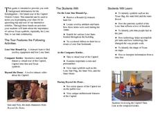
Students take a virtual tour of the Capitol Visitors Center in Austin, Texas. In groups, they receive a list of the artifacts and symbols they are to look for during their exploration of the building. To end the lesson, they make a...
Curated OER
Winter Holiday Activities Extravaganza
Students define culture and explore elements that are part of the custom or culture of a place. In this holiday lesson plan, students identify the cultures they participate in. Students identify the differences in people's...
Curated OER
Living By Water
Learners research a coastal community, locate it on a map and profile its physical, geography, climate, architecture and cultural characteristics. They envision this coastal community and make a detailed drawing of it by blending...
Curated OER
Equator, North Pole, and South Pole
Students identify the Equator, North Pole, and South Pole on the globe. In this map skills lesson, students use a globe marker to locate specific locations on the globe. Students find where they live in relation to the Equator.


