Curated OER
United States of America: 1860
In this United States historical map worksheet, students examine the boundaries of the labeled states and territories of the nation in 1860.
Curated OER
Trails West: Westward Expansion Maps
In this United States historical map learning exercise, students examine the trails that settlers of the Western United States took during the period of Western Expansion. Major cities on the routes are labeled.
Curated OER
Africa & Asia: Physical Map
In this African and Asian physical map worksheet, students investigate the major landforms and bodies of water located on the African and Asian continents.
Curated OER
Africa & Asia: Labeled Map
In this African and Asian political map worksheet, students examine national boundaries and national capitals of the continents.
Curated OER
United States of America: 1860
In this United States historical map worksheet, students examine the boundaries of the states and territories of the nation in 1860. This map is unlabeled.
Curated OER
Central America: Unlabeled Map
In this Central American political map worksheet, students examine the boundaries of the countries and capital cities located in this region of the world.
Curated OER
Mexico: Political Map
In this Mexico political map worksheet, students examine state boundaries. The map also highlights major cities in Mexico.
Curated OER
Canada Map
In this Canada political map learning exercise, students examine province boundaries. The map also highlights each of the province's capitals with a star. The provinces and cities are labeled.
Curated OER
Canada: Outline Map
In this Canadian political map worksheet, students examine Canada's province boundaries. The map also highlights each of the province's capitals with a star.
Curated OER
Central America Map
In this Central American political map learning exercise, learners make note of national boundaries and capitals in this region of the world.
Curated OER
Mexico: Political Map
In this Mexico political map activity, students examine state boundaries. The map also highlights major cities in Mexico. This map is unlabeled.
Curated OER
North America: Political Outline Map
In this North America political map worksheet, students examine the state and province boundaries of Mexico, Canada, and the United States.
Curated OER
North America Map
In this North America political map worksheet, students examine the labeled countries and their respective national boundaries.
Curated OER
North America: Unlabelled Map
In this North America political map worksheet, students examine the unlabelled countries and their respective national boundaries.
Curated OER
Europe Labeled Map
In this Europe political map worksheet, students examine the national boundaries. The map also highlights each of the nation's capitals with a star. The countries and capital cities in this map are labeled.
Curated OER
Afghanistan & Pakistan Map
In this Afghanistan and Pakistan political map worksheet, students examine the national boundaries as well as major cities in each of the countries.
Curated OER
Physical World Map
In this world map worksheet, students practice their geography skills as they label the 7 continents and 5 oceans. Teachers may use this physical map for various classroom activities
Curated OER
World Political Map
In this blank outline map worksheet, students note the political boundaries of the nations of the world on a Mercator projection map.
Curated OER
United States 1860
For this United States historical map worksheet, learners examine the state and territorial boundaries as well as the large cities of the nation in 1860.
Curated OER
North America Map
In this North America outline map worksheet, students examine the political boundaries and identify the countries of North America.
Curated OER
Here's to Your Healthy Heart: Heart Rate Record Work Sheet
For this heart rate record work sheet, learners record their pulse rate after completing different levels of exercise. Students record their hear rate after walking, doing jumping jacks and running at one minute intervals.
Curated OER
"A Sound of Thunder" Worksheet
In this "A Sound of Thunder" activity group, students complete a graphic organizer for the plot of the story. Students then complete activities with vocabulary from the reading and edit passages from the text.
Curated OER
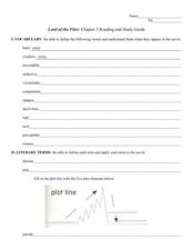
Reading and Study Guide: Lord of the Flies Chapter Three
In this reading and study guide for Lord of the Flies, learners must define vocabulary words found in the reading, complete a plot diagram and answer reading comprehension questions.
Curated OER
Graphic Organizer: Of Mice and Men
In this graphic organizer, students examine the plot of the novel Of Mice and Men by stating the setting, characters involved, main events and the part of the plot line in each chapter of the novel.


