Curated OER
USA Postal Abbreviations Map
In this United States political map worksheet, students examine the postal abbreviations of each of the states.
Curated OER
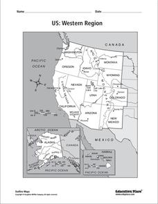
US: Western Region Map
In this United States Western Region worksheet, students examine the state boundaries and landforms found in this region. The map also highlights each of the state capitals.
Curated OER
Lewis & Clark Map
In this Lewis and Clark expedition map activity, students examine the route of the expedition and the separate return routes of both Lewis and Clark.
Curated OER
Colonial America 1776 Map
In this United States historical map worksheet, learners examine the colonial boundaries in 1776 as well as the Proclamation Line of 1763.
Curated OER
The 13 British Colonies Map
In this United States historical map worksheet, students examine the 13 colonial boundaries and noted major cities.
Curated OER
South America Map
In this South American political map learning exercise, students examine both national boundaries and national capitals.
Curated OER
The 13 British Colonies
In this British colonies historical map worksheet, students examine the political boundaries of the 13 original colonies.
Curated OER
Southern Hemisphere Map
In this Southern Hemisphere polar projection map worksheet, students examine this region of the world. The continents shown are labeled.
Curated OER
Northern Hemisphere Map
In this Northern Hemisphere polar projection map worksheet, students examine this region of the world. The continents shown are labeled.
Curated OER
Eastern Hemisphere Map
In this Eastern Hemisphere polar map worksheet, learners examine the Eastern Hemisphere including the political boundaries formed by the countries in this region of the world.
Curated OER
Americas: Physical Map
In this Americas physical map activity, students make note of the major landforms and bodies of water located on the North American and South American continents.
Curated OER
Americas: Political Map
In this North America and South America outline map worksheet, students examine the political boundaries of the 2 continents.
Curated OER
California Regions Map
In this California regions outline map worksheet, students examine the coastal, mountain, central, and desert regions of the state.
Curated OER
Europe: Political Map
In this Europe political map worksheet, students examine each country's boundaries. The map also highlights each of the nation's capitals with a star.
Curated OER
US: Midwest Region
In this United States political map worksheet, students examine the state boundaries of the Midwestern Region. The map also highlights each of the state capitals denoted by stars.
Curated OER
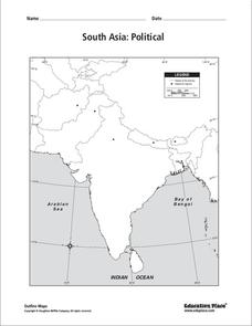
South Asia: Political Map
In this South Asia political map worksheet, students examine the national boundaries. The map also highlights each country's capital city.
Curated OER
World Climate Map
In this world climate map learning exercise, students examine the tropical, dry, warm temperate, cool temperate, polar and subartic, and highland climate regions of the world.
Curated OER
World: Continents Map
In this World outline map worksheet, students note the political boundaries of the continents of the world on this Robinson projection map.
Curated OER
South America Map
In this South America political map worksheet, students examine the country boundaries. The map also labels each of the countries and their capitals.
Curated OER
World: Physical Map
In this world physical map worksheet, learners make note of the major landforms located on this Robinson projection map.
Curated OER
US: Northeast Region Map
In this United States political map worksheet, students examine the state boundaries of the Northeast Region. The map also highlights each of the state capitals denoted by stars.
Curated OER
US: Northeast Region: Unlabelled
In this United States political map activity, students examine the Northeast Region state boundaries. The map also highlights each of the state capitals denoted by stars.
Curated OER
South US Region
In this United States political map learning exercise, students examine the Southern Region state boundaries. The map also highlights each of the state capitals denoted by stars. The states, capitals and major landforms are labeled.
Curated OER
United States of America Map: Capitals
In this United States outline map worksheet, students note the political boundaries of the states that are labeled with postal abbreviation codes as well the labeled state capitals.


