Curated OER
U.S. and Canada: How are We the Same? How are We Different?
Get high school geographers to compare and contrast Canada and the United States. They begin by drawing a freehand map of North America, then complete readings to gain insight into Canada. The text is not provided; however, another text...
Curated OER
U.S. State Reports
Students conduct Internet research on a chosen U.S. state. They include information about the history, climate, geography, symbols, and tourist attractions of their state, and write an original poem.
The New York Times
Decision Point: Understanding the U.S.’s Dilemma Over North Korea
Simulate the Situation Room and analyze the US's relationship with North Korea. The plan starts off with a quick review and an examination of a online timeline that updates as the situation continues. Next, the class reads an article and...
Curated OER
Expanding the Mission: Historical Parks
Students explore U.S. geography by viewing a documentary in class. In this national parks instructional activity, students view video clips of individual national parks and locate them using Google Earth software. Students create a...
Curated OER
Ozark Folk Culture and Geography in the Mountain View, Arkansas Area
Upper grade through early high schoolers develop an understanding of Ozark culture, and the geography of the Ozark Plateau. They study place, location, human environmental impacts, and movement. This interesting plan incorporates muic,...
Curated OER
Wow! You're Eating Geography
Students examine patterns of food producing areas, and identify foods that are grown locally, in the U.S., and around the world. They map and graph the major food crops of their local area, the U.S., and other countries, and discuss the...
Curated OER
Facts, Fictions and Perceptions of Regions
Students examine the different characteristics of the regions of the United States. They discuss places they have visited in the U.S., and in small groups conduct research on a selected region of the U.S. Each group labels a map of...
National Endowment for the Humanities
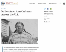
Native American Cultures Across the U.S.
Middle schoolers examine how American Indians are represented in today's society. They read stories, analyze maps, and complete a chart and create an illustration about a specific tribe.
Curated OER
People Behind the Parks
Explore U.S. geography with your class by viewing a documentary. Show a portion of the Ken Burns documentary "The National Parks," and identify the individuals responsible for keeping the parks in order. Elementary and middle schoolers...
Curated OER
Mapping the Most Common U.S. City Names
Pupils discuss the most common U.S. place names. They map the locations of U.S. cities with the most common names and use an atlas, or an online map tool such as MapQuest or Yahoo Maps.
Curated OER
There Is No Place Like Home! U. S. Immigration in the 1800's.
Pupils explore immigration in the late 1800's. They identify and describe the settlement patterns of European immigrants to the U.S. Students work in groups to research immigration from specified countries.
Curated OER
Where Did My Lunch Come From? A U.S. Regional Tour
Students explore the regions from which their food comes. For this social studies lesson, students identify the different agricultural products that are found in the major regions of the United States. Students create a lunch menu.
Curated OER
National Parks
Students conduct research on the U.S. National Parks. They conduct Internet research, analyze maps, and create and solve riddles that present specific clues pertaining to a selected national park and it's location.
Curated OER
The Eerie Canal
Learners discover bodies of water in the United States by investigating the Eerie Canal. For this U.S. Geography lesson, students discuss Lake Eerie and the canal that was built in order to transport goods. Learners research the lake...
Curated OER
"Place the State" Game
Students participate in a computer game in which they locate and place the U.S. states on a blank outline map. In small groups, they take turns dragging and dropping the states in the proper location on a map.
Curated OER
My Summer Vacation
Learners study the United States geography using Google Earth. In this U.S. geography lesson, students create travel journals about five U.S. geographical locations. Learners research the human and physical characteristics for each region.
Curated OER
Hip Hop and Geography
Learners study the various geographic regions of the U.S. and discuss how popular music is influenced by cultural/regional factors. Groups choose East Coast, West Coast, Midwest, or South in rap/hip hop music and create a PowerPoint or...
Curated OER
Popcorn Geography
Students use kernels to create a "Top Corn-Producing States" map or graph. They read and round off numbers. Students identify on a U.S. outline map the location of corn-growing states. They create a visual (map or graph) illustration...
Curated OER
Making a Report to President Washington
Students gain an understanding of some of the challenges the U.S. faced at its birth. They are asked to compose a report on the state of the nation in 1790 (addressed to President George Washington), which includes a narrative, maps and...
Curated OER
Geography: Intro to Canada
Learners investigate the geography of Canada by analyzing a map of the country. In this North American geography lesson, students identify the 13 provinces of Canada and their locations by examining a Canadian map. Learners may use...
Curated OER
Mapping Martin Luther King Jr.
Young scholars examine geographic locations that were important in Martin Luther King Jr.'s life. They research Martin Luther King Jr., and create U.S. maps that show the locations important to him.
Curated OER
Exploring our National Parks
Young scholars utilize maps/Atlases to find key spatial information, locate U.S. National Parks, characterize the geography of a specific region, and create a National Park brochure.
Curated OER
Chihauhan Desert Journaling Activity
Students explore U.S. geography by completing an observational activity with classmates. In this New Mexico lesson, students research the Chihuahuan Desert by visiting several Internet sites. Students write the data they've collected in...
Curated OER
Build a U.S. Strategy for Responding to the Crisis in Sudan
Students work together in groups to discover the situation in Sudan. They discuss what problems arise from helping a foreign country. They answer questions and watch a video as well.
Other popular searches
- U.s. Geography Lesson Plans
- U.s. Geography Southeast
- U.s. Geography Slavery
- U.s. Geography Northeast
- U.s. Geography California
- U.s. Geography Oregon
- U.s. Geography and Economics
- U.s. Geography Pdf
- U.s. Geography West
- U.s. Geography Activity
- U.s. Geography + Slavery
- U.s. Geography Southwest


