Curated OER
Geography of Japan
Students complete a worksheet that guides them through an overview of Japanese geography. Students research the topography, climate, population and size of Japan and consider how these factors work together to produce Japanese culture.
Curated OER
Washington Cities Map Quiz
In this online interactive geography worksheet, students examine a map of the state of Washington and identify the 13 noted cities on the map using a pull down menu within 3 minutes.
Curated OER
The Equator
Middle schoolers investigate cultures located along the equator. In this geography skills activity, students research the geography, history, culture, and tourism of Ecuador, Indonesia, Kenya, Brazil, and Singapore. Middle schoolers...
Curated OER
Personal Stories of the National Parks
Middle schoolers explore historical information about U.S. national parks using the stories of Edward and Margaret Gehrke as a primary source document. In this United States geography, history, and literacy lesson, students view the...
Curated OER
Oil Dependency Among Nations
Students research oil dependency amongst different nations in the world. In this oil dependency lesson plan, students use maps to locate oil sources, consider government actions on oil, and predict U.S. oil dependency.
Curated OER
I Am Freedom Bound!
Upper elementary and middle school learners engage in this awesome lesson plan on the Civil War. In it, they watch streamed video, perform Internet research, engage in hands-on activities, and use their geography skills to locate...
Curated OER
Recreate the Race
Students research and find the route of the Alaskan dog sled race.In this Iditarod race lesson students find the checkpoints for the Iditarod on a map. Students research information in pairs about each one of the checkpoints. Students...
Curated OER
A Long Way from Home: A Hands-on Geography Lesson about World War II
Students build World War II directional signs. In this World War II lesson, students explore the geographic locations of the war as they analyze primary sources and conduct research regarding places of significance in the war. Students...
Curated OER
Geography: Mapping Newspaper Coverage
Students examine the locations of stories appearing in newspapers and determine where to assign reporters. Using various maps, they connect the stories to the correct maps and create charts of the story locations. Students explain their...
Curated OER
Louisiana Purchase
Students use maps, lecture and discussion to explore the unique contributions to the U.S. resulting from the purchase of the Louisiana Territory. They complete worksheets, label maps and participate in discussion groups.
Curated OER
History and Government of the United States
In this U.S. worksheet, students take notes in a graphic organizer as they read several passages, then answer four comprehension questions.
Curated OER
Attu Battlefield: U.S. Army and Navy Airfields on Attu
Students use maps, readings, drawings and photos to research the World War II Battle of Attu. They explain the importance of the battle, discuss the valor and loyalty of both American and Japanese troops and analyze sources of historical...
Curated OER
Where in the World Is That Volcano?
Identify the Earth's major volcanoes with an earth science lesson. Elementary and middle schoolers locate major volcanoes on a world map. Then, in groups, they research how the volcano affects the region in which it is located.
Curated OER
Arkansas State Rock
Here is a lesson which shows the value of a mineral called bauxite to Arkansas during the early 1900's. Learners relate the five themes of geography to the history of bauxite and aluminum production in Arkansas. For teachers of...
Curated OER
The Treaty Trail: U.S. Indian Treaty Councils in the Northwest
Students create a timeline with the major events of the 19th and 20th century dealing with Native Americans. They examine artifacts and discuss how they reflect culture. They also identify trade routes the Native Americans used.
Curated OER
Comparative Geography I
Students use population density and other statistics to compare countries. They find the population density for the countries listed in the table. Students compare findings with a partner, and then share with the class.
Curated OER
As Simple as Beans: Canada's Population
Students gather facts about Canada from various maps. In this Canada instructional activity, students use beans to relate the populations of the U.S. and Canada. Students create population distribution maps based on the placement of the...
Curated OER
You Can Find It!
Students locate different places including U.S. cities using longitude and latitude coordinates. In this longitude and latitude lesson plan, students locate 10 different locations.
Curated OER
USA Immigration by Country Quiz
In this online interactive geography quiz learning exercise, students respond to 30 identification questions about countries U.S. citizens have immigrated from. Students have 5 minutes to complete the quiz.
Curated OER
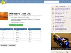
Hottest US Cities Quiz
For this online interactive geography quiz worksheet, students respond to 20 identification questions about the hottest cities in the United States. Students have 4 minutes to finish the timed quiz.
Curated OER
The Emerald Necklace: Boston's Green Connection
This lesson could be used in U.S. history, social studies, and geography courses in units on urban expansion in the late 19th century or city planning.
Curated OER
The Greatest Educational Change America Has Ever Seen
Young scholars connect the symbols from the design of the United States Mint Fifty State Quarters Program to our country's history in this five-activity unit. The culture, unique heritage, and geography of the individual states are probed.
Curated OER
Puerto Rico: The 51st State?
Students research the history of Puerto Rico, its culture, and geography. In this Puerto Rico lesson, students find Puerto Rico on a map and find specific regions or cities. Students discuss Puerto Rico's statehood and listen to salsa...
Curated OER
Mapping Population Changes In The United States
Students create a choropleth map to illustrate the population growth rate of the United States. They explore how to construct a choropleth map, and discuss the impact of population changes for the future.
Other popular searches
- U.s. Geography Lesson Plans
- U.s. Geography Southeast
- U.s. Geography Slavery
- U.s. Geography Northeast
- U.s. Geography California
- U.s. Geography Oregon
- U.s. Geography and Economics
- U.s. Geography Pdf
- U.s. Geography West
- U.s. Geography Activity
- U.s. Geography + Slavery
- U.s. Geography Southwest


