Curated OER
What Do We Learn From the Repartiation of Alaska Native Artifacts?
Students observe and evaluate evidence of Alaska Native cultural symbols and artifacts. They research historical data from a variety of primary resources, including the Harriman expedition journals, related web sites, oral accounts,...
Curated OER
Thematic Maps of Your School
Students are able to list the essential elements of a thematic map, understand and use scale effectively to represent a geographic area, use research skills to develop a body of information, plan and draw an accurate thematic map based...
Curated OER
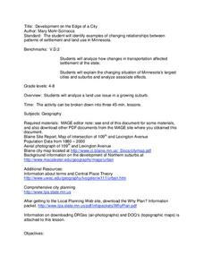
Development on the Edge of a City
Young scholars explore and analyze examples of changing relationships between patterns of settlement and land use in the state of Minnesota. They view different avenues of transportation, cities, suburbs, city planners and suburbanization.
Curated OER
The Underground Railroad
Students discuss how slaves fought against their situation and how did they escape. They discover what the Underground Railroad was and how it slaves used it to reach freedom. They then play a game focusing on the Underground Railroad in...
Curated OER
The Ancient World
Students explore the concept of migration. For this ancient civilizations lesson, students watch "The Ancient World" and research life in the Fertile Crescent. Students then write letters from the perspective of people migrating from...
Curated OER
The Middle East: Land of Contrasts
Students explore the ancient city of Petra. In this Middle East lesson plan, students watch "The Royal Tour of Jordan," and then discuss the history of Petra. Students conduct research on selected sites in the city and use their findings...
Curated OER
South America Map Quiz
For this online interactive geography quiz worksheet, students examine the map that includes all of South America's countries. Students identify the 13 countries in 2 minutes.
Curated OER
Middle East Map Quiz
For this online interactive geography quiz worksheet, students examine the map that includes 26 Middle Eastern countries. Students identify the names of the countries in 4 minutes.
Curated OER
Central America Map Quiz
In this online interactive geography quiz worksheet, learners examine the map that includes 22 Central American countries. Students identify the names of the countries in 3 minutes.
Curated OER
Countries w/ Biggest Armies Quiz
In this online interactive military quiz worksheet, learners examine the chart that includes details about the number of troops in 20 countries. Students identify the names of the countries in 4 minutes.
Curated OER
Canada Map Quiz
In this online interactive geography quiz worksheet, students examine the map that includes 13 Canadian provinces and territories. Students identify the names of the provinces and territories in 2 minutes, 30 seconds.
Curated OER
Canadian Provinces Quiz
In this online interactive geography quiz activity, students examine the map that includes 13 Canadian provinces. Students identify the names of the provinces in 3 minutes.
Curated OER
State Nicknames Quiz
In this online interactive geography quiz worksheet, students examine the chart that includes the names of 49 states. Students identify the nicknames of the states in 6 minutes.
Curated OER
Biggest Cities in Canada Quiz
For this online interactive geography quiz worksheet, students examine the chart that includes the population of 20 Candian cities. Students identify the names of the largest cities in Canada in 4 minutes.
Curated OER
Highest Mountain Countries Quiz
In this online interactive geography quiz worksheet, students examine the chart that includes the elevations of 20 world mountains. Students identify the names of the mountains in 4 minutes.
Curated OER
California Cities Map Quiz
In this online interactive geography quiz instructional activity, students examine the map that includes 12 California cities. Students identify the names of the cities in 3 minutes.
Curated OER
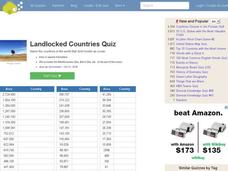
Landlocked Countries Quiz
In this online interactive geography quiz worksheet, students examine the chart that includes details about the population in 44 landlocked countries. Students identify the names of the countries in 5 minutes.
Curated OER
USA National Parks Quiz
In this online interactive geography quiz instructional activity, students examine the chart that includes 58 state names. Students identify the names of the national parks in the listed states in 5 minutes.
Curated OER
Famous Lakes Quiz
In this online interactive geography quiz worksheet, students examine the chart that includes details about 15 famous world lakes. Students identify the names of the lakes in 3 minutes.
Curated OER
Regions of Countries Quiz
In this online interactive geography quiz learning exercise, students examine the chart that includes details about 20 world regions. Students identify the names of the countries where the regions are located in 4 minutes.
Curated OER
Suburbs Quiz
In this online interactive geography quiz worksheet, students examine the chart that includes details about 18 major world suburbs. Students identify the names of the suburbs in 3 minutes.
Curated OER
Country Flags Quiz
In this online interactive country flag quiz learning exercise, students examine the 20 pictured country flags and try to name all of the countries represented in 4 minutes.
Curated OER
German Cities Map Quiz
In this online interactive geography quiz worksheet, students examine the map that includes 12 German cities. Students identify the names of the cities in 3 minutes.
Curated OER
Biggest Cities in India Quiz
In this online interactive geography quiz worksheet, students examine the chart that includes the population of 20 Indian cities. Students identify the names of the largest cities in India in 4 minutes.
Other popular searches
- World Geography Studies
- Geography Studies the Sea
- Geography Studies Rocks
- Elementary Geography Studies
- Geography Studies Cd Rom
- Social Studies Geography
- Social Studies Us Geography
- Social Studies and Geography
- Social Studies Maps Geography


