Curated OER
Oil: The Problem or Solution to the World's Economic Future
Students map the major oil producing and consuming countries and regions. They identify current and future topographic and political problems that could affect the production and transportation of oil.
Curated OER
India and Pakistan: Rivals from Birth
Seventh graders, after being divided into two groups, are assigned either Pakistan or India. They conduct research using the Internet, reference books, and magazines. The class compares and contrasts the two countries to find sources of...
Curated OER
Crude Conversation
Students analyze text and maps in determining the effect the world's energy resources have on human society, and make charts illustrating at least three ways each resource makes life easier for human society.
Curated OER
Introducing Topographic Maps: Guiding Students from Concrete Models to Graphic Representations
Students interpret topographic maps and infer human activity as it is influenced by the landscape.
Curated OER
Yaks, Yurts, and Yogurt: A Look at China's Autonomous Regions
Students are introduced to five Chinese geographical areas. They, in groups, research these areas and develop presentations including information on the physical characteristics, climate, elevation, agriculture and language.
Curated OER
Treasure of the Silk Roads
Students generate world maps that act as creative writing prompts. The prompts reflect on the cultures and history of the past through their own experiences. Students create an original writing sample.
Curated OER
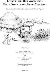
Living in the Oak Woodlands: Early People of the Jewett Mine Area
Students examine the archeology and native peoples of the Jewett Mine area of Texas. Using a map, they explain the economic patterns of the native groups and how the geography of the area affected activities. They compare and contrast...
Curated OER
Six Dynamic Designs for Arts Integrated Curriculum
Students create a recipe for a certain aspect of a culture. They create a culture that has never existed before. They analyze either dance, history, geography, history or the future of space exploration. They compare and contrast...
Curated OER
Alabama Fever
Students describe life on the Alabama frontier. They identify topics important to early settlers and explain the impact of geography on development. They explore the government's role in the sale of public land.
Curated OER
European Newscast
Young scholars work in cooperative learning groups to create and perform a newscast about a European country. This geography-based technology lesson plan concludes with class presentations and student critiques.
Curated OER
Exploring Explorers
Students research a selected explorer and teach their small group about their explorer during a jigsaw activity. Independently they write a letter as if they were on a voyage with their explorer, and create a world map that includes the...
Curated OER
Northeast States and Tribes Word Search
In this geography worksheet, learners find the words that are used to describe places in the Northeastern United States. The answers are found at the bottom of the page.
Curated OER
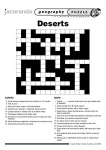
Deserts Puzzle
In this geography worksheet, students complete a crossword puzzle referring all to deserts. They identify the various types of desert land and what plants and animals can survive in these lands. Also, students identify the people who...
Curated OER
South America Puzzle
In this geography activity, students complete a crossword puzzle related to the countries, capitals, bodies of water, and populations of South America. They use the 23 clues given to solve the puzzle.
Curated OER
What do Maps Show?
Seventh graders practice reading maps. In this geography lesson, 7th graders compare a topographical map to a picture of the actual place.
Curated OER
Breads Around the World
Pupils read about bread. In this lesson plan studying bread, students read about the history of bread and it's significance around the world. Pupils identify the three main crops used to make bread and ten common types of bread from...
Curated OER
Waldseemuller's Map: World 1507
Seventh graders analyze various maps. In this Geography lesson plan, 7th graders create a large map as a whole class. Students write a letter to Mr. Waldseemuller.
Curated OER
Learning about Asia
Students explore Asia. In this geography and expository writing lesson, students read a section of their social studies book, generate an outline about important information about Asia, and write an expository paper based on facts...
Curated OER
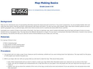
Map-Making Basics
Students study maps. In this geography and art lesson, students create their own map of the classroom.
Curated OER
Beijing: An Important City in China
Students investigate Beijing by reading an essay. In this Chinese Geography activity, students read an essay written about Beijing and answer questions on a comprehension worksheet. Students may research Beijing further by utilizing...
Curated OER
Where in the World is Rubber?
Students research countries where rubber is naturally produced. In this geography lesson, students create a poster from their researched information. They present their poster in class.
Curated OER
Where to Live?
Students decide where they want to live in US. In this geography lesson, students select their residential preferences. Using GIS, they determine the location that meets their preferences.
Curated OER
The Outback
In this geography worksheet, students answer 12 short answer questions describing the landforms and characteristics of the Outback in Australia. Teacher must provide research material.
Curated OER
Washington, D.C. Map
Here is an outline map of Washington, DC. Some of the points of interest in the city are labeled, as are Maryland, Virginia and Arlington. There are plenty of important monuments and locations not identified, making for a good project.
Other popular searches
- Five Themes of Geography
- U.s. Geography
- China Geography
- Africa Geography
- Mexico Geography
- Canada Geography
- Asia Geography
- France Geography
- Japan Geography
- World Map
- Ireland Geography
- Geography Studies


