Scholastic
The Seven Wonders of the Ancient World
The Colossus of Rhodes, the Hanging Gardens of Babylon, the Lighthouse of Alexandria. Young archeologists investigate the Seven Wonders of the Ancient World, map their locations, and match their names with brief descriptions and images....
Curated OER
Exploring the World's Geography
Students discuss the seven continents of Earth and the diverse geography. After discussion, they create their own paper-mache globes which properly display all seven continents, the equator, and the prime meridian. They conduct research...
Curated OER
Deserts of the World
The major deserts of the world are labeled on this geography activity. An excellent map of the world showing where the deserts are located, is used along with a list of the 12 major deserts of the world. Very good!
Curated OER
Simulation: River Cruise: Rivers of the World
Students identify major rivers in the world. In this geography instructional activity, students form teams and play a whole class board game in which clues are read and rivers are identified.
Curated OER
World: Physical Map
In this world physical map worksheet, learners make note of the major landforms located on this Robinson projection map.
Curated OER
World Climate Map
In this world climate map learning exercise, students examine the tropical, dry, warm temperate, cool temperate, polar and subartic, and highland climate regions of the world.
Curated OER
World: Continents Map
In this World outline map worksheet, learners note the political boundaries of the continents of the world on this Robinson projection map.
Curated OER
World: Political Map
In this world political outline map instructional activity, students examine boundaries of each of the countries in the world. This map not is labeled.
Curated OER
World Pacific Map
In this world Pacific projection outline map instructional activity, students examine boundaries of each of the countries in the world. This map not is labeled.
Curated OER
World Political Map
In this blank outline map worksheet, students note the political boundaries of the nations of the world on a Mercator projection map.
Curated OER
World: Continents
In this blank outline map learning exercise, learners note the political boundaries of the continents of the world on a Robinson projection map.
Curated OER
World: Continents Map
In this outline map activity, students note the political boundaries of the continents of the world. The map is labeled with the names of the 7 continents.
Curated OER
World Landforms
In this blank outline map worksheet, learners note the major landforms of the 7 continents of the world on a Robinson projection map.
Curated OER
Where in the World is Hawaii?
Students compare a globe and a two-dimensional world map and explore how they both represent the planet Earth. They locate the Hawaiian Islands on the globe or the world map and describe how the geographical position is unique.
Curated OER
Geomnemonics: Facilitating the Teaching of Social Studies Content with Geography Skills
Students explore how to draw a world map by hand and how to locate countries.
Curated OER
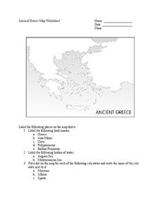
Ancient Greece Map Worksheet
Since the beginning of time, geography has shaped the development of human civilization, and ancient Greece is no exception. This worksheet supports young historians with exploring this relationship as they first identify key land...
Sharp School
Travel Brochure Project
Designing a travel brochure is a classic project that will help your class members develop a variety of skills, such as researching informational texts, designing creative visual products, and communicating what you have learned.
Curated OER
NATO Geography & Language
The class receives background information on NATO, an atlas, and a blank world map. They color the original 1949 countries in red, the 1952 additions in green, and the 1990 additions in blue. This exercise would be a good starting point...
Virginia Department of Education
World History and Geography to 1500 A.D.
Here's a great resource for your curriculum library. The 240-page packet, organized into units by topics, includes sample lesson plans, links to primary and secondary source documents, worksheets, activities, and sample assessments.
Geography for Geographers
Five Themes of Iceland
How do the five themes of geography relate to the country of Iceland? Pupils learn about everything from the differences between relative and absolute location to how humans both adapt and change the environment. The presentation...
Curated OER
Hershey and the World: The 5 Themes of Geography and Google Earth
Students invsestigate cocoa producing regions in the world. In this geography skills instructional activity, students examine how the 5 themes of geography affect the Hershey Chocolate Company as they compare and contrast cocoa...
Curated OER
Continents
Young scholars investigate World Geography by researching the different continents. In this Asian Geography lesson, students discuss the continent of Pangaea and color a worksheet of the continents. Young scholars locate China on the map...
Curated OER
Europe Map
In this world geography instructional activity, students study the map of Europe and locate the 48 countries within the continent. Students write the names on the provided lines.
Curated OER
Geography A to Z: The Letters W,X,Y and Z
Warm up the class with a fun geography quiz. They'll use the letters W, X, Y, and Z to answer seven geography-based questions. Y for Yangtze, Z for Zimbabwe, or Y for Yugoslavia.
Other popular searches
- World War I Map
- Mapping Penny's World
- Map of the World
- World Outline Maps
- Blank Maps of World
- World War 2 Map
- World War 1 Maps
- World War I Outline Map
- Map of World
- World Climate Map
- Blank World Outline Maps
- World Biomes Map


