New York City Department of Education
Colonial America and The American Revolution
How did the founding of the American colonies lead to a revolution? Use the essential question and sample activities to guide learners through a series of history lessons. Additionally, the packet includes effective strategies to...
Curated OER
Little Kinnakeet Lifesaving/Coast Guard Station
Students complete a variety of activities that go along with the study of and possible field trip to the Little Kinnakeet Lifesaving/Coast Guard Station on the Cape Hatteras National Seashore, NC.
Curated OER
Comparative Geography I
Students use population density and other statistics to compare countries. They find the population density for the countries listed in the table. Students compare findings with a partner, and then share with the class.
Curated OER
You Can Find It!
Students locate different places including U.S. cities using longitude and latitude coordinates. In this longitude and latitude lesson plan, students locate 10 different locations.
Curated OER
The Cuban Missile Crisis of 1962
Sixth graders explain the importance the Cuban Missile Crisis of 1962 and the role it played in the Cold War. After studying the crisis, 6th graders compose an essay describing the crisis and how the U.S. became vulnerable to nuclear...
Curated OER
As Simple as Beans: Canada's Population
Students gather facts about Canada from various maps. For this Canada lesson, students use beans to relate the populations of the U.S. and Canada. Students create population distribution maps based on the placement of the beans.
Curated OER
Labeling the World
Sixth graders conduct research on the countries found on the labels on their clothing. They locate the countries on a map, research the labor practices on countries that export clothing to the U.S., and create a graph using the information.
Curated OER
South America
In this South America word search worksheet, students locate the names of 35 South American countries. The word search is in the shape of the South American continent.
Curated OER
Personal Travel Guide to a Chinese City
Scholars become travel guides in this group research project to investigate a Chinese city or region for a presentation. Heavily based on Internet research, the activity requires participants to jigsaw the final project, so each team...
Curated OER
Mapping Population Changes In The United States
Students create a choropleth map to illustrate the population growth rate of the United States. They explore how to construct a choropleth map, and discuss the impact of population changes for the future.
Curated OER
The Geography of Tornadoes OR
Students learn some basic facts about tornadoes and map two selected tornado statistics by state, and observe, analyze and speculate about the pattern(s) created by the completed map.
Curated OER
Made in the USA
Students map products made in the United States. They discuss regional interdependence and identify goods the U.S. produces and trades. They describe how economic links make Americans more alike, and locate major manufacturing centers in...
Curated OER
Hmong Among Us
Students examine the Hmong community in Minnesota, then research and write case studies on refugee communities from the top ten countries with approved applications to the U.S. They write first-person stories from the perspective of...
Curated OER
Where Does It Come from?
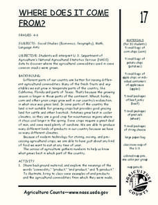
Learners read articles about various agricultural products and create a map using the statistics in the article. In this agricultural statistics lesson, students look at the geography of the country and which products come from the...
Curated OER
ZIP Code Math
Learners add or subtract to solve ZIP Code Math word problems. A ZIP Code Math work sheet is included. This lesson combines math with geography quite nicely.
Curated OER
Rising Temperatures Threaten Penguins
Students examine the continent of Antarctica, then read a news article about the decline in the Antarctic penguin population. In this current events lesson, the teacher introduces the article with a discussion and vocabulary activity,...
Curated OER
New Food Saves Lives, Could End Hunger
Students locate the country of Niger, then read a news article about a new type of food that is being used to fight childhood hunger in Africa. In this current events lesson, the teacher introduces the article with map and vocabulary...
Curated OER
Looking for a Windshield Experience
Students identify American geography by participating in a national parks activity. In this road trip lesson, students view the Ken Burns documentary "National Parks" and identify the importance of automobiles in the park system....
Curated OER
Communicate with a Truck Driver
Sixth graders complete activities to learn about the trucking industry. In this truck driving instructional activity, 6th graders explore websites for positive trucker images and learn about their contributions to society. Students...
Tennessee State Museum
An Emancipation Proclamation Map Lesson
Did the Emancipation Proclamation free all slaves during the Civil War? Why was it written, and what were its immediate and long-term effects? After reading primary source materials, constructing political maps representing information...
Curated OER
Follow the Light
Students investigate the role of lighthouses in navigation and practice the use of cardinal directions through reading activities, discussion, locating geographical features, and mapping lighthouses along the east coast of the United...
Curated OER
Library Guide to the States
Students use a library research activity to research the fifty United States. In this library research lesson, students complete a unit of lessons where they research and study the fifty states in the United States. Students research the...
Curated OER
Yours, Mine, and Ours
Students explore the five themes of geography while they conduct Internet research to compare and contrast their city, region, or country with the city and region of Nagano, Japan.
Curated OER
Japan: Yesterday and Today
Students study the geography and culture of Japan and discover important historical events. They look at the religions of Japan. They determine similarities and differences in the lives of teenagers in Japan and the US. They read and...


