Curated OER
Analyze a Street Map
In this street map worksheet, students analyze a section of a street map of Washington D.C, finding parallel streets, listing streets that form given shapes, and following directions. Answers on page 2.
Curated OER
Understanding Percent
In this understanding percent worksheet, learners use a computer program to complete 8 sections, then work off the computer and answer 7 questions with fraction strips, tables and grids.
Curated OER
Grandma Crab
In this crab life cycle worksheet, students read a 1-page monologue that included details regarding the life cycle of a crab.
Curated OER
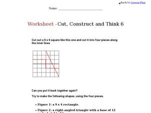
Cut, Construct and Think 6
In this geometry skills worksheet, students follow the provided instructions to cut out geometric shapes on the worksheet and build 5 shapes out of the pieces. Students also complete a graphic organizer regarding the shapes and their...
Curated OER
Double Entry Journal
In this double entry journal instructional activity, students take notes in selected classes using this blank graphic organizer that includes a space for passages from text and connections to they make.
Curated OER
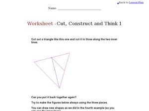
Triangle Worksheet: Cut, Construct and Think 1
In this triangle learning exercise, 6th graders draw and cut out a triangle, cut it into three pieces, then arrange the pieces to make new shapes.
Curated OER
Seeing Is Believing: Atoms
In this scientific investigation activity, learners follow the provided procedures to examine 4 mystery objects and then respond to 2 short answer questions.
Curated OER
Fly Away Moon Experiment
In this fly away moon experiment activity, students follow the procedures to demonstrate the effects of gravity on the earth and the moon.
Curated OER
Classifying Classes
In this classifications worksheet, students add levels of classifications for humans by splitting them into smaller and smaller classes. Students add 5 new levels.
Curated OER
Blank US Map
In this blank outline map worksheet, students study the physical boundaries of the 50 states that make the United States. This outline map may be used for a variety of geographic activities.
Curated OER
Anatomy of the Texas Brown Tarantula
In this Texas brown tarantula worksheet, students examine the 7 labeled parts of the spider. The parts include spinnerets, abdomen, cephalothorax, leg, eyes, pedipalp, and chelicerae.
Curated OER
Pulleys Experiment
In this pulleys experiment worksheet, students follow the procedures to set up an experiment with one and two pulleys, a rope, bucket and load.
Curated OER
Alabama Outline Map
In this Alabama outline map worksheet, students examine political boundaries of the state and the placement its capital city as well as its major cities. This map is not labeled.
Curated OER
Arizona Outline Map
In this Arizona outline map activity, students examine political boundaries of the state and the placement its capital city as well as its major cities. This map is not labeled.
Curated OER
Arkansas Outline Map
In this Arkansas outline map worksheet, students examine political boundaries of the state and the placement its capital city as well as its major cities. This map is not labeled.
Curated OER
California Outline Map
In this California outline map instructional activity, students examine political boundaries of the state and the placement its capital city as well as its major cities. This map is not labeled.
Curated OER
Colorado Outline Map
In this Colorado outline map instructional activity, students examine political boundaries of the state and the placement its capital city as well as its major cities. This map is not labeled.
Curated OER
Florida Outline Map
In this Florida outline map learning exercise, students examine political boundaries of the state and the placement its capital city as well as its major cities. This map is not labeled.
Curated OER
Georgia Outline Map
In this Georgia outline map activity, learners examine political boundaries of the state and the placement its capital city as well as its major cities. This map is not labeled.
Curated OER
Idaho Outline Map
In this Idaho outline map instructional activity, students examine political boundaries of the state and the placement its capital city as well as its major cities. This map is not labeled.
Curated OER
Illinois Outline Map
In this Illinois outline map worksheet, students examine political boundaries of the state and the placement its capital city as well as its major cities. This map is not labeled.
Curated OER
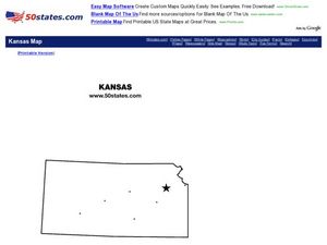
Kansas Outline Map
In this Kansas outline map worksheet, students examine political boundaries of the state and the placement its capital city as well as its major cities. This map is not labeled.
Curated OER
Louisiana Outline Map
In this Louisiana outline map worksheet, learners examine political boundaries of the state and the placement its capital city as well as its major cities. This map is not labeled.
Curated OER
Massachusetts Outline Map
In this Massachusetts outline map activity, students examine political boundaries of the state and the placement its capital city as well as its major cities. This map is not labeled.


