Luminations Media Group
Geography: Map Reading Basic Skills
Enhance scholars' map skills using this activity displaying the land of Kahitsa’an from the series, The Realm, by K.L. Glanville. The activity helps readers visualize the make believe-land, examine its attributes, and answer 10 short...
Space Awareness
Let's Map the Earth
Before maps went mobile, people actually had to learn how to read maps. Pupils look at map elements in order to understand how to read them and locate specific locations. Finally, young cartographers discover how to make aerial maps.
Curated OER
Mapping Electricity
Students complete Internet research and use their map reading skills to learn about how the United States creates and uses electricity in different states. In this energy sources lesson, students study the mini map of energy usage in the...
Tennessee State Museum
An Emancipation Proclamation Map Lesson
Did the Emancipation Proclamation free all slaves during the Civil War? Why was it written, and what were its immediate and long-term effects? After reading primary source materials, constructing political maps representing information...
Curated OER
Geography of Africa
Students examine the geography of Africa and understand its diverse ethnicity. In this African geography lesson, students create a mental map of Africa. Students label the maps and list the languages of Africa. Students compare the...
Curated OER
Traveling Cat Flown Home to Family
Students locate Wisconsin and Belgium on a world map, then read a news article about a cat that stowed away on ship from the U.S. to Europe. In this current events lesson, the teacher introduces the article with map and vocabulary...
Curated OER
Bank Loans Money to Start Businesses
After locating Latin American countries on a world map, children read about how microbanks are loaning money to help start small businesses. Involving both current events and economics, the teacher introduces the article with a map...
NOAA
Into the Deep
Take young scientists into the depths of the world's ocean with the second lesson of this three-part earth science series. After first drawing pictures representing how they imagine the bottom of the ocean to appear, students investigate...
NET Foundation for Television
1850-1874 Homestead Act Signed: The Challenges of The Plains
Start a whole new life in a land known as the Wild Wild West! Learners analyze maps, personal accounts, the Kansas-Nebraska Act, songs, and video clips to uncover life under the Homestead Act. Using their new skills, class members role...
Curated OER
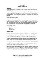
The Globe and World Map
Students explore how to use maps for travel. In this map skills lesson, students read the text, With Love from Gran and discuss the places the character traveled. Students list the names of each city and country on chart paper.
Curated OER
World Map and Globe- Introduction to Symbols
Students investigate picture symbols. In this symbols lesson plan, students define symbols and discuss symbols that they see in everyday life. Students identify symbols on maps by using post-it notes.
Curated OER
Tooling Around Arizona: Reading Arizona Maps
Students study geography. In this Arizona maps lesson, students develop their map reading skills. They have class discussions and work independently with various copies of Arizona maps to practice those skills. This lesson mentions...
Scholastic
The Seven Wonders of the Ancient World
The Colossus of Rhodes, the Hanging Gardens of Babylon, the Lighthouse of Alexandria. Young archeologists investigate the Seven Wonders of the Ancient World, map their locations, and match their names with brief descriptions and images....
Curated OER
Follow the Light
Students investigate the role of lighthouses in navigation and practice the use of cardinal directions through reading activities, discussion, locating geographical features, and mapping lighthouses along the east coast of the United...
NET Foundation for Television
1850-1874 Railroads and Settlement
Have you ever wondered how your town was placed where it is? Scholars research the impact the advancement of the railroad due to the passage of the Kansas-Nebraska Act had on the formation of civilization in the Great Plains. Map...
US Mint
Symbols in My Eyes
Explore the hidden meanings behind the images on US currency with this elementary school lesson on symbolism. Starting with a class discussion about symbols, children go on to brainstorm different objects that represent the Unites States...
Curated OER
Will Smog be a Problem at the Olympic Games?
Learners locate China on a world map, then read a news article about pollution in Beijing. In this current events lesson, the teacher introduces the article with a discussion about smog and a vocabulary activity, then students read the...
Curated OER
Maps that Teach
Students study maps to locate the states and capital on the US map. Students locate continents, major world physical features and historical monuments. Students locate the provinces and territories of Canada.
Curated OER
Maryland’s Chesapeake Bay Landscape Long Ago and Today
Combine a fantastic review of primary source analysis with a study of Captain John Smith's influence on the Chesapeake Bay region in the seventeenth century. Your young historians will use images, a primary source excerpt, and maps...
Curated OER
Convergence with The Cay: Exploring Geographic Concepts Wrapped in a Story
Here's an awesome unit that uses The Cay as the anchor text. The 16-page packet is loaded with teaching ideas, activities, and suggested adjustments.
Curated OER
Rising Temperatures Threaten Penguins
Learners examine the continent of Antarctica, then read a news article about the decline in the Antarctic penguin population. In this current events lesson, the teacher introduces the article with a discussion and vocabulary activity,...
Curated OER
New Food Saves Lives, Could End Hunger
Students locate the country of Niger, then read a news article about a new type of food that is being used to fight childhood hunger in Africa. In this current events activity, the teacher introduces the article with map and vocabulary...
Curated OER
Marvelouw Mongolia
Students are able to: tell basic information about Mangolia: locate it on a world map, locate its capital, name the countries surrounding Mongolia, read a Mongolian folk tale, and explore about the balalaika.
Curated OER
The Well of Truth
Students read and explore an Egyptian folktale. In this folktale lesson, students read the book The Well of Truth and discuss geographical facts about Egypt. Students complete several reading comprehension activities including a...


