Curated OER
Scaling it Down: Caves Have Maps, Too
Measurement and map skills are the focus of this lesson, where students crawl through a "cave" made out of boxes, desks and chairs, observing the dimensions. Your young geographers measure various aspects of the cave and practice math...
Curated OER
Exploring Scale And Ratio
Students measure the actual size and distance of the solar system using scale and ratio. They watch and discuss a video, create a distance-scale solar system model, and compare the scale sizes of planets to their actual sizes.
California Academy of Science
Modeling Eclipses with Size and Distance Scales
Size within the solar system is a difficult thing for pupils to imagine. Using everyday objects, they build models to show the scale between the sun, moon, and Earth. They situate their props in proportional distances between the objects...
Curated OER
Use Google Maps to Teach Math
Capture the engagement of young mathematicians with this upper-elementary math lesson on measuring time and distance. Using Google Maps, students first measure and compare the distance and time it takes to travel between different...
Exploratorium
Measuring and Mapping the Playground
The school playground is a great place to learn about math. Pupils measure the dimensions of a playground using baby steps and individual strides. They use their measurements to create a scale drawing of the playground by applying an...
Curated OER
Map Scale and the Pioneer Journey
Fourth graders, using a map, ruler and calculator, determine the distance the pioneers traveled from Nauvoo, Ill. to the Salt Lake Valley.
Curated OER
Estimate Distances on a Map
In this estimation worksheet, students estimate the distance on a city map based on the scale given to them. Students answer 4 short answer questions.
Curated OER
Draw To Scale The E-Z Way
Fourth graders draw a rough floor plan of a house to scale without using a ruler to determine measurements. They see how architects use scale to draw blueprints, and solve math problems using scale.
Curated OER
Measure Twice, Cut Once
Elementary schoolers learn about metric units and how they are used by engineers. They learn how engineers use the units to measure mass, distance, and volume. Then, they estimate measurements of units, and compare them to actual...
Curated OER
You Are Here
Students map local places and learn to use scale and distance. In this mapping lesson plan, students map their school and a favorite place. Students recreate their maps showing distance and scale sizes. Students locate their location...
Prince William Network
Migration Math Madness
A great way to incorporate math into life science, this lesson has learners measure migratory routes on a map and calculate the actual distance that shorebirds on the routes would cover. Learners compute the distance covered in both...
Curated OER
Map Adventures
Students explore the relationship between a scale drawing and actual distance. In this mapping instructional activity, students use an amusement park map to determine distances and what they would be like in real life.
Curated OER
Right Place, Right Time
Fourth graders complete mathematical word problems. They study the relationships among distance, speed, and time; and measure travel distances. They measure distances using a piece of string and a ruler and practice converting several...
Curated OER
One Size Fits All?
Students describe the differences between an estimate and a guess. They create reasonable estimates based on comparison and activities. Students explain how estimation is helpful in showing the relative size on a scale. They also...
Curated OER
Scuba Diving in Belize
Learners plan a scuba diving trip to Belize. In this planning a scuba diving trip to Belize lesson, students research about the barrier reef in Belize. Learners make travel plans that involve finding distance, time, and cost of...
Curated OER
Calculating Distance On Maps
Fourth graders determine the mileage from the local community to various scenic attractions in the Four-Corners-Region. They receive direct instruction and carry out activities in cooperative group settings.
Curated OER
Principles of Flight: Flying Paper Airplanes
Learners investigate ways to enhance an object's flying ability. In this model construction lesson, students construct two paper airplanes, one of which is twice as big as the first. Learners compare and contrast the two separate...
Curated OER
Math and Measurement
Engage the class in exploring linear measurement and map scales. They work in groups to measure various distances in the classroom and convert measurements to other units as directed by the teacher. To access this Word document, click on...
Curated OER
Map Your House
Students are introduced to the concepts of maps as scale models of the whole. After a brief lecture on creating and using an accurate scale when drawing and reading a map. They create a scale drawing of the floorplan of their homes.
Curated OER
Map Work: How Far?
In this map scale worksheet, students analyze a map of an area with several towns marked. Students use the scale (1 cm = 1 km) to answer 6 questions about the distances between towns.
Curated OER
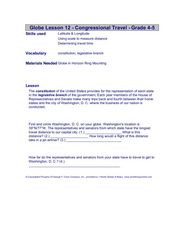
Congressional Travel
Students determine the distances traveled by the members of the legislative branch of the US Government. In this travel distance lesson, students locate Washington, DC on a globe using the longitude and latitude of the city. They...
Curated OER
Are We There Yet?
Students discover how to use maps and why they are important when using a map. They calculate distance using a map scale and time using travel speed and a map scale.
Curated OER
Exploring the Hudson in 1609
While this lesson focuses on a study of the Hudson River, it could be used as a template for a discussion of map skills, converting measurements, and plotting a route. The lesson includes vocabulary and other resources to make it a...
Curated OER
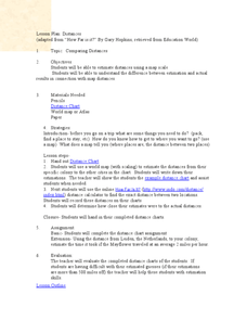
Comparing Distances
Learners practice estimating distances by analyzing a map. In this length measurement lesson, students view a map with a distance key and use their measurement skills to estimate the distance between two cities. Learners utilize an...


