Hi, what do you want to do?
Alabama Learning Exchange
Alex: Primary Technology Maps
This hands-on, inquiry-based lesson combines maps skills which include identifying map elements, applying an understanding of cardinal directions, interpreting resource maps, and identifying a location. Learners will have the opportunity...
Alabama Learning Exchange
Alex: Dream Vacation
This unit teaches students to plan a trip with an itinerary, remain within a budget, and work cooperatively. It is a technology-based project that combines a study of mathematics, economics, geography, and social studies.
Alabama Learning Exchange
Alex: Plotting Points in Alabama
The students will be able to use coordinates to find locations of specific cities on a map of Alabama.
Alabama Learning Exchange
Alex: Capture the Flag
This instructional activity requires students to read maps in order to play the game capture the flag.
Alabama Learning Exchange
Alex: Treasure Hunt
Get hands-on with students in building a map with a class. Take students outside to a sandbox and work with them to build a map of campus. Once the map is drawn you can turn their design into a treasure hunt to assess map interpretation.
Alabama Learning Exchange
Alex: Where in the World Am I?
A collaborative distance learning project on world geography.Two classrooms will interact while solving clues about "mystery" counties.
Other
Usps: The Flags of Our Nation: All Over the Map
This activity reinforces students' geographic, directional, and map skills while conveying interesting facts and state trivia.
E-learning for Kids
E Learning for Kids: Math: Bus Station: Position on a Map
Help Jamal read maps, describe directions, and identify coordinates in this series of interactive exercises.
BBC
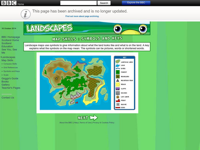
Bbc: Landscapes: Map Skills: Symbols and Keys
A guide for young learners to understand reading maps and their keys.
BBC
Bbc: Landscapes: Map Skills: Grid References
Young map readers will learn the idea of referring to the grid numbers to help find locations or to describe locations on a map.
Enchanted Learning
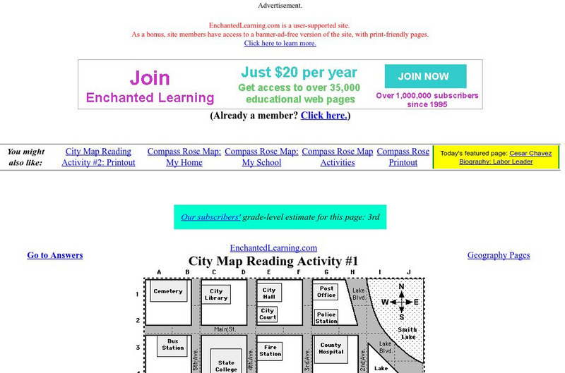
Enchanted Learning: City Map Reading Activity #1
Using a diagram of a labeled map, students follow the directions given to find a certain location.
New York Times
New York Times: Crossword Puzzle: Latitude & Longitude
Here is an interactive & printable crossword puzzle developed by the New York Times Learning Network. The theme of this puzzle is Latitude & Longitude.
National Geographic
National Geographic: Getting Lost
The National Geographic Society provides this lesson on cardinal directions for primary students that employs common classroom materials.
ClassFlow
Class Flow: North American Regions
[Free Registration/Login Required] This flipchart contains a labeling activity and Activote questions pertaining to the North American regions.
Scholastic
Scholastic: Hunting for States, Capitals, and National Parks! [Pdf]
Students can use a map of the United States to locate state capitals and national parks.
SMART Technologies
Smart: Final Project Map Skills
This lessons explores the different ways we can view our world along with the different parts of a map or globe.
HotChalk
Hot Chalk: Lesson Plans Page: Find Captain Hook's Treasure
Lesson that helps learners understand maps, map directions, and map symbols. Students use teacher-created maps to locate numbered keys on the playground.


![Scholastic: Hunting for States, Capitals, and National Parks! [Pdf] Activity Scholastic: Hunting for States, Capitals, and National Parks! [Pdf] Activity](https://content.lessonplanet.com/knovation/original/480522-367e1f79d58efef695e5c826460eaadd.jpg?1661587497)
