Hi, what do you want to do?
PBS
Pbs: The Perilous Fight: America's World War Ii in Color
Online home of the PBS documentary "The Perilous Fight" provides access to an eclectic array of color photographs and films of World War II at home and abroad. Overviews, contextual clues, maps, letters, and similar resources can be...
Library of Congress
Loc: World War Ii Military Situation Maps
World War II Military Situation Maps contains maps showing troop positions beginning on June 6, 1944 to July 26, 1945. Starting with the D-Day Invasion, the maps give daily details on the military campaigns in Western Europe, showing the...
US Holocaust Memorial Museum
U.s. Holocaust Memorial Museum: World War Ii in Europe: Animated Maps
The maps on this website show the ebb and flow of Germany's initial domination of Europe, and then the allies' retaking of the territory in WW II. Audio commentary describes the changes from 1939 to 1945.
Georgia Department of Education
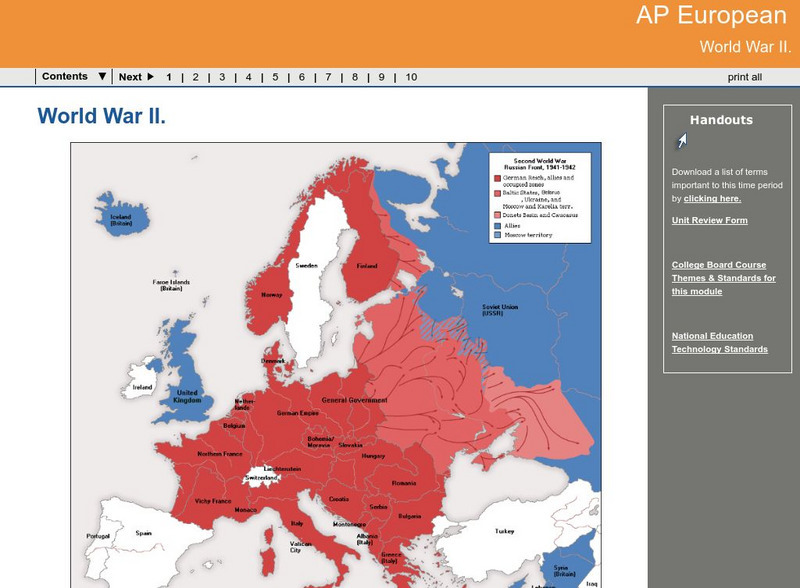
Ga Virtual Learning: Ap European: World War Ii
AP European History learning module on World War II traces the beginnings of the war from a dissillusioned Europe through the course of the war. Module includes assignments, enrichment activities, downloads, maps and assessment for...
University of Texas at Austin
Ut Library: Perry Castaneda World War Ii Maps
An excellent collection of WWII maps. Scroll down for selections from the European Theater of the war.
University of Oregon
Mapping History: American History
Interactive and animated maps and timelines of historical events and time periods in American history from pre-European times until post-World War II.
US Army Center
U.s. Army Center of Military History: The Centennial: Omar Nelson Bradley
This lengthy biography of General Omar Bradley was written on the centennial of his birth. It traces his life as a military man through World War I, World War II, and Chairman of the Joint Chiefs of Staff. Included is a map that shows...
Library of Congress
Loc: World War Ii Military Situation Maps
Interactive timeline with audio feature depicts the key events of "The Battle of the Bulge" which took place in northern France beginning December 16, 1944 to January 18, 1945 as told through the daily situation maps made for the US...
Ohio State University
E History: The Second World War
An interactive chronicle of WWII. Starts with the causes of WWII and goes through the entire war step by step. Interactive maps, videos, and a step by step explanation of each event.
Pennsylvania Historical and Museum Comission
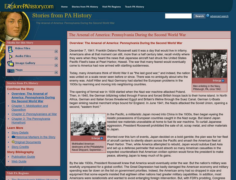
Explore Pa History: Pennsylvania During World War Ii
Examine the contributions of Pennsylvania's major industries and Pennsylvanians to World War II. Included in this detailed, historical account are links to maps and pictorial images of the era.
Curated OER
National Park Service: World War Ii Memorial
Description of the National World War II Memorial, located on the National Mall in Washington D.C. Contains information on all facilities and park map and brochures in PDF form etc.
Other
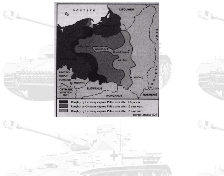
Euronet: Map of Polish Blitzkrieg
Map of Poland five, ten, and fifteen days after the German invasion.
Other
University of Arkansas at Little Rock: Life Interrupted
The history of Japanese Americans during World War II. Includes videos, pictures, and maps.
Library of Congress
Loc: Battle of the Bulge
HQ Twelfth Army Group situation maps of the Battle of the Bulge.
A&E Television
History.com: Vj Day: Victory Over Japan Day
Comprehensive discussion of V-J Day or the day victory was declared in Japan. Includes details and facts about World War II and the war in the Pacific, the surrender, related photos and speeches, battle maps, and more.
United Nations
United Nations: Cartographic Section: The World in 1945 [Pdf]
Find out what the political world map looked like after World War II in 1945. Enlarge the map so you can see what countries belonged to the UN, which were still dependent territories, and which did not belong to the UN.
US Holocaust Memorial Museum
U.s. Holocaust Memorial Museum: Holocaust History Animated Maps
To fully understand the breadth and scope of the Holocaust, view the following maps of key locations. These maps are in video form with explanations provided. There are also links provided for further research.
US Army Center
U.s. Army Center of Military History: Wwii Philippines/bataan Peninsula
A very good overview of the WWII Japanese conquest of the Philippines, with information on the Bataan Peninsula specifically, including a map, toward the bottom of the page.
Other
H.m.s. Hood Assoc.: Battle of the Denmark Strait Documentation Resource
Part I, Introduction and Background; Part II, Fighting Bismarck; and Part III, Conclusion and Sources provide the exciting story of the sinking of the Bismarck by the combined Royal Navy. Basic facts about each ship are supplied such as...
Yale University
Avalon Project: Casablanca Conference 1943
Read the document that was issued at the conclusion of the Casablanca Conference between Franklin Roosevelt and Winston Churchill mapping out the Allied strategy necessary to win World War II.
University of South Florida
Holocaust Timeline: The Nazification of Germany
This incredible site outlines the rise and implementation of the Nazi Party in Germany. While learning about Hitler's transformation of Germany, explore the incredible pictures, audio clips, maps, video clips, and an interactive quiz.
American-Israeli Cooperative Enterprise
Jewish Virtual Library: Deportations to Killing Centers in Occupied Poland
Map of routes to move Jews to killing centers in Poland during its German occupation. Includes short description.
BBC
Bbc: History: Animated Map: Operation Overlord
A nicely done Flash animation using a map of Normandy and the beaches where the D-Day invasion took place. You can trace the movement of the Allied armies into Normandy and there is a timeline showing when and what happened. Archived.
War Times Journal
War Times Journal: Invasion of Peleliu
Read about the little publicized, but very important invasion of Peleliu in September, 1944. Watch the troop movements of the American Marines and the Japanese Army on the animated maps and find out about the tremendous casualties on...


