United Nations
United Nations: Cartographic Section: Horn of Africa [Pdf]
This relief map from the United Nations shows the countries on the Horn of Africa. Roads, rivers, and other geographic features are marked on the map.
United Nations
United Nations: Cartographic Section: Great Lakes Region (Map 2) [Pdf]
This map of the Great Lakes region in Africa from the United Nations shows the large lakes, the countries the lakes touch, and rivers that flow into and out of the lakes.
United Nations
United Nations: Cartographic Section: Great Lakes Region (Map 1) [Pdf]
The United Nations offers this very clear map of part of the Great Lakes region in eastern Africa. The lakes, of course, are labeled, as are the rivers, major cities, and countries.
Wisc-Online
Wisc Online: Horn of Africa
This resource addresses the economies and geographic locations of African countries.
NOAA
Noaa: Cpc: Regional Climate Maps
Provides large colorful maps of climate data about each continent for the current week, month, or previous quarter.
BBC
Bbc: News: Country Profile: Kenya
BBC News features a general overview on the East African country of Kenya. Includes country facts, information on leaders and media, videos, and links to a timeline of key events and recent news.
BBC
Bbc: News: Country Profile: Rwanda
BBC News presents a general overview on the turbulent East African country of Rwanda. Includes country facts, information on leaders and media, and links to a timeline of key events and recent news.
Curated OER
University of Texas: Mauritius: Political Map
This map of Mauritius from the Perry-Castaneda Collection shows the island of Mauritius in isolation as well as a map inset showing its location east of the mainland of Africa and an inset of one of the smaller islands making up the...
University of Texas at Austin
The Perry Castaneda Library Map Collection
This collection contains more than 250,000 maps covering all areas of the world, and ranging from political and shaded relief maps to the detailed and the historical. Select from a region of the world or an area of highlighted interest.
BBC
Bbc: News: Country Profile: Uganda
BBC News presents a general overview on the East African country of Uganda. Includes country facts, information on leaders and media, and links to a timeline of key events and recent news.
Nations Online Project
Nations Online: Tanzania
Offers a country profile of the East African country of Tanzania, background details, and numerous links to comprehensive information on the country's culture, history, geography, economy, environment, population, news, government, maps,...
Nations Online Project
Nations Online: Somalia
Presents a country profile and travel guide to the East African nation of Somalia, background overview, and numerous links to extensive information on the nation's culture, history, geography, economy, environment, population, news,...
Other
Islam Project: Maps
A series of historical and near-present-day maps that span Islamic history. Starting with A.D. 750, the maps illustrate both the spread of Islam (from Medina outward to Africa, the Middle East, Europe, and other parts of the world) and...
Nations Online Project
Nations Online: Eritrea
Features a detailed destination guide to Eritrea, background overview, and numerous links to comprehensive information on the nation's culture, history, geography, economy, environment, population, news, government, maps, and much more...
Encyclopedia of Earth
Encyclopedia of Earth: Kenya
The Encyclopedia of Earth provides an overview of Kenya, including its geography, natural resources, history, government, economy, and much more. Maps and images are also included, along with sources used to create the entry.
Nations Online Project
Nations Online: Burundi
Explore this page to get a country profile of Burundi, background details, travel guide and numerous links to an abundance of information on the nation's culture, history, geography, economy, environment, population, news, government,...
Lizard Point Quizzes
Lizard Point Quizzes: Eastern Africa: Countries Quiz
Take this eleven question interactive map quiz to practice and test your knowledge of Eastern African geography.
Other
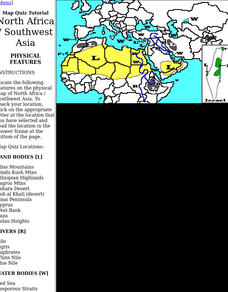
Harper College: North Africa/ Sw Asia Map Tutorial
Quiz yourself on the physical geography of Southwest Asia and North Africa by using this tutorial to Check your knowledge of landforms, bodies of water, and rivers in this area of the world.
Other
The Map as History: Europe's Colonial Expanision 1820 1939
European countries began exploring and seeking to dominate the rest of the world during the 15th and 16th centuries, thanks to their ability to control sea routes and to the discovery of the American continent. In the 19th century,...
Open Door Team
Open Door Web Site: The Scramble for Africa: Germany
Briefly describes the limited role Germany had in the scramble for African territories. A link to a map of colonial holdings during this period of New Imperialism is included.
Central Intelligence Agency
Cia: World Factbook: Regional and World Maps
Maps of major areas of the world can be downloaded here. The maps have excellent detail and are in color.
Curated OER
Educational Technology Clearinghouse: Maps Etc: Colonial Africa, 1914
A map of Africa in 1914, showing the presence of European powers, including British, French, German, Portuguese, Spanish, Italian, and Belgian possessions. Native states, major cities and major railways are also shown. This map reflects...
Curated OER
Educational Technology Clearinghouse: Maps Etc: Africa, 1906
A map of the African continent in 1906 showing European land claims such as British East Africa, German East Africa, Portuguese East Africa, Italian Somalia, and others, and European colonies and corporate states such as Cape Colony,...
Curated OER
Educational Technology Clearinghouse: Maps Etc: The Lake Victoria Region, 1920
A map of the region around Lake Victoria, or Victoria Nyanza, in 1920, showing the northern portion of German East Africa, the eastern portion of Belgian Congo, and all of British East Africa including the Uganda Protectorate. The map...
![United Nations: Cartographic Section: Horn of Africa [Pdf] Graphic United Nations: Cartographic Section: Horn of Africa [Pdf] Graphic](https://d15y2dacu3jp90.cloudfront.net/images/attachment_defaults/resource/large/FPO-knovation.png)


