Curated OER
The United States and Canada: Climate and Vegetation
Display U.S. and Canadian climate and vegetation through this text-companion worksheet. Learners read about the geography of these regions, take notes, and answer 3 comprehension questions as they read the selection. A graphic organizer...
Chicago Botanic Garden
Climate Change Impacts on Ecosystem Services
The fourth activity in a series of five has classes participate in a jigsaw to learn about global impacts of climate change and then share their new information with a home group. Groups then research impacts of climate change (droughts,...
Curated OER
Climate Types
For this weather worksheet, students identify the type of vegetation found in particular regions across the United States. Then they list the six groups of climates in the Köppen Classification System. Students also describe the...
Curated OER
Climate Change in Canada
In this Canada worksheet, students read a 6 page detailed informational text about climate change in Canada. Students then complete 10 essay/short answer questions.
University of California
Seasons Lab Book
Unlock the mystery behind seasonal change with a collection of worksheets and activities. Whether they are drawing pictures of Earth's orbit around the sun or graphing the temperature and daylight hours of different locations...
National Wildlife Federation
Hot, Hotter, Hottest: Extreme Weather's Impact on Our Resources
How dry is it? It's so dry, the river only runs twice a week! Through an analysis of maps and discussions, pairs learn about droughts across the United States in the ninth of 12 lessons. They then read about, answer questions, analyze...
K12 Reader
Eastern Woodland Natives
Supplement your social studies instruction with a reading passage about the Eastern Woodlands. After reading the passage, learners respond to five related questions.
Curated OER
USA: Average Precipitation and Temperature Map
In this United States map instructional activity, students make note of the average precipitation and temperature in regions of the country.
Curated OER
History and Government of the United States
In this U.S. worksheet, students take notes in a graphic organizer as they read several passages, then answer four comprehension questions.
Curated OER
Alaska
In this Alaska worksheet, students complete 6 pages of readings and questions about the state of Alaska. Included are general facts, First Nation groups, European arrival, industry and people. Each page has a short text and 6 multiple...
Curated OER
Are You an Energy Efficient Consumer?
In this energy consumption worksheet, learners use on line resources to explore the energy use by different countries around the world. Students compare the amount of light emitted by different countries and their carbon dioxide...
Curated OER
Virginia: Reading Comprehension
In this Virginia reading comprehension worksheet, students read a multiple-page selection regarding the state and then respond to 10 true or false questions.
Curated OER
Do You Have Good Manners?
Who cares about manners anyway? According to the New York Times, Mrs. Mason does. Learners read and consider an article which addresses the decline of manners and the impact it has on society. They answer seven critical thinking...
Other
United States Global Change Research Program
This government program integrates federal research on global climate change. Agency offers many resources regarding global as well as American climate change. For example, click on the section of the country where you live. Key issues,...
Other
Earth Journalism Network: Climate Commons
A unique interactive tool that embeds news articles and information about climate change into a map of the United States. Users are able to explore what the impact of climate change at a local, regional or national level, as well as...
NOAA
Noaa: Cpc: Regional Climate Maps
Provides large colorful maps of climate data about each continent for the current week, month, or previous quarter.
Science Education Resource Center at Carleton College
Serc: Studying Eco Climatic Domains
After learning about the climates of different ecological regions of the United States, students investigate the impact of climate change on plants that live in those regions. By looking at changes over time, they can better understand...
National Weather Service
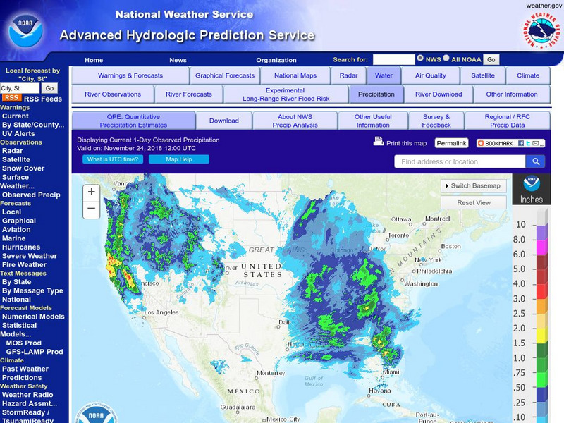
National Weather Service:climate Prediction Center: Daily Precipitation Analysis
Find real-time daily precipitation analysis for the United States, Mexico, and South America as well as accumulated precipitation maps for the past 30 or 90 days.
Thinkport Education
Thinkport: Made Clear: What Is Mid Atlantic Climate Change?
Climate change is impacting every nation and continent on Earth- including the Mid-Atlantic region of the United States. Find out how.
US Environmental Protection Agency
Epa: Ecological Regions of North America
A helpful map of North America which color codes its 15 ecological regions. Click on the different regions for a brief description of the area.
Cornell University
Cornell University: The Regional Climate Centers
Site provides information on the National Climatic Data Center's Regional Climate Centers Program. Click a region on the map of the United States and find information about that region's climate!
Curated OER
Etc: Maps Etc: Mexico, Central America, and the West Indies, 1898
A map from 1898 of Mexico, Central America and the West Indies. The map includes an inset map of Cuba and the Isthmus of Nicaragua. "The surface of the Rocky Mountain highland in Mexico is quite similar to that of the great plateau...
Curated OER
Educational Technology Clearinghouse: Maps Etc: Industrial Sections, 1898
A map from 1898 of the United States showing the Industrial Sections of the contiguous 48 states at the time. "Owing largely to differences in surface structure, climate, and soil, the great productions of our country are confined more...


