Curated OER
Where in the World is Mrs. Waffenschmidt? #23
Mrs. Waffenschmidt is hanging out at the Paricutin Volcano in Mexico. But your class won't know that until after they read the fact-filled paragraph that divulges her location. Each sheet includes two sections to be cut and handed out....
Curated OER
World Map Labels
In this geography skills worksheet, students identify the countries and bodies of water labelled on the maps of the world, Africa, Asia, Canada, Europe, the Caribbean, the Middle East, North America, Australia, and South America.
Curated OER
World Map
In this world map worksheet, students practice their geography skills as they label the 7 continents and 5 oceans. A word bank in included.
Curated OER
North America
In this map of North America worksheet, students study the map of North America and then write the names of the 11 countries on the provided lines.
Devine Educational Consultancy Services
Geography Student Workbook, Australia
Your youngsters will be experts on the geography of Australia after working with these activities and worksheets, which review the continent's weather, major landforms, dimensions, history, and climate.
Curated OER
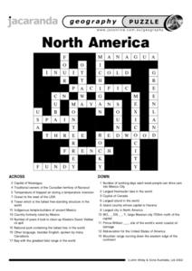
North America Puzzle
For this geography worksheet, students complete a crossword puzzle in reference to North America. They identify capitals of some countries, the specific landforms of different areas, and languages spoken. There are 21 clues to solving...
Curated OER
North America Puzzle Answer Sheet
In this geography worksheet, students name the capitals of various countries found in North America. They also identify the various weather patterns across the continent and specific bodies of water. There are 21 descriptions and 21...
Richmond Community Schools
Map Skills
Young geographers will need to use a variety of map skills to complete the tasks required on this worksheet. Examples of activities include using references to label a map of Mexico, identify Canadian territories and European...
K12 Reader
Conflict Over North American Lands
Readers are introduced to some of the conflicts that arose over land and resources in the Americas in a two-part cross-curricular comprehension worksheet that asks kids to study the article and then to use information provided to...
Curated OER
The Geography of Russia
In this geography of Russia learning exercise, students read a 4 page article about the geography of Russia and complete short answer questions and assignments based on the article. Students complete 6 assignments.
Curated OER
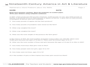
Mathematics Word Problems About the 1800s
In this history and math worksheet, students solve 20 problems pertaining to life in America in the 1800s. Students read four paragraphs and solve the five problems using that information. Basic math operations are used.
Cornell University
Too Much of a Good Thing?
Continuing their study of beneficial insects, young entomologists discover where in the world some of these bugs are. By labeling, coloring, and using the scale on a map, pupils explore the territories and arrival of the Asian lady...
Curated OER
Internet Hunt at the "Fact Monster" Web Site- May #3
In this Internet fact hunt worksheet, students access the "Fact Monster" web site to find the answers to 5 multiple choice questions. They answer science, history, and geography questions.
Curated OER
Landforms and Resources of the United States and Canada
In this North American geography worksheet, students read about the physical features and resources of the United States and Canada. Students take notes and answer 3 short answer comprehension questions as they read the selection.
Core Knowledge Foundation
Volume 1 - A History of the United States: Precolonial to the 1800s
Volume One of the 299-page Core Knowledge History of the United States covers events from the Precolonial Period to the 1800s.
Curated OER
Continents and Oceans
In this geography worksheet, students read a paragraph and learn about the seven continents and five oceans of the world. Students study a map of the world and answer 12 short answer questions. This is an online interactive worksheet.
Curated OER
Nowhere to Run
For this environmental science worksheet, students explore the different climate change around the world and summarize them. They fill in the table provided.
Curated OER
The Great American Desert
In this American deserts worksheet, students study the images and read the passages to learn about the 6 divisions in the American landscape: the Eastern lowlands, the Flood Plain, the Great Plains, the Rocky Mountains, and the Pacific...
Curated OER
Tourism in Northern Ireland
In this tourism worksheet, students label pictures of tourist destinations with the name of the country they are located in, write sentences about pictures showing damage caused by tourists, identify locations on a map, and fill in...
World Atlas
World Atlas: North America
Features maps and a description of the geography and history of North America with links to information on its countries, famous people, flags, symbols, and much more.
Georgia Department of Education
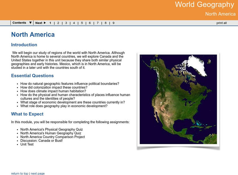
Ga Virtual Learning: World Geog: North America: The United States and Canada
World Geography learning module on the United States and Canada explores similarities and differences in the population, climate, resources and evolution of the two countries.
World Geography Games
World Geography Games: Countries of North America
Test your knowledge of the countries of North American with this interactive.
Central Intelligence Agency
Cia: World Factbook: Regional and World Maps
Maps of major areas of the world can be downloaded here. The maps have excellent detail and are in color.
World Geography Games
World Geography Games: Capitals of America
Match the country in the Americas with its capital city.


