Curated OER
Unscramble the State Capitals
In this state capitals worksheet, learners unscramble each capital to each of the fifty states located in the United States of America.
Curated OER
Find the States
In this word search worksheet, students find and circle the names of the 50 United States in the word search. All of the states are listed at the bottom of the worksheet.
Curated OER
Southern States Word Search
Sixteen of our southern states are hidden in this basic word search. Learners must find words that are hidden in every way possible within the search - even backwards! Luckily, an answer key does accompany this resource.
Curated OER
Do You Know Your 50 States?
Learners use the names and abbreviations of the 50 states to label a blank map of the United States.
Curated OER
Maryland Statehood
In this statehood activity activity, students draw a picture relating to the statehood of Maryland. Students also write information about the state.
Curated OER
USA States, Capitals, and Abbreviations
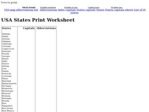
For this recognizing the fifty states worksheet, students read a list of the names of the states and complete a Double T Chart by filling in the capitals and abbreviations columns. Students write 100 answers.
Curated OER
Mystery State #31
In this mystery state worksheet, students answer five clues to identify the state in question. They then locate that state on a map.
School Improvement in Maryland
Smart Growth
New roads, new businesses, new developments, new mass transit systems. All growth has both positive and negative effects on communities. Government classes investigate the principles of Maryland's 1997 Smart Growth program and the...
Curated OER
Child Labor in Maryland: An Historical Investigation
Tenth graders, after reading two excerpts about contemporary child labor situations, discuss two broad questions in detail along with the industrial boom following the Civil War conditions in the United States. They investigate how the...
Curated OER
Maryland’s Chesapeake Bay Landscape Long Ago and Today
Combine a fantastic review of primary source analysis with a study of Captain John Smith's influence on the Chesapeake Bay region in the seventeenth century. Your young historians will use images, a primary source excerpt, and maps...
Curated OER
Maryland State Quarter
For this online interactive Maryland quarter worksheet, learners examine a Maryland quarter picture and answer 4 questions regarding it. This worksheet may be printed for classroom use.
Curated OER
What Do You Know About Maryland?
In this online interactive Maryland worksheet, students respond to 10 multiple choice questions that require them to exhibit what they know about the state. Students may submit their answers to be scored.
Curated OER
Historical Maryland Women
Students identify objects, activities, and people in pictures of women in Maryland's history. In groups of four, they analyze photo packets of historical women. Students complete an acrostic using phrases reflecting specific...
Curated OER
Maryland Outline Map
In this Maryland outline map worksheet, students examine political boundaries of the state and the placement its capital city as well as its major cities. This map is not labeled.
Curated OER
USA States, Capitals Print Worksheet
For this United States worksheet, learners read a list of all of the states and their capitals. Students write the abbreviations for each state. Learners are given 50 states and 50 capitals.
Curated OER
States in the USA Quiz
For this online interactive geography quiz worksheet, students respond to 50 identification questions about the states in the United States of America. Students have 4 minutes to complete the quiz.
Curated OER
Social Studies: Maryland and Its Culture
Students discuss the history and culture of Baltimore, Maryland. they discover the importance of the city's port along with the state bird and song. Background sources include "The Prairie Dog That Met the President" and "Journey of...
Curated OER
Designing a Coin for Your State
Students design a coin on a piece of aluminum tooling foil for their state after examining the new state coins recently issued.
Curated OER
U.S.A. State Capitols
In this state capitol worksheet, learners fill in the state capitol of given states. A reference web site is given for additional activities.
Curated OER
Arrest of the Maryland Legislature
For this Civil War history worksheet, students read and discuss a selection regarding the arrest of the Maryland legislature.
Curated OER
What's The Plan?
Students identify how the human activities in the state of Maryland have changed/ evolved over the last 50 years. They evaluate a land planning document and prepare a fictitious planning document for a given area of land.
Curated OER
State to State Scavenger Hunt
In this states worksheet, students utilize the Internet to access one specific website to locate the answers to five fill in the blank statements about the states found on a United States map.
Curated OER
The Powers of National and State Government
High schoolers define term federalism, identify the powers granted to state and national government, and identify powers shared by the state and national governments.
Curated OER
The United States in 1790
In this geography skills instructional activity, students study the provided map of the United States in 1790 and then complete the provided quiz over the 17 states and territories.


