Tennessee State Museum
An Emancipation Proclamation Map Lesson
Did the Emancipation Proclamation free all slaves during the Civil War? Why was it written, and what were its immediate and long-term effects? After reading primary source materials, constructing political maps representing information...
Illustrative Mathematics
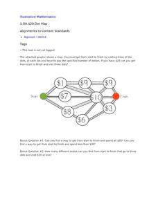
$20 Dot Map
Challenge the addition skills of young learners with this open-ended math problem. The task is simple, get from start to finish by connecting a series of three numbers. The trick is that the sum of the numbers must be less than or equal...
Curated OER
Map Exploration
Are you looking for a terrific lesson on map activities for your second graders? Then, this resource is for you! The activities range from decoding, to fill-in-the-blank, to read-and-search. There is a website activity related to maps...
Curated OER
Topo Map Mania!
Students read and use topographical maps. They also use a compass to find bearing to an object on a map and in the classroom. Ask your students how they might travel to somewhere they have never been to befo
Curated OER
Understanding Protagonists and Antagonists
How can you tell if a character is a villain? What about a hero? Work on literary analysis with an engaging language arts worksheet. After completing an activity about the four types of conflict, learners fill out a character map about a...
Curated OER
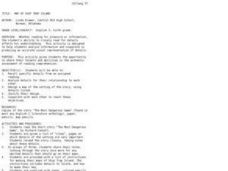
Map of Ship Trap Island
Young scholars read the short story "The Most Dangerous Game," and create maps of Ship Trap Island and justify why items are placed on their map in certain locations.
Curated OER
Mapping My World
First graders make two maps. In this developing and reading maps lesson, 1st graders read Mapping Penny's World, discuss the parts of a map, create a map of their classroom, and create a list of directions of how to get to various...
Curated OER
Mapping the Census
Students learn why the census makes a difference. For this U.S. Census lesson plan, students learn the key elements of cartography, examine the difference between data and their representation, and create a map using census data.
Curated OER
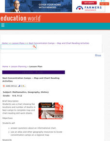
Nazi Concentration Camps -- Map and Chart-Reading Activities
Students use an informational chart about Nazi concentration and death camps to complete a mapping activity and a chart-reading activity.
Curated OER
Globe Lesson 7 - Parallels and Meridians - Grade 6+
In this parallels and meridians worksheet, students read a 2-paragraph review of parallels and meridians and respond to 7 short answer questions.
Curated OER
Globe Lesson 5 - Latitude - Grade 6+
In this latitude learning exercise, students read a 3-paragraph review of latitude and respond to 12 short answer questions.
Curated OER
Globe Lesson 3 - Cardinal Directions - Grade 6+
In this cardinal directions worksheet, middle schoolers read a 2-page review of cardinal directions and use a globe to respond to 5 questions.
Curated OER
Globe Lesson 9 - Around the World - Grade 6+
In this geography skills worksheet, middle schoolers read 5-travel scenarios and use their problem solving skills to respond to 9 short answer questions.
Curated OER
As the Kids Come and Go: Mapping a Classroom
Map the classroom with your kids to help them understand how maps work and how to read them. The activity starts off with a story about animals living and moving around the globe, and then kids create maps of their classroom to show how...
Curated OER
Read a Fall Foliage Map
Students examine the purpose of a color key and use a color key to help them read a map.
Curated OER
A Walk Around the School: Mapping Places Near and Far
After reading Pat Hutchins’ Rosie’s Walk, have your young cartographers create a map of Rosie’s walk. Then lead them on a walk around the school. When you return class members sequence the walk by making a list of how the class got from...
Curated OER
Science Review for Grade 5 (5.2)
In this science review for grade 5 (5.2) activity, 5th graders answer 25 earth science questions in a standardized test format, including reading maps and diagrams.
Curated OER
A world of oil
High schoolers practice in analyzing spatial data in maps and graphic presentations while studying the distribution of fossil fuel resources. They study, analyze, and map the distribution of fossil fuels on blank maps. Students discuss...
EngageNY
Carl Hiaasen’s Perspective of Florida: Part 2
Look it up. Scholars read Florida: A Paradise of Scandals Excerpt 1 and use a dictionary to look up any unfamiliar words. They then do a close read of the text and answer text-dependent questions. Learners analyze author perspective by...
Education World
The African American Population in US History
How has the African American population changed over the years? Learners use charts, statistical data, and maps to see how populations in African American communities have changed since the 1860s. Activity modifications are included to...
Curated OER
Forest Fun
Students explore orienteering and how to use a compass. They explore the importance of forests and identify some of the trees in a local forest.
Curated OER
"Potato Mountain": Reading/Understanding Topographic Maps
Learners investigate how to read topographic maps. In this map reading lesson students complete a topographic map activity.
Curated OER
Food on the Map
Pupils work together to examine the tastiest towns in the United States. After discovering the names of the equipment, they identify the seven continents. They take a survey and locate the cities and states of the foods mentioned.
Curated OER
Around the Town
Students explore reading maps. In this map reading lesson, students compare distances fom place to place. Students work in groups and predict the distance then find the actual distance using string or rulers.


