A to Z Teacher Stuff
Facts About Australia
Here is a quick printable with some basic facts about Australia, such as its population, area, type of government, and currency, as well as a simple drawing of an outline of the country.
Curated OER
Labeling a Map of Australia
Third graders label a map of Australia. Using the internet, they research the history and maps of the continent and print a blank map. They review on how to use a compass rose and legend. In groups, they create a brochure to share...
Institute for Geophysics
Understanding Maps of Earth
Here is your go-to student resource on primary geography concepts, including facts about the surface of the earth and its hemispheres, latitude and longitude, globes, types of maps, and identifying continents and oceans.
Curated OER
Australia/Oceania Outline Map
In this Australia and Oceania outline map worksheet, students explore the region of the world as they label the 14 countries. The countries are numbered and lines for the answers are provided on the sheet.
Curated OER
Australia
In this map of Australia worksheet, students research and study a map of Australia. Students label Australia's regions, major states and important landmarks.
Curated OER
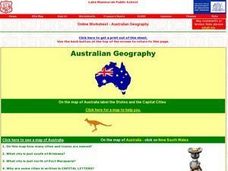
Australian Geography
In this map reading instructional activity, students label a map of Australia by adding the names of states and cities. They answer eight questions about the map.
Curated OER
Map of Australia
In this geography of Australia worksheet, students color and label a map with major states, cities and physical features. The Australian state borders are shown but not labeled.
Curated OER
Map Skills
In this map skills worksheet, students research and label the states in Australia and add in the major cities, oceans and seas.
Curated OER
Australia Map: Labeled
In this Australia outline map activity, students make note of the political divisions of the 5 provinces and territories of the nation. This map is labeled.
Curated OER
Australia Map: Labeled
In this blank outline map worksheet, students explore the political boundaries of Australia and its provinces and territories. This map is labeled and may be used in a variety of classroom activities.
Curated OER
Australia Map
In this blank outline map worksheet, students explore the political boundaries of Australia. This map is labeled and may be used in a variety of classroom activities.
Curated OER
World Map Labels
In this geography skills worksheet, students identify the countries and bodies of water labelled on the maps of the world, Africa, Asia, Canada, Europe, the Caribbean, the Middle East, North America, Australia, and South America.
Cornell University
Too Much of a Good Thing?
Continuing their study of beneficial insects, young entomologists discover where in the world some of these bugs are. By labeling, coloring, and using the scale on a map, pupils explore the territories and arrival of the Asian lady...
Curated OER
Australia Map Resource Sheet
In this Australia map resource worksheet, students use the map of Australia to supplement their study of the country. They see a map labeled with Australian cities, and the surrounding countries and water bodies.
Curated OER
Australia Map Skills
For this Australia map worksheet, students research, find and label the following cities: Canberra, Sydney, Darwin, Brisbane, Adelaide, Hobart, Melbourne and Path.
Curated OER
Australia
Young scholars research Australia using the Internet. They draw a flag, identify and label Australia's major cities. They discover facts about Australia's tourists attractions and culture. They design a travel brochure using the facts.
Curated OER
Map Keys
In this geography learning exercise, students identify who a cartographer is and what they do specifically. They study an outline map of a fictitious island and then, respond to the three questions that follow. Finally, students add...
World Maps Online
Introduction to the World Map
Students identify the differences between maps and globes. In this map skills instructional activity, students are shown a globe and a map and recognize the differences. Students use post-it notes to locate several locations on the world...
California Polytechnic State University
Australian Geography Unit
At the heart of this resource is a beautifully detailed PowerPoint presentation (provided in PDF form) on the overall physical geography of Australia, basic facts about the country, Aboriginal history, and Australia culture and lifestyle.
Curated OER
Australian Map (Regions)
In this Australian map worksheet, students research and label the regions of Australia on an Australian map. Students check their labeled regions when completed.
Curriculum Corner
Earth Day Book
This Earth Day, celebrate our beautiful planet with an activity book that challenges scholars to show off their map skills, complete a crossword puzzle, write acrostic poems, alphabetize, and reflect on their personal Earth-friendly habits.
Curated OER
Mapping Australia
In this mapping Australia activity, students locate and label various features and places on a blank map, 10 total. A reference web site is given for additional activities.
Curated OER
Lesson Plan on Map Skills for South Asia
Seventh graders observe and discuss an overhead transparency map of South Asia. In small groups, they label a blank map of South Asia, and listen to a lecture on the realm.


