Curated OER
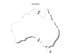
Australia Map
In this blank outline map worksheet, students explore the political boundaries of Australia. This map is labeled and may be used in a variety of classroom activities.
Curated OER
Australia Map: Labeled
In this blank outline map worksheet, students explore the political boundaries of Australia and its provinces and territories. This map is labeled and may be used in a variety of classroom activities.
Curated OER
Australia Map: Labeled
In this Australia outline map activity, students make note of the political divisions of the 5 provinces and territories of the nation. This map is labeled.
Curated OER
Australia Map
In this Australia outline map worksheet, students make note of the political divisions of the 5 provinces and territories of the nation.
Curated OER
Australia and Oceania Map Quiz
In this online interactive geography quiz activity, students examine the map that includes 23 countries, territories, and dependencies of Oceania. Students match the names of each to the appropriate...
Curated OER
Australia Map Skills
For this Australia map worksheet, students research, find and label the following cities: Canberra, Sydney, Darwin, Brisbane, Adelaide, Hobart, Melbourne and Path.
Devine Educational Consultancy Services
Geography Student Workbook, Australia
Your youngsters will be experts on the geography of Australia after working with these activities and worksheets, which review the continent's weather, major landforms, dimensions, history, and climate.
Institute for Geophysics
Understanding Maps of Earth
Here is your go-to student resource on primary geography concepts, including facts about the surface of the earth and its hemispheres, latitude and longitude, globes, types of maps, and identifying continents and oceans.
Curated OER
Topographic Mapping Skills
In this geography worksheet, students read an excerpt about topographic maps and why they are useful for various jobs. They also respond to eleven questions that follow related to the excerpt and locating specific map points on the map...
Curated OER
Australia Outline Map
In this Australia and Oceania outline map worksheet, students make note of the major landforms and bodies of water located within this region.
Curated OER
Australia and Oceania: Physical Map
In this Australia and Oceania physical map instructional activity, students make note of the major landforms and bodies of water located within this region.
Curated OER
Australia/Oceania Outline Map
In this Australia and Oceania outline map worksheet, students explore the region of the world as they label the 14 countries. The countries are numbered and lines for the answers are provided on the sheet.
Curated OER
Australia
In this map of Australia worksheet, students research and study a map of Australia. Students label Australia's regions, major states and important landmarks.
Curated OER
Australia
In this Australia map, students research and locate the main regions, states and important landmarks found on the map and discuss them with their classmates.
Curated OER
Map Skills
In this map skills worksheet, students research and label the states in Australia and add in the major cities, oceans and seas.
Curated OER
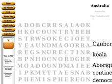
Australia Word Search
For this social studies worksheet, students find the words that are used to describe the continent of Australia and the answers are found by clicking the button at the bottom of the page.
Curated OER
Choropleth Mapping Skills
In this geography worksheet, students identify and describe how to apply choropleth mapping skills. They examine the map given and convert it into a choropleth map through coloring. Then students use those colors to shade in their key...
Curated OER
Australia Shape Book
In this Australia shape book worksheet, students use a map shape of Australia to make a shape book after printing as many pages they will need for their projects. They fasten the pages together for use in reports, vocabulary words or...
Curated OER
BOLTSS Map
In this geography instructional activity, students identify the six features always used on maps. They identify each of these features by the acronym BOLTSS. Students examine the Melbourne Cricket Ground shown and respond to the 4...
Curriculum Corner
Australian Christmas
Where is Australia? How is an Australian Christmas from other Christmases around the world? Learners participate in a mini-research project where they discover what an Australian Christmas is like.
Curated OER
Australia States, Territories and Capitals Map Quiz
In this online interactive geography quiz worksheet, students respond to 14 identification questions regarding the shapes of countries and capitals of Australia.
Curated OER
Mapping Australia
In this mapping Australia activity, students locate and label various features and places on a blank map, 10 total. A reference web site is given for additional activities.
Curated OER
Map Keys
In this geography learning exercise, students identify who a cartographer is and what they do specifically. They study an outline map of a fictitious island and then, respond to the three questions that follow. Finally, students add...
Curated OER
Map of Australia
In this geography of Australia worksheet, students color and label a map with major states, cities and physical features. The Australian state borders are shown but not labeled.
Other popular searches
- Mapping Geography Australia
- Map of Australia
- Types of Maps Australia
- Types of Maps "Australia
- Types of Maps "Australia"
- Mapping Australia
- Australia Map Skills
- Social Studies Australia Map
- Australia Map Outline
- Australia Mapping Activities
- Label Map of Australia
- Australia Map Game


