Curated OER
Diversity
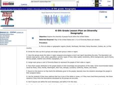
Students work in groups to research and prepare an oral report about a region. In this regions lesson plan, students find out about the geography, population, state capitals, and landmarks. Students assign attributes to the people...
Curated OER
Mapping India
Young scholars participate in an activity in which they place placards listing geographic features, landmarks, etc. in the correct place on a large fabric map of a given country. They also examine artifacts, photos, sounds/music, etc....
Curated OER
United Kingdom
Middle schoolers investigate the geographical features of the United Kingdom. They create a clay, playdoh, or salt and flour map of the region. The maps should be labeled with landmarks and bodies of water. They can also draw maps on...
Curated OER
Australia
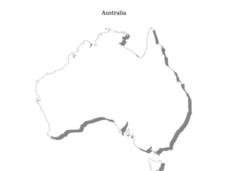
In this Australia map, students research and locate the main regions, states and important landmarks found on the map and discuss them with their classmates.
Curated OER
Geography Grid
Fourth graders search a database to find images and scan and affix them on an 8-foot long map of the state of Illinois. They then use it as a basis for discussion.
Curated OER
Traveling Through North America
Students identify places and landmarks in North America, specifically Canada and the United States, by using and constructing maps. Six lessons on one page; includes test.
Curated OER
This Is Tanzania
Learners begin the lesson by locating Tanzania on a world map. While reading an article, they note what the author's opinion is of the people who live there and discover the connection the people have with the land. They examine the...
Curated OER
Yo Ho, Yo Ho, A Pirate's Map for Me: An Original Story
Students read Blackbeard and brainstorm their knowledge of maps. In this language arts and geography lesson, students use landmarks on their playground to review north, south, east and west and discuss the compass rose. Students read...
Curated OER
5 Themes Awareness of Current Event Issues
Students analyze newspaper articles for the 5 themes of geography. They create a colorful portfolio explaining how each theme: location, place, etc. is relevant in a chosen current event.
Curated OER
Where in the World?
Students create global geography podcasts by choosing a location, researching that location, and describing that location verbally. Other schools/students can then guess what the Podcast is describing via email.
T. Smith Publishing
48 Contiguous States
What do your pupils know about the United States? This resource asks learners to respond to 10 questions about certain states and landmarks. Useful for a geography lesson and to help familiarize your learners with the continent. An...
Curated OER
TE Activity: The Trouble with Topos
Students study the uses of topographical maps including the many forms that they take. They discover that the map features show its intended use such as city maps, wilderness maps, and state maps. They complete a worksheet in which they...
Curated OER
Tasty Mapping
Young scholars create an edible map. In this civics and geography lesson, students research their town's features and local government. Young scholars work in groups to design and create a physical map of their town based on research.
Curated OER
Colonial Vacation Planner
Students plan a family vacation to states that were among the original 13 colonies. The groups determine which state they visit, map their route, calculate the mileage, and determine how much money they spend on gasoline.
Curated OER
I Can Compass, Can You?
Students discover how to use geographic tools. In this compass lesson, students identify cardinal directions by appropriately using compasses along with a number of various maps.
Curated OER
Mayan History
Students examine Mayan contributions to the world. For this Mesoamerican culture lesson, students view a slideshow about the Maya and then peruse books about the accomplishments of the culture. Students create charts that highlight Mayan...
Curated OER
Minnesota Floor Map
Learners examine the physical geography of Minnesota, work cooperatively to design a map of Minnesota and develop spatial and relative location of Minnesota landmarks and physical characteristics.
Curated OER
Exploration and Settlement of the American Southwest
Students scrutinize the Zuni Pueblo Revolt in this seven lessons unit on early Spanish explorers in the American southwest. The discovery of the Spanish missions, the search for the seven cities of gold, and particular geological...
Curated OER
Mapping My Trip to the 2002 Winter Olympics!
Eighth graders map their route from their local community to Salt Lake City, Utah for the Winter Olympics. Using atlases, they gather topographical information and use the internet to research any landmarks they might pass on the way....
Curated OER
Alaska Trade
Students spend two days traveling throughout Alaska, trading as they go. They explore universal principles related to trade and commerce while studying about Alaska's geography and indigenous people. At the end of the instructional...
Curated OER
China
Learners explore the geography, culture and history of China. As a class, they discuss historical contributions to China, Confucius, and geographic features of the country. Pupils use the internet to answer questions about China.
Curated OER
Census Statistics
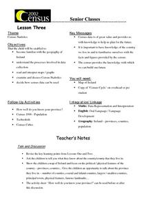
Twelfth graders become familiar with the geography of Ireland. They explore the processes involved in data collection. Students examine and discuss Census Statistics and read and interpret maps/graphs. They decide how the census data can...
Curated OER
Planning A Bicycle Race
Students plan the route of a proposed bicycle race. They indicate the passage through or around regional landmarks. The goal is for students to translate information into a primary language as part of learning a foreign language.
Curated OER
Lost Creek- Sacred Landscapes
Eighth graders engage in the discovery of the meaning of Sacred Landscapes. The religious concept is researched for its impact upon the practices of Native Americans and the geographical regions. They write reflection papers upon the...


