Curated OER
Michigan Map
In this state maps worksheet, students identify the map of Michigan. Students then fill in the capital city, major cities, and other state attractions.
Curated OER
Maine Map
In this state maps worksheet, students identify the map of Maine. Students fill in the capital city, major cities, and other state attractions.
Curated OER
Connecticut Map
In this state maps instructional activity, students identify the state of Connecticut, and fill in the state capital, major cities, and other major attractions.
Curated OER
The Great States Race
Here is another in the interesting series of lessons that use the special State Quarters as a learning tool. This one uses the Indiana State Quarter. During this lesson, utilize a brilliantly-designed board game that is embedded in the...
Curated OER
The 50 States
Fifth graders use maps and music to learn the 50 states. In this US Geography lesson plan, 5th graders map out a region of the United States and practice singing the song, The 50 States that Rhyme.
Curated OER
Describe That State
Students broaden knowledge about all the 50 states. They combine their knowledge about states with their knowledge about parts of speech to create grammatically correct sentences that describe the characteristics of the states.
K12 Reader
Write About a State
Kids select a state, describe its climate and geography, and include interesting facts about it. The template includes space for drawings and pictures.
Curated OER
States: United States Map
In this United States political map worksheet, students examine state boundaries. The map is labeled with the names of each of the 50 states.
Curated OER
What's In a Name?
Students examine the origins of the names of U.S. states, focusing on names that were derived from Native American words. They are provided with lists of the names of the 50 states, and then research online or in library resources the...
Curated OER
State Names: Frequency
Data grathers determine the frequency of specified data. They identify the frequency that specified letters occur in the names of all 50 states. They create stem-and-leaf plots, box-and-whisket plots and historgrams to illustrate the data.
Curated OER
Mapping America
While learning about the Louisiana Purchase, pupils practice map skills. This motivating instructional activity has them answer questions about the Louisiana Territory and the United States. It provides a quick and easy way review of...
Curated OER
Where in the United States Are We?
Students spend the lesson identifying the location of the fifty states and the capitals. Using a software program, they retrace te outline of each state numerous times. To end the lesson, they write a story about a state and city of...
Curated OER
Capitals, Oceans, And Border States
Young scholars investigate geography by completing games with classmates. In this United States of America lesson, students examine a map of North America and identify the borders of Mexico and Canada as well as the Pacific and Atlantic....
Curated OER
Follow the Light
Here is another in the interesting series of lessons that use the special State Quarters as a learning tool. During this lesson, pupils learn about lighthouses, maps, the cardinal directions on a compass, and U.S. geography. There are...
Curated OER
Run/Walk Across America
Walk, jog, or run across America. Maps of individual states, visual progress, competition, and rewards, seem to be great motivational ideas. Make sure that the distances that each class has to walk or run are the same, because getting...
Curated OER
United States Map Quiz
In this online interactive geography quiz worksheet, students respond to 50 identification questions about the shapes of countries shown. Students have 5 minutes to complete the quiz.
Curated OER
Blank Map: The United States of America
In this map worksheet, students use the blank outline map of the United States to label the 50 states or for any other study purpose. Each state boundary is shown with no name labels.
Curated OER
United States Identifier
Fifth graders examine and research a major region of the Unites States in groups of four. In addition, they locate the states, capitals, mammals and two bodies of water or mountain ranges found within their region. After the research,...
Curated OER
Utah: State History
For this Utah state history worksheet, students read two and a half pages of information about Utah and complete 10 true and false questions.
Curated OER
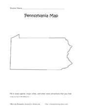
Pennsylvania Map
In this state maps worksheet, students identify the map of Pennsylvania. Students fill in the state capital, the major cities, and other state attractions.
Curated OER
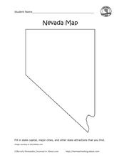
Nevada Map
In this state maps instructional activity, students identify the state of Nevada. Students then fill in the state capital, major cities, and other state attractions for the state.
Curated OER
States And Shapes
Students work together and investigate the shapes of 50 states. They identify the states that they find hardest to recognize. The group then list the states in order from most difficult to just difficult to recognize and create a...
Curated OER
Making Cents of Independence
Have your class explore the history of Texas using this comprehensive lesson! They read about Texas' march toward statehood, the Alamo, and more. There is a series of worksheets, graphic organizers, and a rubric which make this activity...
Curated OER
States and Capitals of the United States
Students label states and capitals on a United States map and complete research on one of the states. In this states lesson plan, students fill in the states on blank maps.


