Curated OER
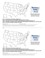
Mystery State #12
What's better than learning about US geography? Having fun while your doing it! After reviewing each of the five given clues, learners attempt to name the mystery state. A great way to reinforce geography skills and deductive reasoning...
Curated OER
Mystery State #2
Which is the mystery state for today? Using five super clues, your class will work to uncover which state is being described. They'll have no problem remembering facts about Nevada after this fun warm-up activity.
Curated OER
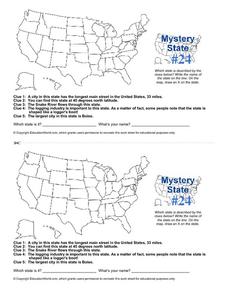
Mystery State # 24
Prepare those brains for a rousing day of learning with a fun geography activity. Your pupils use five different clues to determine the name of mystery state number 24. Where do all those potatoes come from? Idaho!
Curated OER
United States Map- State Capitals
Students explore map skills. For this state capital lesson, students view a United States Political Map and identify and use post-it notes to label the state capitals.
Curated OER
States and Capitals
This map skills PowerPoint features an interactive states and capitals game. The object of the game is to identify the capital cities of each of the 50 states. The excellent presentation includes United States maps, game directions, and...
Curated OER
50 States: New England States
Young scholars discover where certain states are located and what the look like. They look for their information on a web site. Each student is assigned a state which they must research then present to the entire class.
Curated OER
Name the States Worksheet 5
In this name the states worksheet, learners examine 6 state map outlines and identify each of them by writing the state names and postal abbreviations.
Curated OER
Name the States Worksheet 4
In this name the states activity, students examine 6 state map outlines and identify each of them by writing the state names and postal abbreviations.
Curated OER
Name the States Worksheet 2
In this name the states worksheet, learners examine 6 state map outlines and identify each of them by writing the state names and postal abbreviations.
Curated OER
Name the States Worksheet 1
In this name the states worksheet, students examine 6 state map outlines and identify each of them by writing the state names and postal abbreviations.
Curated OER
The United States and Its Capitals
Have your class learn about the fifty states in the United States and their capital cities. Learners play matching games, complete quizzes, and a variety of activities in order to cement their knowledge of the states.
Curated OER
Archaeology- State Map
Students study state maps. In this map skills instructional activity, students identify the states' location and how to use a legend. Students complete photocopies of the state map.
Curated OER
Play Doh Map of Your State
Students create a state map using Playdoh. In this hands-on state geography lesson, students work in groups to form a three-dimensional map of their state using Playdoh made at home following a (given) recipe. Students use four colors...
Curated OER
United States Map- State Capitals
Students explore the state capitals. In this geography instructional activity, students use a political map to identify the state capitals and place post-it notes on various capitals.
Curated OER
Illinois State Map
In this Illinois geography worksheet, students color and label a map of Illinois. Students study the location of the capital and where Illinois is situated in the United States. There is a black line map of the state with a grey US map...
Curated OER
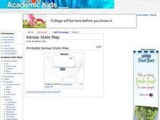
Kansas State Map
In this map of Kansas worksheet, students color and label major cities and physical features of this state. Students also study the location of Kansas in relation to the other states in the U.S. by studying the background map.
Curated OER
Virginia State Map
In this geography of Virginia worksheet, students color the map and label major cities and physical features. Students also study a second map showing the location of the state of Virginia in the United States.
Curated OER
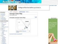
Georgia State Map
In this geography of Georgia worksheet, students color the map and label major cities and physical features. Students also study a second map showing the location of the state of Georgia in the United States.
Curated OER
Florida State Map
In this geography of Florida worksheet, students color the map and label major cities and physical features. Students also study a second map showing the location of the state of Florida in the United States.
Curated OER
New Mexico Map
In this state maps activity, learners identify the state of New Mexico. Students fill in the state capital, major cities, and other state attractions.
Curated OER
Tennessee Map
In this Tennessee outline map, learners examine the political boundaries of the state. Students mark the state capital, major cities, and other state attractions.
Curated OER
Vermont Map
In this state maps worksheet, learners identify the map of Vermont. Students fill in the state capital, the major cities, and other state attractions.
Curated OER
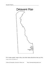
Delaware Map
In this state maps worksheet, students identify the state of Delaware, and fill in the state capital, major cities, and other attractions in the state.
Curated OER
Colorado Map
In this state maps worksheet, students identify the state of Colorado, and fill in the state capital, major cities, and other attractions for the state.


