Curated OER
Land Surveys
Students read and think about the relationship between maps and nature. They examine the origins of the Land Ordinance of 1785 and the large-scale topographical surveys that were commissioned a century later. They also read and analyze...
Polar Trec
What Can We Learn from Sediments?
Varve: a deposit of cyclical sediments that help scientists determine historical climates. Individuals analyze the topography of a region and then study varve datasets from the same area. Using this information, they determine the...
Curated OER
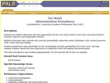
Car Wash
Students determine the most appropriate site for a car wash, based on each site's soil characteristics (chemical, physical) and topographic features. They perform an experiment to determine the changes to three different soil types when...
Curated OER
Exploring Our Watershed System
Students examine how watershed systems are made up, and visit the Susquehanna watershed system and map out the system. They evaluate the order of watercourses in their area.
Channel Islands Film
Island Rotation: Lesson Plan 1
How do scientists provide evidence to support the theories they put forth? What clues do they put together to create these theories? After watching West of the West's documentary Island Rotation class members engage in a series of...
National Park Service
Leave it to Beavers
Many people know cats mark their territories by rubbing the back of their necks to leave a scent, but not many people know beavers also leave a scent to mark their territories. During the first activity of two, scholars use their noses...
Curated OER
What's Its Slope
Young scholars identify the slope of a lines.For this algebra lesson, students define the meaning of slope and write an equation given the slope. They graph linear functions using the slope and y-intercept.
Curated OER
Exploring Our Watershed System
High schoolers study watersheds and examine how they are composed. In this watershed system lesson students explain how water enters a watershed and the concept of stream order.
Curated OER
BACK IN TIME
Students explain what is involved in exploration and settlement of new areas. They become explorers and discover their surroundings through various activities.
Curated OER
GEOGRAPHY: SPACE CENTERS
Students examine the descriptive science dealing with the surface of Earth, its division into continents and countries, climate, natural resources, inhabitants and industries of the various divisions and analyze the political geography...
Curated OER
Analysis of Atmospheric Conditions for a High Mountain Retreat
Students examine the relationship between altitude, atmospheric pressure, temperature and humidity at a particular location. They practice science and math in real world applications. They write reports detailing their scientific...
Curated OER
High Mountain Retreat
Students explore and analyze atmospheric conditions for a high mountain retreat. They examine the relationship between altitude, atmospheric pressure, temperature and humidity at a particular location. In addition, they write reports...
Curated OER
Physical Habitat of a Stream
Students measure in metric units and use a stopwatch, calculator. They collect data with minimal instructions after the initial pre-activity briefing, then record data in the data sheets provided.
Curated OER
Fostering Geospatial Thinking: Space to Earth: Earth to Space (SEES)
High schoolers locate and access data to help them with their science inquiry. In this geographical positioning activity students evaluate and compare data sets.
Curated OER
Lâlâkea Stream: Diversion and Restoration
Students research the history of the Lalakea stream diversion and restoration. They examine the restoration project from multiple viewpoints and consider how it affects the stream-related environments.
Curated OER
The Archaeology of Cactus Ruin
Students simulate archaeologists by excavating a paper site. In groups, they use a sampling strategy to determine information about the people who lived at the site.
Curated OER
Do Human Practices Affect Water Quality?
Students determine if human practices have any noticeable effects on the quality of stream life as measured by the presence of certain macroinvertebrates. They collect, preserve and identify macroinvertibrate samples and quantify the data.
Curated OER
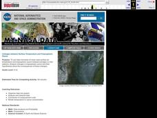
Linkages Between Surface Temperature And Tropospheric Ozone
Students collect and interpret data to make predictions about the levels of ozone in the atmosphere. Using the internet to collect data students use their collected data to create a line graph for analysis. Students make mathematical...
Curated OER
Natural Hazards
Students evaluate the hazards of naturally occurring events. After watching a video concerning safety hazards, students work in groups to discuss the safety issues involved in taking a trip to a mountainous region. Recommendations are...
Curated OER
Creating and Analyzing Graphs of Tropospheric Ozone
Students create and analyze graphs using archived atmospheric data to compare the ozone levels of selected regions around the world.
Curated OER
Using My Nasa Data To Determine Volcanic Activity
Learners use NASA satellite data of optical depth as a tool to determine volcanic activity on Reunion Island during 2000-2001. They access the data and utilize Excel to create a graph that has optical depth as a function of time for the...
Curated OER
Linkages Between Surface Temperature And Tropospheric Ozone
High schoolers organize and analyze data regarding changes in tropospheric ozone and then hypothesize about the consequences of these changes.


