Curated OER
Orienteering - Lesson 10 - Putting It All Together
Wrap up this unit by navigating through a prescribed course using a map and a compass. Put all the skills learned about reading a compass and using a map to navigate through an unknown course. Each learner should have a control card...
Curated OER
A world of oil
Students practice in analyzing spatial data in maps and graphic presentations while studying the distribution of fossil fuel resources. They study, analyze, and map the distribution of fossil fuels on blank maps. Students discuss gas...
Edline
How Did the Unification of Germany Change the Course of World History?
Here you'll find a nice guided notes worksheet on Otto von Bismarck, which details Bismarck's plan to unify Germany, as well as asks learners to analyze his motivations and overall impact.
Curated OER
Bridge to the Future: Enlarging the European Union
The political, social, and economic challenges the European Union faces as it enlarges is the focus of a six-lesson unit. Class members investigate and craft a presentation about a member country, the treaties member states must sign,...
Curated OER
Cross-Cultural Dialogue Lesson
Students read and analyze a personal narrative written about a Peace Corps Volunteer teaching English in Guinea-Bissau, Africa. They discuss the concept of crossing cultures, analyze maps, complete worksheets, and develop a writing...
K-State Research and Extensions
Water
How are maps like fish? They both have scales. The chapter includes six different activities at three different levels. Scholars complete activities using natural resources, learn how to read a map, see how to make a compass rosette,...
Curated OER
Mapmaker, Mapmaker, Make Me a Map!
Students evaluate the different types of historical and geographical information that one can gather through close study of historical maps from the 16th through the 19th centuries. They create their own maps.
Curated OER
A High-Interest Novel Helps Struggling Readers Confront Bullying in Schools
Bully, bullied, or bystander? Paul Langan's The Bully is the anchor text in a unit that examines bullying and violence. After a close reading of the text, readers imagine themselves as the characters and consider how they would react in...
Education World
The African American Population in US History
How has the African American population changed over the years? Learners use charts, statistical data, and maps to see how populations in African American communities have changed since the 1860s. Activity modifications are included to...
Curated OER
Gopher It! Exploring German Cyberspace
Students are introduced to the Gopher research tools. In groups, they compare and contrast English and German services on the gopher servers. They create their own dictionary of computer related terms and spend time downloading picture...
Curated OER
Finding Your Way Around the World
Students plan a trip around the world and create a PowerPoint presentation of the journey. In this map, atlas, and technology instructional activity, students plan a trip around the world in which they avoid using an airplane. Students...
Smithsonian Institution
We Have a Story to Tell: Native Peoples of the Chesapeake Region
How did colonial settlement and the establishment of the United States affect Native Americans in the Chesapeake region? Your young historians will analyze contemporary and historical maps, read informational texts, and work in groups to...
Curated OER
Understanding "The Stans"
Learners explore and locate "The Stans" in Central Asia to create, write and illustrate maps, graphs and charts to organize geographic information. They analyze the historical and physical characteristics of Central Asia via graphic...
New York Historical Society
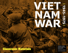
The Vietnam War: 1945-1975
Do pupils know that the Vietnam War spanned a period of 30 years? A war that long is bound to leave devastating effects. Help young historians develop a comprehensive understanding of the war through multiple units on the subject that...
Curated OER
Mapmaking
Young scholars examine the craft of cartography and how the Lewis and Clark expedition created and used maps. They analyze maps, read a handout, create a map, participate in a mini expedition and map out a route based on travel...
Curated OER
Topographic Maps
In this topographic map worksheet, students learn how to read a topographic map and create a topographic map of their own using clay or Play-Doh. Students include contour lines by layering the clay. Students answer 6 questions about...
Curated OER
Weather, Data, Graphs and Maps
Learners collect data on the weather, graph and analyze it. For this algebra lesson, students interpret maps and are able to better plan their days based on the weather reading. They make predictions based on the type of clouds they see.
National Geographic
The Monsoon
Few things are as fascinating as the challenge of climbing Mount Everest. This lesson investigates how monsoon weather impacts climbers. To begin, you are instructed to show various video clips. The only one directly provided, however,...
Echoes & Reflections
Rescuers and Non-Jewish Resistance
What does it mean to be a rescuer during the time of the Holocaust? Learners consider the role of those who resisted the Nazi invasions, including hiding Jewish people, throughout Europe. Activities include listening to the testimony of...
Constitutional Rights Foundation
Refugees from the Caribbean: Cuban and Haitian “Boat People”
Should refugees fleeing poverty be allowed the same entrance into the United States as those fleeing persecution? High schoolers read about US foreign policy in the late 20th century regarding refugees from Cuba and Haiti, and engage in...
Constitutional Rights Foundation
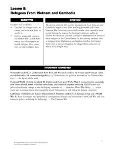
Refugees From Vietnam and Cambodia
The United States may have pulled its troops from the Vietnam War in 1973, but the conflict was far from over for the citizens living in Asia at the time. An informative resource lets learners know about the wave of over 220,000...
PHET
Mapping the Ambient Magnetic Field
No GPS allowed! High school scientists continue to explore magnetic fields with a hands-on activity. After mapping the ambient magnetic field in the classroom and completing data analysis, they write about the similarities and...
Curated OER
Map Your Favorite Sports Team's Next Road Trip
Students track a sports team across the country. They use a map scale to calculate the number of miles traveled by their sports team on a trip, conduct Internet research, and calculate how much it would cost them to go along on the trip.
National Endowment for the Humanities
Ending the War, 1783
The various peace proposals, made by both sides, to end the Revolutionary War come under scrutiny in this final lesson of a three-part series on the war. Class members read primary source documents and compare them with military...


