Virginia Department of Education
World History and Geography: 1500 A.D. (C.E.) to the Present
Intended to help Virginia teachers align their curriculum to the state's history and social science standards, this packet provides a wealth of materials for any social studies or science instructor. Loaded with plans, suggestions for...
Curated OER
Greeks Around the World: A Case Study on Greek Diaspora
Students gain an understanding of the concept of Diaspora relating to Greeks. They use guided discovery to apply the geographic inquiry model to an examination of the reasons for Greek Diaspora.
Howard Hughes Medical Institute
BiomeViewer
Which holds more influence, the environment over humans or humans over the environment? Young scientists explore an online interactive that addresses this discussion. They observe changes in the natural world over time and see which...
Curated OER
Grades 6-8 Lesson Plan - Cities as Transportation Centers
Students examine maps of the 1800's and 1900's. In this geography skills lesson plan, students collaborate to read core maps and identify transportation centers and travel networks.
Curated OER
European Agriculture
Students make inferences on how physical geography affected the development of early civilizations and come up with solutions to global issues. For this physical geography lesson plan, students compare maps of the past to maps of today...
Curated OER
Treaty of Versailles
Learners describe the purposes of the Treaty of Versailles. In groups, they analyze the causes and effects of the treaty and discuss why the Americans were so against it. They note ideas for and against its ratification and they make...
Curated OER
Empire State-Building
Students explore how empires around the globe have impacted the world in which they have existed. They analyze whether or not the United States is an imperialist nation and create their own empires based on their understanding of empires...
Curated OER
Chart Making for Navigators
Students discuss the importance and function of nautical maps for sailors. They, in groups, take soundings of a simulated bay in a shoebox and develop a nautical chart that enable them to navigate the shoebox safely.
Curated OER
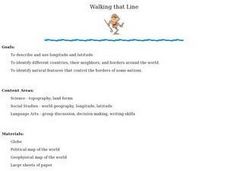
Walking that Line
Students attempt to describe and use longitude and latitude. They will identify different countries, their neighbors, and borders around the world. Included in the lesson the students identify natural features that control the borders of...
Curated OER
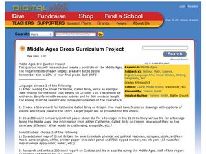
Middle Ages Cross Curriculum Project
Middle schoolers complete several projects on the Middle Ages. In this world history lesson, students complete language arts, social studies, math, and science projects. Some of these include: comparing a teenager's life now to that in...
Mesa Public Schools
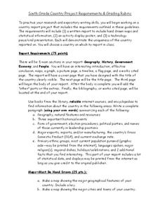
Country Project
Give your young learners the chance to discover more about countries in their world community with a research project. Class members write reports on an assigned country and include such major features as geography, important historical...
Chicago Botanic Garden
Faces of Climate Change
Sometimes, the best solution to a problem can be found by walking in someone else's shoes. Here, scholars use character cards to take on the roles of people around the world. They determine how their character's life affects our...
Curated OER
Historical Atlas
Sixth graders evaluate how revolutions have affected the world throughout history (i.e. boundaries of nations, culture, economics, etc...) through the research for and creation of a historical atlas for assigned countries.
Curated OER
Lesson 2: Mapping With Words
Students demonstrate an understanding of the personal relationship that Wabanaki peoples had with the land by analyzing selected Wabanaki place names. They practice map-reading and map-making skills.
Curated OER
Mary, Queen of Scots: Heroine or Harlot?
Students explain how international politics, religion, and cultural beliefs influenced the life of Mary Queen of Scots. They watch a film about Mary, Queen of Scots and participate in a discussion and variety of extension activities.
Curated OER
Charting Neptune's Realm: Profiles
Pupils identify and describe the importance of nautical profiles in early navigation. They draw a profile of a street or mall and explore the effectiveness of different types of directions.
BBC
Eu, Un, and Commonwealth: Keeping Peace
What are the UN, the EU, and Commonwealth? Have the class brainstorm all they know about these powerful international organizations. Then have them compare and contrast the ways in which different countries or political groups work. They...
Curated OER
Virginia In the World: The Geography of Commerce
Young scholars examine how Virginia connects with the world through export trade. Using a map, they use symbols to depict the value of trade and the direction of the flow of goods. They complete a scavenger hunt using electronic almanacs...
Theodore Roosevelt Association
Roosevelt's Legacy: Conservation
The legacy of Theodore Roosevelt carries through modern American politics, economics, foreign policy, and society. But his proudest and most profound efforts were in the world of conservation, and in preserving the natural beauty of...
Curated OER
Lewis and Clark and the Native Americans
Pupils practice using maps and identifying landmarks on the Lewis and Clark expedition. They research Lewis and Clark's relationship with the Native Americans and report their findings to the class. They identify the impact of the...
Curated OER
Polar Bears and Ice
Students explore the Arctic food chain. They examine the needs of the polar bear and the threat that global warming poses to them. Students write a letter to a local political representative explaining what they have studied and...
Curated OER
Hungary: The Landscape
Young scholars work in small groups to create a topographic map of Hungary. The map will include labeled line drawing of the bordering countries. Hungary should be three dimensional, made of salt and flour clay. The mountains, plains and...
Curated OER
Do We Still Need the Electoral College?
One of the most confusing aspects of any presidential election year is the role of the Electoral College. Learners read a bit about how the Electoral College works and then they hold a mock election in their classroom. They'll redraw a...
Other popular searches
- World Political Map
- World Outline Political Map
- Blank World Political Map
- World Political Map Labeled


