Curated OER
MAP UNIT
First graders investigate how maps are used to identify different locations. They will also appreciate how there are different types of maps for their purposes. Finally students study how maps contain symbols that represent real places.
Curated OER
Country Capitals
Learners locate country capitals on a world map. In this map skills lesson, students review the definition of the word country and discuss what a capital is. Learners locate and label capital cities on a world map using a map marker.
Curated OER
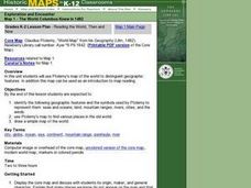
Reading the World, Then and Now
Students distinguish geographic features using Ptolemy's map of the world.
Curated OER
Treasure Hunt
Learners find lost "treasure" using a treasure map after being shown a map that you have created where terms and symbols are discussed. The class is divided into small groups where they locate your treasure and then read a section from...
Curated OER
United States All the Way
Learners create patriotic books about the United States and some of its special symbols.
Curated OER
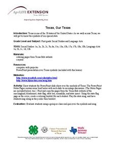
Texas, Our Texas
Students explore U.S. geography by completing a coloring activity in class. In this Texas history lesson, students utilize the web to locate Texas on a map of the U.S. Students view a PowerPoint presentation which showcases the state...
Curated OER
Cardinal Directions
Students explore cardinal directions. In this social studies lesson, students create maps of home and school using the cardinal directions.
Curated OER
Put Me in My Place: Using Alphanumeric Grids to Locate Places
Students practice locating points on a large wall grid and create and label a neighborhood map. In this geography lesson, students spell and discuss places as the teacher places them on the map. They discuss the concept of an...
Curated OER
Flags and Freedom
Students create their own flag with symbols and colors that each have specific meanings. For this flags lesson plan, students review the American Flag and what the symbols and colors of it mean.
Curated OER
Countries of the World
Students identify countries on a world map. In this map skills lesson, students define the word "country" and use post-it notes to locate several countries on a world map.
Curated OER
The Desert Alphabet Book
Students explore world geography by researching a science book with their classmates. In this desert identification lesson, students utilize a U.S. map to locate the geographical locations of deserts. Students create an oral report based...
Curated OER
How Do I Get There? Planning a Safe Route to School
One much-needed skill for young learners is direction giving. Have your class plan and draw a safe route for them to travel from home to school. They will also draw places and items that are in between home and school in order to build a...
Curated OER
United States Map- Rivers
Students identify major rivers on a map of the United States. In this geography activity, students discuss what a river is and use a map marker to identify the symbol of a river on a map.
Curated OER
Expanding Map Vocabulary
First graders name the vocabulary words in Navajo, Ute and Spanish for the cardinal directions.
Curated OER
Our City
Second graders familiarize themselves with the town they live in by practicing their imagination, library research and writing skills.
Curated OER
Social Studies: African Banner Boxes
Students write creation stories and design stamps to use on banners accompany them. They discuss the use of stamps in African culture to take the place of words. Students use a handout of stamps and their own creations to create banners...
Curated OER
Ticky Plans His Trip to Antarctica to See Tacky
First graders participate in a creative problem solving activity to help Ticky get to the Atlantic Ocean. They identify Ticky's problem, brainstorm ways to solve the problem, and develop a plan. They write the steps Ticky needs to take...
Curated OER
The Edge of the Lake
Second graders explore the geography of Nevada. In this map-making lesson plan, 2nd graders use salt dough to create a relief map of Nevada. Students label the landforms and bodies of water that are studied and specified in the lesson...
Curated OER
Other kinds of groups- part 4 of 5
Students compare and contrast characteristics of groups. Students create graphs using various symbols of different groups. Students make maps of their neighborhood 'groups'.
Curated OER
Where Is Japan? How Far Is That?
First graders use literature and hands-on activities with maps and globes to explain distance and tools used to measure distance. They select tools to measure various objects in the classroom, then apply those concepts to their map...
Curated OER
Nina Bonita: Culture and Beauty
Students read Nina Bonita by Ana Maria Machado. In this reading comprehension/ geography lesson, students recall various parts of the story and create a map of where the rabbit traveled throughout the story. They participate in group...
Curated OER
U.S. Geography: The Northeast
Students investigate U.S. Geography by creating a map in class. In this natural resource lesson, students create a map of the United States and research the Northeast based on their resources and recyclable materials. Students utilize...
Curated OER
Boats, Trains, and Wagons
Students read map symbols for transportation, specifically canals, railroads, and highways.
Curated OER
Mapmaking: Colorado Quarter Reverse
Learners examine the Colorado quarter reverse and draw symbols of the state's land and water features on maps. Using copies of the Colorado reverse, they color the coin design. They list reasons for the state's motto of "Colorful Colorado"
Other popular searches
- Weather Map Symbols
- Weather Map Weather Symbols
- Topographic Map Symbols
- Map Symbols First Grade
- Teaching Map Symbols
- Geography Map Symbols
- Os Map Symbols
- Map Symbols and Neighborhood
- Location/ Map Symbols
- Wetaher Map Symbols
- Reading Weather Map Symbols
- Weather Map Symbols Exercise


