Curated OER
Tear the Continents
Students tear paper into representative continent shapes and configure them with world oceans through relative location, direction and latitude and longitude starting points. They recognize the shape of the continents. Students recognize...
Curated OER
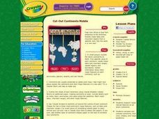
Cut-Out Continents Mobile
Young scholars research major natural features on all seven continents. They compare and contrast continents, their sizes, shapes, and major landforms. Students create a unique display of the continents to show major landforms.
PBS
Make a Balloon Globe
"We've got the whole world in our hands," is what your students will be singing after completing this fun geography activity. Using the included templates for the seven continents and a balloon, they create their very own globes.
Curated OER
Geography of Australia: The Shaping of a Continent
Whether you are embarking on a unit on ecosystems, or on the characteristics of the Australian terrain, this picture-packed presentation would be a great one to use. Not only does the presentation contain useful information, it also has...
Curated OER
Identifying and locating the continents and oceans of the world.
Third graders physically construct a balloon replica of the world globe by coloring, correctly labeling, and cutting out the seven continent shapes from the worksheet, gluing them onto their correct locations on an inflated blue balloon....
Curated OER
Putting the World in Perspective
Learners work in small groups to: make a mental map of the world by tearing paper shapes of the seven continents and locating them on a flat surface in their relative positions, compare their finished mental map to a reference world map,...
Curated OER
The Continents and Oceans of the World
Students explore world mapping skills. In this world geography lesson, students identify and label the continents and oceans on a world map using the Visual Thesaurus. Students generate mnemonic devices to help memorize these terms.
Curated OER
United States Map- Continent, Country, State
Students identify their continent, country, and state on a globe. In this geography lesson, students use a globe to identify the seven continents, the United States, and the state which they live in. Students define key terms.
Curated OER
Continents and Oceans Word Search
In this geography instructional activity, students locate the names of 18 continents and oceans in a word search. Students write a C by the continents in the word bank and O for the oceans. Then students identify 5 continents by looking...
Curated OER
Continents Adrift
Students examine how tectonic plates change the Earth's land. In this geology lesson, students are divided into small groups to construct a continent puzzle. Students use transparency pieces to demonstrate how Africa and South America...
Curated OER
2nd Grade - Act. 22: The World Game
Second graders play World Game to become more familiar with continents, oceans, countries and states.
Curated OER
Modeling Earthquake Data
Students evalute evolutionary theories and processe of Geology. They examine evidence that the movement of continents has had signicicant global impact, major geological events. Students evaluate the forces which shape the lithosphere...
Curated OER
Continental Drift
Be sure to come prepared to discuss the theory of Pangaea and the two super-continents, Laurasia and Gondwanaland. Collaborative learners look for fossil evidence that supports the theory that one super-continent divided into two. They...
Curated OER
Plate Tectonics: First Grade Lesson Plans and Activities
A set of first grade geology lessons focuses on plate tectonics and movement of plate boundaries. During the pre-lab, learners experience three types of plate movement through a kinesthetic demonstration. The lab demonstrates stresses...
Curated OER
United States Map
Learners compare the United States on a globe and on a map. In this map activity, students relate the sizes of the continents and locate the United States. Learners identify the location of the continental US as well as Alaska and Hawaii.
Curated OER
The World Game
Second graders participate in a game that familiarizes them with continents, oceans, countries, and states. They sing a song about the earth and decipher clues to location on the earth.
Curated OER
The World (With an emphasis on the United States)
Fourth graders recognize the different continents. They are introduced to longitude and latitude and how to find locations using these measurements. This series ends with an emphasis on the fifty states of the United States and their...
Curated OER
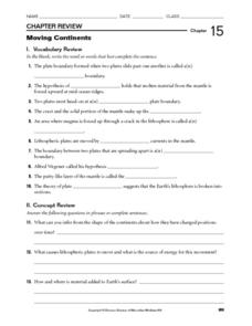
Moving Continents
In this moving continents worksheet, students review the different types of plate boundaries, what causes earthquakes, and where volcanoes are formed. This worksheet has 10 fill in the blank and 9 short answer questions.
Curated OER
Major American Water Routes
Sixth graders locate and identify the major bodies of water and waterways in the United States. Through a simulation activity, they describe how early explorers would have described their surroundings. Working in groups, they create...
Curated OER
Celebrate Kwanzaa in the United States
Students explore and study the celebration of Kwanzaa in which African-Americans remember their heritage and remind people of the importance of sharing with family and friends. They participate in a chant about the seven continents and...
Curated OER
Mapping Africa
Students identify the location of parallel and meridian coordinates. They illustrate their understanding of the physical shape of the continent of Africa through a mapping activity, then explain the processes that have influenced the...
Curated OER
Important Rivers of the World
Third graders become familiar with names of the different parts of a river, define and locate drainage basins, locate six of the continents and explore the major rivers on each one, conduct research on a river of their choice.
Curated OER
Introduction to African Folklore
Learners are read "Anansi the Spider" to begin their discussion on continents. Using a map, they locate the continent of Africa and the country of Ghana. They discover who the Ashanti people are and view examples of their artwork. They...
Curated OER
Planet Earth
Students explore and analyze data from different maps in order to explain geographic diversity among the continents. Student groups research continents' physical features and examine how they contribute to quality of life for inhabitants.


