Curated OER
Mapwork: A Place In the News
Students determine how to find geographic information about places they read about in the news. In this geography lesson, students look at political and physical maps to determine the difference. They access maps online to find the...
Curated OER
Life in Old Babylonia: The Importance of Trade
Students read maps and artifacts for information indicating the existence of a trade network in Old Babylonia and beyond. They list goods imported to and exported from Babylonia. They indicate trading centers on a map of ancient...
Curated OER
On the Road with Marco Polo: Marco Polo in China
Students investigate who the Mongols were and where their empire was located. They research Kublai Khan and the region he ruled. They study the major products of 13th Century China.
Curated OER
African Savannah- Description and Mapwork
In this African savannah short answer worksheet, students describe the climate and the animals that live in the savannah. They draw an African map and label the savannah regions using the back of the paper.
Curated OER
Volcanoes In Japan
Sixth graders study the characteristics of volcanoes in this unit. They apply the research to the study of three volcanoes in Japan. They complete mapwork, identify indicators of impending volcanic activity, and describe the dangers...
Curated OER
Back-to-school ESL Ideas
Pupils share their countries and languages, flags, cultural identity, and pride in home culture.
Curated OER
Me On the Map
Second graders listen to Joan Sweeney's book, Me On the Map. They design a map of their bedroom and their house emphasizing the important characteristics.
Curated OER
Where Is Japan? What Direction Is It?
First graders locate countries on maps and globes and learn about the hemispheres and the cardinal directions. They listen to books read out loud and dicuss geography.
Curated OER
The 21st Century Lewis and Clark Trail
Students create a better route through the Rocky Mountains for the Lewis and Clark expedition after tracing the original path.
Curated OER
Labeling a Map of the British Isles and Elapsed Time
In this map work and elapsed time activity, students label England, Scotland, Wales, and Ireland on a map. They calculate the elapsed time of a delivery that is described in a word problem that is broken down into four parts.
Curated OER
The Country of Chile - Map Work
In this map worksheet, learners label a map of Chile by following 11 directions given at the bottom of the page. They label landforms and water bodies associated with the country.
Curated OER
Finding My Way
Students determine a route from their home to the Stones River National Battlefield. In this map work lesson, students use a detailed city map of Murfreesboro to locate a route to the Stones River National Battlefield. They follow...
Curated OER
A Special Relationship: Connecticut and Its Settlers
Students study both geological and geographical features of Connecticut and the New Haven area. They focus on map works and rock formation.
Curated OER
"Trails, Rails, and Roads" Lesson 2: Road Tripping
Students practice map skills and take a virtual road trip through Maine examining the history of transportation. They create questions from the information they learned and play a game against other groups.
Curated OER
Map Work: How Far?
In this map scale worksheet, students analyze a map of an area with several towns marked. Students use the scale (1 cm = 1 km) to answer 6 questions about the distances between towns.
Curated OER
'European Exploration, Conquest, and Trade
Fifth graders examine the motives, progress and results of the European exploration and conquest of Asia, Africa and the West Indies from the 15th to the 17th centuries. They use maps to trace spice routes and research the role of spices...
Curated OER
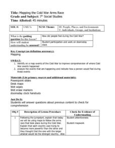
Mapping the Cold War Arms Race
Seventh graders create a visual representation of the Cold War Arms Race. Using a map of the world, they identify where the events where the Cold War to place.
Students analyze the events and create a journal entry explaining how a...
Other popular searches
- Mapwork of Africa
- Geography Mapwork
- Scale in Mapwork
- Mapwork Gr 10
- Geography Europe Mapwork
- Research Skills Mapwork
- Mapwork Geology
- South Africa Mapwork
- Mapwork Gr10
- South African Mapwork
- Scale and Mapwork


