Curated OER
California Map
In this California blank outline map learning exercise, students examine the political boundaries of the state and then mark the state capital, other cities, and other state attractions on the map.
Curated OER
West Virginia Map
In this map activities worksheet, students use an outline of the map of West Virginia to add the state capital, major cities, and other state attractions. Students complete 3 activities.
Beverly Hills High School
Mapping Napoleon's Empire at Its Height (1812)
The complicated political history of Europe becomes apparent as young historians create a map of the borders of France when Napoleon's Empire was a its height in 1812.
Kate Stickley
Reading the World: Latitude and Longitude Lesson latitude and longitude, maps, coordinates on a map, prime meridian, reading maps, equator, globes
Find five activities all about longitude and latitude! Use oranges to show the equator and prime meridian, plot birthdays on a map using coordinates, and plan a dream vacation.
NASA
Outline Maps
Don't miss this gold mine of blank maps for your next geography lesson! Regions include traditional continents such as Asia, Europe, and Africa, as well as other major world areas such as the Pacific Rim and the Middle East.
Curated OER
Missouri Map
In this Missouri blank outline map worksheet, students examine the political boundaries of the state and then mark the state capital, other cities, and other state attractions on the map.
Curated OER
Wyoming Map
In this blank outline map activity, students fill in the state capital, major cities, landforms, and other places of interest on this map of Wyoming.
Curated OER
Tennessee Map
In this Tennessee outline map, students examine the political boundaries of the state. Students mark the state capital, major cities, and other state attractions.
Curated OER
Orienteering - Lesson 2 - Topographical Maps
One of the most important skills in orienteering is being able to read a topographical map. Understanding the contour lines and symbols and the scale of the map will make planning your route so much better. In this lesson, partners get...
Curated OER
Identifying, Mapping, and Personifying Countries Involved in WWII
Get artsy with this WWII group activity, starting with a whole-class assignment. Create a map of Europe, Northern Africa, and the Pacific using geometric shapes cut from construction paper and placed on the floor. Consider splitting the...
Public Schools of North Carolina
Democratic Republic of Congo - Map Skills
Work on your map skills with a packet of activities about the river basins in the Democratic Republic on Congo. Learners study the maps provided before answering the geography questions and writing an acrostic poem about the region.
Scholastic
Organization Outline
Forming a strong organizational outline is important when reading a complex text, writing an informative essay, or analyzing a complicated problem. Use a straightforward organization outline to teach learners about concept mapping.
Student Handouts
Compare and Contrast Chart with Bubble Map
Take your traditional Venn diagrams and mind maps to the next level with this unique bubble map! The graphic organizer allows students to compare and contrast several aspects of two concepts, encouraging a more in-depth analysis overall.
Curated OER
Rhode Island Map
In this recognizing the shape of the state of Rhode Island instructional activity, students fill in the state capital, major cities, and other attractions or follow their teacher made directions. Students write at least 7 answers.
Curated OER
Things That Stick Out Or: How To Find Your Way Around on a Map
Students explain the meaning of and recognize the map outlines of a peninsula, an isthmus, and a cape.
Fremont Unified School District
4th Grade California Relief Map Project
Bring life to your next California geography lesson with this great project! Learners design a three-dimensional wall relief map of California, painting and decorating regions using a variety of materials and labeling major geographical...
Curated OER
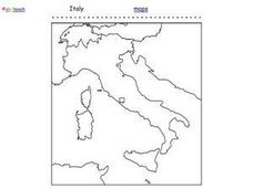
Italy Outline Map
In this outline map learning exercise, students examine the political boundaries of the European nation of Italy. The map may be used in variety of activities that individual teachers create to accompany it.
Curated OER
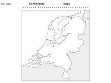
Netherlands Outline Map
In this outline map worksheet, students examine the political boundaries of the European nation of the Netherlands. The map may be used in variety of activities that individual teachers create to accompany it.
Curated OER
Alabama Outline Map
In this Alabama outline map worksheet, students examine political boundaries of the state and the placement its capital city as well as its major cities. This map is not labeled.
Curated OER
Arizona Outline Map
In this Arizona outline map worksheet, students examine political boundaries of the state and the placement its capital city as well as its major cities. This map is not labeled.
Curated OER
Arkansas Outline Map
In this Arkansas outline map worksheet, students examine political boundaries of the state and the placement its capital city as well as its major cities. This map is not labeled.
Curated OER
Colorado Outline Map
In this Colorado outline map worksheet, students examine political boundaries of the state and the placement its capital city as well as its major cities. This map is not labeled.
Curated OER
Delaware Outline Map
In this Delaware outline map worksheet, students examine political boundaries of the state and the placement its capital city as well as its major cities. This map is not labeled.
Curated OER
Florida Outline Map
In this Florida outline map worksheet, students examine political boundaries of the state and the placement its capital city as well as its major cities. This map is not labeled.
Other popular searches
- Continent Outline Map
- Japan Outline Map
- Caribbean Outline Map
- Asia Outline Map
- Europe Outline Map
- Outline Map
- Mexico Outline Map
- Africa Outline Map
- Australia Outline Map
- India Outline Map
- Arctic Outline Map
- France Outline Map


