Free Management Library
Map: Key Concepts in Design of Organization
Defines organizational design and describes the key concepts. Provides links to more information.
ClassFlow
Class Flow: Map Key
[Free Registration/Login Required] This flipchart introduces the purpose of a map, map symbols, and the map key or legend. Activote questions reinforce the concepts.
SMART Technologies
Smart: Geography Unit: Maps
This geography unit is designed to follow the 1st Grade geography skills required in Virginia. Students are expected to use cardinal directions, read map keys and understand map symbols, as well as identify our city and capital.
US Geological Survey
Usgs: Geologic Maps
This site has a good description of what this particular type of map represents. It also explains the colors and letter symbols, faults, and strike and dips.
ClassFlow
Class Flow: Parts of a Map
[Free Registration/Login Required] This flipchart explores the basic parts of a map including the map title, compass rose and map legend.
Curated OER
U. Of Texas: Yemen: Distribution of Ethnoreligious Groups and Key Tribal Areas
An interesting map showing the distribution of the major religious groups, the tribal areas, and pie graphs showing the percentages of ethnic groups and religious sects. From the Perry-Castaneda Collection.
PBS
Pbs Learning Media: Gorongosa Interactive Map | Hhmi Bio Interactive
This interactive map of Gorongosa National Park in Mozambique allows users to explore different features of the park, including key components of the conservation strategy.
Louisiana Department of Education
Louisiana Doe: Louisiana Believes: Social Studies: Grade 1: Using Maps
First graders develop and express claims through discussions and writing in which they explore and create maps using map keys, and map symbols. Students engage with the sources to build their map skills.
Texas Instruments
Texas Instruments: Map It!
In this activity, students explore map making. Students' read a story, identify the locations of different places in the story, decide the distance between each set of places in the story, and create a map with a legend.
ClassFlow
Class Flow: Introduction to Maps
[Free Registration/Login Required] Students are expected to: explain the purpose of a map; identify and use a compass rose; use a grid to locate objects on maps; and use a map key. Activities are hands-on with students manipulating...
Soft Schools
Soft Schools: Geography/map Skills Quiz
In this ten question quiz, students can assess their understanding of key geographical features on maps.
Other
Reading Quest: Strategies for Reading Comp.: History Frames: Story Maps
This activity will help you teach students chronological order as well as identifying key people and events. Printable worksheets.
Enchanted Learning
Enchanted Learning: Pennsylvania: Facts, Map, and State Symbols
A list of key facts about the state of Pennsylvania, including information about Pennsylvania's state symbols. Useful extras for teachers include black-line masters of concept diagrams, maps, and thought organizers.
Other
Map of Gibraltar
This site provides a detailed map of Gibraltar, Spain. It includes a map key, and also an image of where Gibraltar is in relation to Spain.
Science Education Resource Center at Carleton College
Serc: Mn Step: Student Created Landform Maps With Glacial Emphasis
An activity where students work together to make topographic maps of a local park. The map must include a key and the grid locations of landforms in the park.
ClassFlow
Class Flow: Map Sense
[Free Registration/Login Required] This flipchart reviews the basic components of maps: legend, scale, Compass rose and labels. Clips from United Streaming video are included to illustrate these concepts. Student assessment and a student...
ClassFlow
Class Flow: Maps and Globes
[Free Registration/Login Required] This flipchart reviews map and globe features. The seven continents, four oceans, and city-county-state-country relationships are also explained. Student assessment on directions is included.
University of Oregon
Mapping History Project: Missouri Compromise: 1820
Interactive map showing free states and territories and slave states and territories before and after the Missouri Compromise of 1820. Click on the map to choose before or after and the key. Shockwave required.
Texas State Historical Association
Texas State Historical Association: Texas Geology Map [Pdf]
A black and white outline map that can be colored in, using the key provided, to show the geologic periods in Texas history. A full color map is available in the Texas Almanac, which is free to download from the main website.
Other
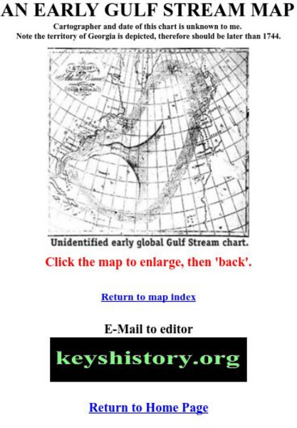
Florida Keys History Museum: An Early Gulf Stream Map
This is one of the earliest maps of the Gulf Stream, probably after 1744.
University of Oregon
Mapping History Project: Mexican Cession: Political Boundaries
Click on this map to see the boundaries of Mexico, Texas, and the United States before the Mexican Cession, and then click again to see the land ceded to the U.S. after the Treaty of Guadalupe Hidalgo. Be sure to click to see the key...
University of Oregon
Mapping History: Late Aegean Bronze Age
A key makes this map useful for locating cities and palaces of the Late Aegean Bronze Age (1250-1000 BC) and for understanding the extent of Mycenaean culture.
BBC
Bbc History: World Wars: World War Two: Animated Map: Burma Campaign
Map animation tracks key events that unfolded in Burma during the Second World War, beginning with the Japanese invasion.
PBS
Pbs Learning Media: Aiming for the Basketball Hall of Fame
In this video segment from TV 411, two Atlanta Hawks players plan a driving route to reach the Basketball Hall of Fame. They use map scales to estimate their travel distances.
Other popular searches
- Map Key and Legend
- Map Legends
- Map Key Legend
- Map Keys and Legends
- Map Key Legend Activities
- Map Legends and Symbols
- Map Legends First Grade
- Interpreting Map Legends
- Reading Map Legends
- Creating Map Legends
- Using Map Legends
- Semantic Map Legends


