Curated OER
Families and Neighborhoods
Students distinguish where their homes are in relation to the city of Pittsburgh. In this geography lesson plan, students read the book All Families Are Specialand find their city on a map of Pennsylvania. Students locate Pittsburgh and...
Curated OER
Building A Topographic Model
Learners visualize, in three dimensions, features represented by contour lines on a topographic map. They see that the different elevations shown on a two dimensional topographic map can be used to build a 3-D model.
Curated OER
Bimaadagaako Adventure
Pupils use an interactive website to complete a wilderness trail adventure where they learn about Native cultures, voyagers, and the Canadian fur trade. In this interactive history instructional activity, students visit the wilderness...
Curated OER
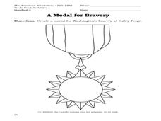
A Picture Book of George Washington
Students discuss the character traits of George Washington. In this George Washington lesson, students read A Picture Book of George Washington, discuss the book, and complete worksheet activities about Washington's self-discipline and...
Curated OER
Night by Elie Wiesel
Tenth graders explore WWII by reading a book with their class. In this Holocaust research lesson, 10th graders read the book Night, and discuss the horrors of the concentration camps and Nazi brutality during WWII. Students complete...
Curated OER
Countries of the World
Students in a ESL classroom examine a world map and study the various countries' names. The study the cultures of selected countries and create a vocabulary list. Finally they label an empty map with the countries' names and a short...
Curated OER
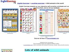
Wild Animals in the World
In this wild animals learning exercise, students answer multiple choice map questions, choose the correct animal names for the pictures, and more. Students complete 4 activities.
Curated OER
You Are Uniquely You; Reflecting and Sharing
Students write a letter as a culminating activity to a service project. In this reflection project, students draw something that occurred during the project and attach words to their drawings. Students pair share to edit their work.
Curated OER
What is a Globe?
In this globe worksheet, students read a definition of a globe and identify the North Pole. Students color the globe to illustrate the land and water.
Curated OER
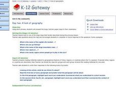
A Look at Geography
Students discover geographical places and terms in another language. In this geographical identification lesson, students utilize their geographical vocabulary to describe to other classmates where they would like to go or where they...
Curated OER
Because of Winn-Dixie
Students make connections with the book Because of Winn-Dixie through writing. In this writing instructional activity, students pretend to be the main character and write a letter to her mother, using very descriptive language. ...
Curated OER
Building an Empire Mapping China
Learners create travel brochures of China's nine regions and make a bulletin board display with them.
Curated OER
School Sleuths Treasure Map
Students are explained how a grid and compass work. They are also explained that archaeologists use grids as a record of the exact location of artifacts. Students define the term datum as a point of reference on grids from which all...
Curated OER
Effigy Mound Activity
Students research effigy mounds of Native people in Wisconsin. They create large models of effigy mounds in a given area based on factual information from their studies and research.
Curated OER
Computer Activities: Countries of the World
Students research a country. In this research and computers lesson plan, students select a country and research various aspects about it including the capital city, the flag and fun facts. Students create slides about their country and...
Curated OER
Winter Holiday Activities Extravaganza
Young scholars define culture and explore elements that are part of the custom or culture of a place. In this holiday lesson, students identify the cultures they participate in. Young scholars identify the differences in people's...
Curated OER
Westward Expansion
Students locate California and New York on a map and explore available means of travel in the 19th century. Students explore the role of trade in pioneer America and simulate various barter transactions.
Core Knowledge Foundation
Columbus Sailed the Ocean Blue
Young adventurers embark on a journey, setting sail along the blue ocean with Christopher Columbus. Teachers will find that this unit makes their lesson planning smooth sailing!
National Geographic
Protect the Blue: Marine Protected Areas
Introduce your class to marine protected areas, or MPAs with a succinct lesson. Use discussion and direct instruction. With a tabletop map, have them predict the amount of ocean that is set aside for preservation. The lesson does not...
National Geographic
Introduction to GIS
Today's teens love technology! Draw them into this lesson by finding out what they know about GPS. Use it as a starting point for introducing them to GIS (geographic information systems). Using yarn, your class outlines the United States...
Curated OER
Mapping Human Rights in Our Community
Learners work in groups to draw a map of their town or neighborhood. They include their homes, major public buildings and places. Students analyze their maps from a human rights perspective.
Curated OER
Active Faulting in Idaho
Young scholars use CAD maps to explore active faults in Idaho. Through observation of maps, they explore the layers of the Quaternary and Holocene faults. Individually, or in groups, they identify characteristics of faults such as...
Curated OER
Initial (and/or Remedial) Road Map Navigation
Students determine their location(s) on the map, keep track of which direction they are headed on which street on the map, and predict what roads they cross very soon.
Curated OER
Finding Your Way Around A Map
Students use the Internet to learn and/or review map and globe skills and will recognize the difference in perspectives as shown on maps.
Other popular searches
- Korean War Map Activity
- Prehistory Map Activity
- Ancient Greece Map Activity
- Us Imperialism Map Activity
- China Map Activity
- Map Activity Europe
- Cold War Map Activity
- Israel Map Activity
- Topographic Map Activity
- Economic Activity Map
- Pangaea Map Activity
- Outline Map Activity


