Curated OER
Our Nation's Natural Disasters
Sixth graders classify their regions' natural disaster(s). Within this lesson students enhance their research skills by utilizing different resources, as well as their writing skills by composing short research papers.
Curated OER
Natural Disaster
Describe how plate tectonics account for various land formations. Learners discuss different marine sanctuaries and create a poster about tectonic activity in these areas. They share their posters with the class.
Curated OER
Applications of GIS
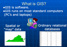
Don't be concerned that the title slide of this presentation mentions Virginia's Geospatial Extension Program; this slide show is very informative for any technology-focused curriculum when considering global information systems. It...
Curated OER
Natural Disasters
Students create an expressive painting documenting their experience of a storm. They create a slide show presentation comparing and contrasting the impact and the response to a natural disaster in the 19th century with the impact...
Curated OER
Living with Disaster: Mother Nature Rules
Learners analyze various types of natural disasters and discover techniques man uses to live with nature and to control nature. They are able to identify ways that man has learned to predict natural disasters; identify ways that man has...
Curated OER
Check Out Community Preparedness
Learners research storm preparedness in local community, identify ways citizens are notified of impending weather emergencies, contact city administrators to discuss disaster plan and whether it has ever been implemented, and interview...
Curated OER
Exploring Energy with GIS
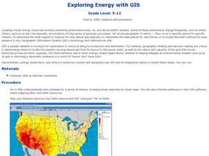
Students examine GIS technology as it is used to locate energy sources. In this GIS lesson, student access an assigned website to locate a series of lessons using the GIS software. They use the maps that are located on the primary lesson...
Teach Engineering
Earthquakes Living Lab: Designing for Disaster
Build and design to rock and roll. Pairs research building design in earthquake areas and use computer simulations to see the effects of earthquakes on buildings,. They then sketch and explain a building design that would withstand a...
Curated OER
Avalanche
Students investigate natural disasters by participating in an experiment. For this water formation lesson, students define the dangers associated with avalanches and landslides. Students utilize a bag of sand, meter-stick and a wood...
Curated OER
Natural Disasters
Learners investigate why natural catastrophes occur around the world and the results of such catastrophes. They investigate how people recover from catastrophes and can they be prevented. Students create their own work of art depicting a...
Curated OER
Images of Katrina
High schoolers use maps and online data to find specific geographic areas. In hurricane Katrina lesson students use aerial photographic imagery to see some impacts of hurricane Katrina.
Curated OER
The 1927 Flood
Upper elementary and middle schoolers examine the Great Flood of 1927 in the state of Arkansas. They each prepare an oral report about this flood and the huge impact it had on the economics of that time. Additionally, learners research...
Curated OER
Natural Disasters
Ninth graders write a description of a natural disaster. They list as many natural disasters as they can think of. The class discusses any natural disasters individuals have witnessed first hand. They watch a brief clip of a film that...
Curated OER
Migration: An African American Adventure
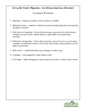
Learners read the book, The Great Migration by National Geographic, then complete this set of related worksheets. They review vocabulary, complete five short answer questions, discuss push and pull factors for the migration, then write a...
Curated OER
Radio Program Disc 1, Track 6
Students place the Ohio river in its historical and geographical context. They listen to the radio stories, and are asked what postive and negative influences does the Ohio River have on nearby communities>
Orange County Water Atlas
Location, Location, Location…
Young geographers discover not only how to read and recognize coordinates on a map, but also gain a deeper understanding of latitude and longitude and how climate changes can vary significantly across latitudes.
Curated OER
But They Never Told Me!
Students investigate how government legislates the protection of citizens from natural disasters such as earthquakes in California. They read the Alquist-Priolo Special Studies Act and debate its pros and cons. They discuss how much...
Curated OER
Twister Redux
Students pick up science knowledge as they track and examine natural disasters. They keep a daily journal of results and reflections. Students get to follow a real tornado chaser and learn thunderstorm formation. They incorporate how...
Curated OER
Trembling, Spewing Earth: Impacts on Human Activity
Seventh graders study to identify patterns in earthquake activity and impacts on human behavior. They also develop plans to cope with such natural disasters.
Curated OER
Hurricane Strength: Spatial Association of Wind Speed and Water Temperature
In this hurricane worksheet, students read and analyze satellite images of hurricane Rita. They complete 4 short answer questions about it.
Curated OER
Avalanche And Landslide Hazards in Canada
Students explore where the natural disasters, avalanche and landslides, are most frequent in Canada and investigate their associated causes and effects. They navigate the Atlas of Canada Web site for natural hazards.
Curated OER
Disaters!
Students read a fiction and nonfiction accounts about different types of disasters. The class uses iChat AV and iSight camera to interview students in a different part of the country about natural or manmade disasters in their area....
Curated OER
Geography And The Gulf War
Students develop maps, tables, graphs, charts, and diagrams to depict the geographic implications of current world events, and analyze major human conflicts to determine the role of physical and cultural geographic features in the...
Curated OER
Agricultural Hard Times And The Great Depression 1920 - 1930, Screen 5 and 6
Learners study the interaction between the inhabitants of the state of Utah and its geographic features. In this Utah geography lesson, students determine how the geographic feature of Utah affected it settlement, land use and...


